Binghamton’s post office opened in 1830, and 45% of its homes were built before 1940
More historic than 98% of U.S. towns · #58 of 758 in New York. What drives it
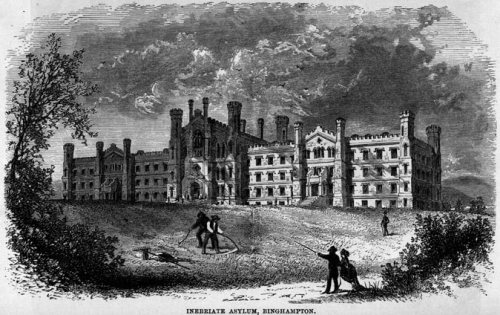
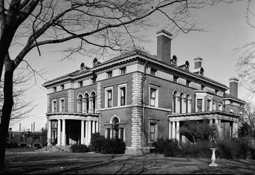
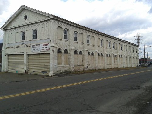
35 places in town are on the National Register, among them the New York State Inebriate Asylum, a National Historic Landmark, and six historic districts with 1,257 buildings between them. Below: 11 old photos and papers, maps from 1887 on, and the census since 1830.
The Binghamton post office opened in 1830, the earliest record of the town by name. Wikidata gives 1834. Another post office, Chenango Point (1803), opened inside today’s city and later closed.
First census: 1,203 in 18302020 census: 47,969196 years
How historic is Binghamton?
A+
More historic than 98% of U.S. towns, on its age, its old homes and the National Register.
Founding year: the first Binghamton post office (Blevins & Helbock, CC0). Wikidata: 1834.The full story ↓
History grade
What drives Binghamton’s History grade
On its age, its old homes and the National Register, Binghamton is more historic than 98% of U.S. towns, #58 of 758 in New York. All 3 inputs are above most U.S. towns; its share of homes from before 1940 ranks highest and its age lowest.
A+
HistoryA character grade: shown, never part of Binghamton’s overall grade.
New York towns list more on the Register than most of the country (a typical New York town has 12.3 per 10,000 residents, the U.S. 2.4), so Binghamton’s 273 sits above most of its state (85% of New York towns have fewer) while its 1,287 historic buildings outnumber those of 99% of U.S. towns.
How sure. Graded on any two of the three inputs instead, the letter would range from A to A+. The pre-1940 share (±2.2 points) is firm at this size. The founding year is the first post office, not a stated founding date; Wikidata’s 1834 falls in the same era, so the grade doesn’t depend on which one is used.
Founding year: the first post office (other dates in Quick answers). Homes: Census ACS 2020–24. National Register: National Park Service, May 2026 list; each listing counted once (boundary changes and added documentation belong to their listing), and a historic district counts its contributing buildings. How TownRatings grades history →
What stands out about Binghamton’s past
Read from the archive, the National Register and the record. The page puts what stands out first.
The country’s official list of buildings and places worth saving. One is a National Historic Landmark, the highest tier. Boundary changes and added documentation are counted with their listing.
The first known people of European descent to come to the area were the troops of the Sullivan Expedition in 1779, during the American Revolutionary War, who destroyed local villages of the Onondaga and Oneida tribes. The city was named after William Bingham, a wealthy Philadelphian who bought the 10,000 acre patent for the land in 1786, then consisting of parts of the towns of Union and Chenango. Joshua Whitney Jr., Bingham's land agent, chose land at the junction of the Chenango and Susquehanna Rivers to develop a settlement, then named Chenango Point. After being officially conveyed the land by Bingham on July 4, 1800, Whitney arranged for the construction of the settlement's first two streets, Court Street and Water Street, and the first residence was built later that year. Whitney continued to expand Chenango Point and sell plots to new settlers, and helped erect the first bridge i…
Every edition of the U.S. Geological Survey’s map of Binghamton. Tap a year, or press play to watch the town change.
1904Binghamton sheet · 1:62,500
U.S. Geological Survey historical topographic maps (public domain), via Esri’s collection of the scans. The red ring marks the center of Binghamton.
Every building
Binghamton, building by building, 1887–1918
Fire insurance maps drew every building, what it was made of and what it was used for, so insurers could price the risk of fire. Pick a year, then a sheet.
Peaked at 80,674 in 1950; 47,969 people lived here in 2020.
20 censuses, 1830–2020.
U.S. Census Bureau decennial counts, from the census table on Binghamton’s Wikipedia page.
Places that used to be
Lost post offices, places now gone and burying grounds
Binghamton’s post office has been open since 1830. Another post office, Chenango Point, opened and closed inside today’s town.
Chenango Point
1803–1830
Binghamton
1830–today
18001910today
Gone or out of use
Binghamton Psychiatric CenterhospitalEastview Post Officepost officeEmmanuel Evangelical United Bretheren ChurchchurchPhelps ParkparkSaint Francis ConventchurchSaint Paul's ConventchurchSaint Thomas Conventchurch
1cemetery inside Binghamton
Spring Forest
US Post Offices dataset (Blevins & Helbock, CC0). Places and cemeteries from the USGS Geographic Names Information System (2021).
Help out
Finish Binghamton’s story
Most archives stop around 1920. The photos from after that are in family albums, not libraries.
Decades since 1900 with photos
00s10s20s30s40s50s60s70s80s90s
0 of 10 decades. The empty ones are waiting for someone’s album.
The Binghamton post office opened in 1830, the earliest record of the town by name (U.S. post office records). Wikidata gives 1834.
How does Binghamton rank for history?
Binghamton is more historic than 98% of U.S. towns, #58 of 758 in New York. The History grade combines the town’s founding era, the share of homes built before 1940 and its National Register listings. It’s a character grade, so it isn’t part of the overall grade. How it works.
What is on the National Register in Binghamton?
35 listings: 26 buildings, among them the New York State Inebriate Asylum (a National Historic Landmark since 1997) and the Binghamton City Hall (listed 1971, the first), 6 historic districts with 1,257 contributing buildings, 1 structure, and 2 objects. 1,287 historic buildings in all.
How old are the homes in Binghamton?
45% of Binghamton’s homes were built before 1940 (Census estimate, ±2.2 points), against a typical 27% for a New York town; the median home was built in 1945.
Founding dates: Wikidata, Wikipedia, the U.S. post office records of Blevins & Helbock (CC0) and the Census. Homes by year built: Census ACS 2020–24. National Register of Historic Places: National Park Service (list of May 22, 2026). Old photos, postcards and papers: Wikimedia Commons, the Library of Congress and other public archives, credited on each item’s page. Maps: U.S. Geological Survey historical topographic maps (via Esri) and Sanborn fire-insurance maps (Library of Congress). History text and census tables: Wikipedia (CC BY-SA 4.0). Places that used to be: USGS Geographic Names Information System (2021).
From Wikimedia Commons (10), the Library of Congress (1), Wikidata (1), the National Register of Historic Places (35), Wikipedia, Wikidata and Wikipedia for famous people, U.S. Geological Survey historical maps, U.S. Census counts (via Wikipedia), the US Post Offices dataset (Blevins & Helbock), the USGS Geographic Names Information System and Sanborn fire insurance maps (Library of Congress). Archive images are copied here with their credits and licenses, shown on each photo’s page. Refreshed monthly.


 ★ Landmark





 1876
 1876
 1876
 1876
 1876
 1876
 1876
 1876
 1876


