Guest, Sign inJoin

Post to Santa Fe

We’ll email a one-tap link to publish your post. No password, and nothing is public until you click it.
Already a member? Sign in
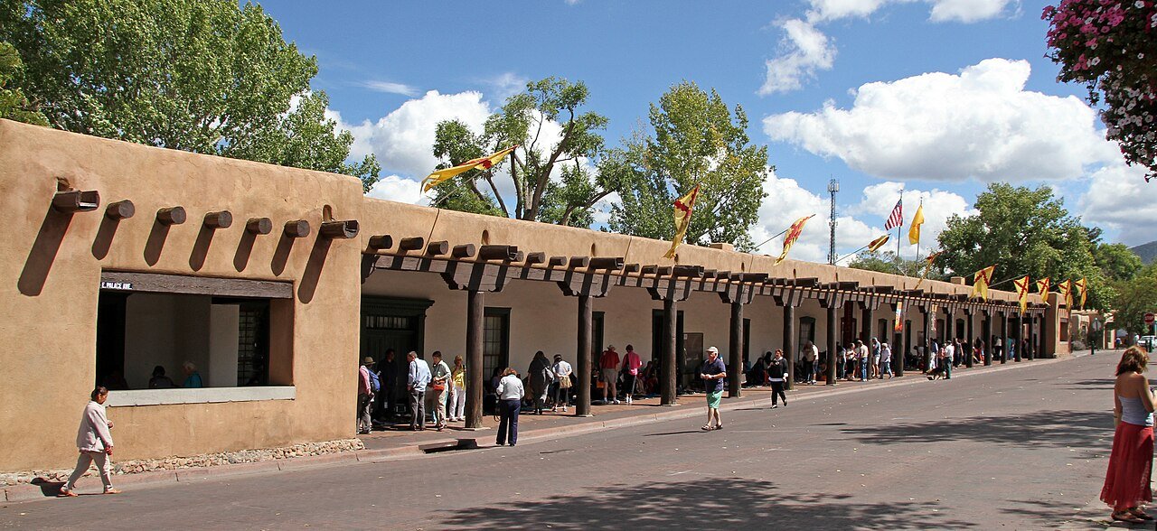
Palace of the GovernorsPhoto: Tony Hisgett from Birmingham, UK · CC BY 2.0
AOutdoors
Outdoors in Santa Fe

Santa Fe has 191 miles of mapped trails, 3.7 for every square mile of land

94% of residents live within a half mile of a park. The biggest trail networks: La Tierra Trails (29.6 mi), Frank S Ortiz Park (2.9 mi), Santa Fe Open Space (2.6 mi). 2,653 acres are parks and preserves, 30 per 1,000 residents.

Ahead of 89% of U.S. towns · #13 of 73 in New Mexico. What drives it

Conserved land
4%
1,334 acres · of 52.2 sq mi of land
Trails
191 mi
3.7 per sq mi of land
Park land
2,653 ac
30 acres per 1,000 residents
Near a park
94%
of residents within ½ mile
Bike routes
102 mi
54 mi lanes · 27 mi paths
Highest peak
8,084 ft
Moon Mountain
Lakes & rivers
2

What kind of outdoors town is Santa Fe?

Read from the map. The page puts what stands out first.

Outdoors grade

How much outdoors does Santa Fe have?

On conserved land, trails, park land and how close residents live to a park, Santa Fe is ahead of 89% of U.S. towns, #13 of 73 in New Mexico. All four inputs are above most U.S. towns; trail miles rank highest, conserved land lowest.

A
OutdoorsA character grade: shown, never part of Santa Fe’s overall grade.
All U.S. towns we grade (21,298)Ahead of 89%
LessMore
New Mexico towns of 2,500+ (73)Ahead of 83%
How sure. Graded on any three of the four inputs instead, the letter would range from A− to A+. Trails and many small parks come from OpenStreetMap, mapped by volunteers, so coverage varies from town to town; the half mile is a straight line from each census block, so a river or highway in the way isn’t counted against it.

PAD-US, OpenStreetMap (© OpenStreetMap contributors), Census 2025 Gazetteer and 2020 blocks; details in Sources below. How TownRatings grades the outdoors →

The map

Conserved land, trails & bike routes

Tap a number to zoom to a park. Tap a layer to hide it.

12345678
Easements protect land from building but are usually private.© OpenStreetMap contributors · USGS PAD-US
Places to walk

Pick a walk

The longest trail network is La Tierra Trails, with 29.6 miles. Directions go to the nearest trailhead or public parking.

La Tierra Trails

Managed by City of Santa Fe
1,459 acres29.6 mi of trail
17-18-192-15-614-12+1
Dog rules not recorded
Directionsto the trailhead

Frank S Ortiz Park

Park
39 acres2.9 mi of trail
Dog rules not recorded
Directionsto the parking lot

Santa Fe Open Space

Park
68 acres2.6 mi of trail
Dog rules not recorded
Directionsto the parking lot

Santa Fe Railyard Park

Park
10 acres1.5 mi of trail
Dog rules not recorded
Directionsto the parking lot

Museum Hill

Managed by New Mexico Department of Cultural Affairs
41 acres1.4 mi of trail
Upper Arroyo Chamisa TrailDayton-Curles Art Trail
Dog rules not recorded
Directionsto the parking lotWebsite ↗

State of New Mexico South Capitol Complex

Park
62 acres1.3 mi of trail
Dog rules not recorded
Directionsto the parking lot

New Mexico State Capitol Complex

Park
41 acres1.3 mi of trail
Dog rules not recorded
Directionsto the parking lot

Ragle Park

Park
23 acres1.2 mi of trail
Dog rules not recorded
Directionsto the parking lot
All 74 parks & preserves
La Tierra Trails1,459 acres · 29.6 mi of trail · City of Santa Fe
Directions
Frank S Ortiz Park39 acres · 2.9 mi of trail
Directions
Santa Fe Open Space68 acres · 2.6 mi of trail
Directions
Santa Fe Railyard Park10 acres · 1.5 mi of trail
Directions
Museum Hill41 acres · 1.4 mi of trail · New Mexico Department of Cultural Affairs
Directions
State of New Mexico South Capitol Complex62 acres · 1.3 mi of trail
Directions
New Mexico State Capitol Complex41 acres · 1.3 mi of trail
Directions
Ragle Park23 acres · 1.2 mi of trail
Directions
General Franklin E. Miles Park31 acres · 1 mi of trail · City of Santa Fe
Directions
Frenchy's Field Park22 acres · 0.9 mi of trail · City of Santa Fe
Directions
Salvador Perez Park15 acres · 0.6 mi of trail · City of Santa Fe
Directions
Historic Fort Marcy Park14 acres · 0.6 mi of trail · City of Santa Fe
Directions
Ashbaugh Park16 acres · 0.5 mi of trail · Santa Fe
Directions
Ron Shirley Alto Park11 acres · 0.5 mi of trail
Directions
Larragoite Park8 acres · 0.5 mi of trail
Directions
Herb Martinez Park10 acres · 0.4 mi of trail
Directions
Las Acequias Park5 acres · 0.4 mi of trail · Santa Fe
Directions
Calle Alvarado Park5 acres · 0.4 mi of trail
Directions
Santa Fe River State Park8 acres · 0.3 mi of trail · State of New Mexico
Directions
SWAN Park2 acres · 0.3 mi of trail · City of Santa Fe
Directions
Via Caballero Park5 acres · 0.2 mi of trail · City of Santa Fe Parks and Recreation
Directions
Cerro Gordo Park4 acres · 0.2 mi of trail
Directions
Water History Park2 acres · 0.2 mi of trail
Directions
Harvey Cornell Rose Park2 acres · 0.2 mi of trail · City of Santa Fe
Directions
Colores Del Sol Park2 acres · 0.2 mi of trail · HOA
Torreon Park1 acres · 0.2 mi of trail
Directions
Santa Fe National Historic Trail7 acres · 0.1 mi of trail · National Park Service
Directions
Monica Lucero Park5 acres · 0.1 mi of trail
Directions
Monsignor Patrick Smith Park4 acres · 0.1 mi of trail
Directions
Rio Vista Park4 acres · 0.1 mi of trail
Southridge Calle Lorca Park2 acres · 0.1 mi of trail
Las Estancias Park2 acres · 0.1 mi of trail
Gregory Lopez Park2 acres · 0.1 mi of trail
Nava Adé Park2 acres · 0.1 mi of trail · City of Santa Fe
Willy Park1 acres · 0.1 mi of trail
Vegas Verdes Park1 acres · 0.1 mi of trail
Directions
Candelero Park1 acres · 0.1 mi of trail
Directions
Casitas de Santa Fe Park1 acres · 0.1 mi of trail
Directions
Young Park1 acres · 0.1 mi of trail
Directions
El Camino Park1 acres · 0.1 mi of trail
Directions
Arroyo Trails12 acres · Santa Fe Botanical Garden
Directions
Las Soleras Park11 acres
Directions
Santa Fe National Forest8 acres · United States Forest Service
Directions
Brother Edward de Reina Park8 acres
Directions
New Mexico State Offices8 acres · State of New Mexico
Directions
Villa Linda Park5 acres
Directions
Atalaya Park4 acres · City of Santa Fe
Directions
Los Hermanos Rodriguez Park4 acres
Directions
Santa Fe River Park East3 acres · City of Santa Fe
Directions
Amelia White Park3 acres
Directions
O'Bannon Field3 acres
Directions
San Isidro Park3 acres
Directions
Cielo Azul Park3 acres · HOA
Directions
De Vargas Park2 acres
Directions
Sagebrush Park2 acres
Directions
Villa Sonata Park2 acres
Fairway Park1 acres · HOA
Directions
Los Milagros Park1 acres · Santa Fe
Directions
Cielo Vista Park1 acres
Directions
Rancho del Sol Park1 acres
Directions
Martin Luther King Jr. Park1 acres
Directions
The Santa Fe Plaza1 acres · City of Santa Fe
Directions
Calle Nueva Vista Park1 acres
Chavez Center Park1 acres
Directions
Birch Park1 acres
Directions
John F Ray Griego Park1 acres
Directions
Pueblo Alegre North Park1 acres
Galisteo Park1 acres
Directions
Cathedral Park1 acres
Directions
Orlando Fernandez Park1 acres
Directions
Maclovia Park1 acres · Santa Fe Parks and Rec
Directions
Cypress Park1 acres
Directions
Pueblo Alegre South Park1 acres
Olive Park1 acres
Who protects it

1,334 conserved acres

4% of Santa Fe’s land. Who manages Santa Fe’s conserved land, from the USGS Protected Areas Database. Approximate, because parcels can overlap.

Town or city839 ac
State land board286 ac
Bureau of Land Management98 ac
County74 ac
Land trusts & nonprofits48 ac
U.S. Forest Service8 ac
Other state land1 ac
Local Park · 468 acLocal Recreation Area · 378 acState Resource Management Area · 286 acNational Public Lands · 98 acOther Easement · 47 ac
Good to know

Conserved doesn’t always mean open to visitors. 76 acres are conservation easements, usually private land. Public access isn’t recorded for 2 of 77 parcels. The walks above are places people visit.

The biggest protected parcels
Parcel (PAD-US)Managed byAcresPublic access
State Trust Land
State Resource Management Area
State land board286Open
Dale Ball Trails
Local Recreation Area
Town or city219Open
Taos Field Office
National Public Lands
Bureau of Land Management98Open
Southwest Activity Node Park
Local Recreation Area
Town or city65Open
Buckman Track
Local Recreation Area
Town or city55Open
Villa Linda Park
Local Park
Town or city36Open
Ragle Park
Local Park
Town or city33Open
Santa Fe River Park
Local Park
Town or city32Open
Fort Marcy Magers Field Park
Local Park
Town or city29Open
Gen Franklin E Miles Park
Local Park
Town or city28Open

5 smaller protected places aren’t shown.

Things to do

177 places to go in Santa Fe

Beaches, playgrounds, peaks, falls and more. Pick a kind.

Dog parks in Santa Fe
Dale Ball Dog Run
Directions
Frank Ortiz Dog RunIn Frank S Ortiz Park
Directions
Park Plazas Dog Park
Directions
Salvador Perez Dog ParkIn Salvador Perez Park
Directions

Plus 7 dog parks without a name on the map. Tap “Show all on map” to see them.

Trails & water

25 named trails and 2 lakes & rivers

Named trails
Open to bikes · 48.0 miHorses · 25.8 miUnpaved · 45.2 mi
South Summit Trail2.7 mi
Upper Arroyo Chamisa Trail2.0 mi
17-18-191.5 mi
11-101.5 mi
New Track1.5 mi
La Piedra1.2 mi
Saint John's Trail (174)1.2 mi
Thornburg Trail1.1 mi
Arroyo Barranca walking trail1.1 mi
2-11.0 mi
15 more trails
City of Santa Fe Open Space Trail
0.8 mi
Sun Mountain Trail
0.8 mi
Cruz Blanca Trail
0.7 mi
5-6
0.6 mi
5-4
0.6 mi
14-12
0.6 mi
Dorothy Stewart Trail
0.5 mi
Arroyo Trail
0.5 mi
8-6
0.5 mi
St John's Arroyo Trail
0.5 mi
Piñon Ridge Trail
0.5 mi
12-13
0.4 mi
19-11
0.4 mi
21-11
0.4 mi
21-
0.4 mi
Lakes & rivers tap for directions
Biking & sports

102 miles of bike routes

Bike lanes are often missing from the map in smaller towns, so that number is likely low.

54 mi
painted or protected bike lanes
27 mi
off-road bike paths
21 mi
shoulders & shared lanes
La Tierra TrailsBike route
21.5 mi
Arroyo Chamisos TrailBike route
0.3 mi
Courts & fields
118Basketball
89Tennis
26Baseball
14Football
13Pickleball
10Tracks
10Soccer
8Golf

Includes school and college facilities, which aren’t always open to the public.

History along the way

52 places on the National Register, 4 of them National Historic Landmarks

The country’s official list of places worth saving (National Park Service). The map also marks 79 historic points from OpenStreetMap: plaques, memorials and old buildings.

History →
★
Santa Fe PlazaNational Historic Landmark · Site · listed 1966
About it
★
Palace of the GovernorsNational Historic Landmark · Building · listed 1966
About it
★
Barrio de Analco Historic DistrictNational Historic Landmark · District · listed 1968
About it
★
National Park Service Southwest Regional OfficeNational Historic Landmark · Building · listed 1970
About it
Randall Davey HouseBuilding · listed 1970
About it
Reredos of Our Lady of LightObject · listed 1970
About it
Donaciano Vigil HouseBuilding · listed 1972
About it
Spiegelberg HouseBuilding · listed 1973
About it
U.S. CourthouseBuilding · listed 1973
About it
Santa Fe Historic DistrictDistrict · listed 1973
About it
Federal BuildingBuilding · listed 1974
About it
Pinckney R. Tully HouseBuilding · listed 1974
About it

40 more on the History page.

When to get out

The best walking months in Santa Fe: April to June and August

NOAA’s 1991–2020 normals for the town and the daylight at its latitude. Outlined months have long days, highs of 59 to 86 °F and little rain for the place.

JanFebMarAprMayJunJulAugSepOctNovDec
Daylight (h)10.010.811.913.014.014.614.313.512.311.210.29.8
High (°F)444957647485868478675443
Rain (in)0.60.50.70.60.90.92.52.21.41.20.70.7

February is the driest month (0.5 in) and July the warmest (highs of 86 °F). 2.5 inches fall in July, the wettest month. Summer highs reach 86 °F, too hot for the outline. The climate in Santa Fe →

Next door

Santa Fe and its neighbors

Santa Fe has the most mapped trails of the 8 towns around it. Tap a town to see its outdoors.

TownConserved
of land
Trail mi
per sq mi
Park acres
per 1,000
Near a park
½ mile
Outdoors
Santa Fe4%3.73094%A
La Cienega34%1.317724%A
Tres Arroyos13%2.69646%A
Tano Roadunder 1%1.4439%C
Santa Fe Foothills— not graded: under 1,000 residents or part of its town
Conejo— not graded: under 1,000 residents or part of its town
Tesuque15%2.7121%B
Hyde Park— not graded: under 1,000 residents or part of its town

The four inputs of the Outdoors grade, from the engine; shares are of land, not water.

Questions about parks and trails in Santa Fe

Where can I hike in Santa Fe?

The longest trail networks: La Tierra Trails, 29.6 miles; Frank S Ortiz Park, 2.9 miles; Santa Fe Open Space, 2.6 miles; Santa Fe Railyard Park, 1.5 miles. Each one is on the map above, with directions to the nearest trailhead or parking.

How much of Santa Fe is conserved land?

4% of its land, against a typical 4% for a New Mexico town and 4% nationally (PAD-US). Conserved doesn’t always mean open to visitors: easements are usually private land.

Are dogs allowed on Santa Fe’s trails?

La Tierra Trails and Frank S Ortiz Park don’t have dog rules recorded on the map; check the signs at the trailhead.

Where can I bike in Santa Fe?

102 miles of bike routes are on the map: 54 of painted or protected lanes, 27 of off-road paths and 21 of shoulders and shared lanes. Named routes: La Tierra Trails and Arroyo Chamisos Trail.

Is there public land near Santa Fe?

104,778 acres of parks and open public land lie inside Santa Fe or within 10 miles of it (PAD-US), 3,039 of them inside the city line.

How much outdoors does Santa Fe have?

Ahead of 89% of U.S. towns on the Outdoors grade, #13 of 73 in New Mexico. The grade combines the share of land that is conserved, miles of mapped trail per square mile of land, park acres per 1,000 residents and the share of residents within a half mile of a park. It’s a character grade, so it isn’t part of the overall grade. How it works.

Trail talk

Conditions, parking and favorite walks from Santa Fe neighbors.

Town Square →
Share a tip
Sources

Where this page comes from

Conserved and public land: USGS Protected Areas Database of the United States (PAD-US), service updated July 2026. Parks, trails, playgrounds, beaches and other places: OpenStreetMap (© OpenStreetMap contributors, ODbL), map data as of 2026-10-28. Land and water area: Census 2025 Gazetteer. Residents near a park: 2020 Census blocks. National Register: National Park Service. How TownRatings grades the outdoors →