Santa Fe dates to 1610, and 52 of its places are on the National Register
More historic than 88% of U.S. towns · #2 of 73 in New Mexico. What drives it
Most of Santa Fe was built recently: 7% of its homes predate 1940 and the median home dates from 1986. 52 places in town are on the National Register, among them 4 National Historic Landmarks and seven historic districts with 436 buildings between them. Below: 2 old photos and papers, maps from 1883 on, and the census since 1850.
Founding year: Wikidata. First post office: 1849.The full story ↓
History grade
What drives Santa Fe’s History grade
On its age, its old homes and the National Register, Santa Fe is more historic than 88% of U.S. towns, #2 of 73 in New Mexico. Its age holds the grade up; its share of homes from before 1940 pulls it down.
A
HistoryA character grade: shown, never part of Santa Fe’s overall grade.
New Mexico towns list about as much on the Register as the country (a typical New Mexico town has 2.2 per 10,000 residents, the U.S. 2.4), so Santa Fe’s 54.0 sits above most of its state (86% of New Mexico towns have fewer) while its 481 historic buildings outnumber those of 97% of U.S. towns.
NoteThe founding year comes from Wikidata alone; no second source gives 1610.
How sure. Graded on any two of the three inputs instead, the letter would range from B+ to A+. The pre-1940 share (±0.8 points) is firm at this size.
Founding year: Wikidata (other dates in Quick answers). Homes: Census ACS 2020–24. National Register: National Park Service, May 2026 list; each listing counted once (boundary changes and added documentation belong to their listing), and a historic district counts its contributing buildings. How TownRatings grades history →
What stands out about Santa Fe’s past
Read from the archive, the National Register and the record. The page puts what stands out first.
The country’s official list of buildings and places worth saving. 4 are National Historic Landmarks, the highest tier. Boundary changes and added documentation are counted with their listing.
Before European colonization of the Americas, between AD 900 and the 1500s, the area around present-day Santa Fe was known to the Tewa peoples as Ogap’oegeh (pronounced [ʔògà pʼòːɡè], 'white shell water place', one of a number of places named for their water access) and by the Navajo people as Yootó ("bead" + "water place").
In 1598, Juan de Oñate established the area as Santa Fe de Nuevo México, a province of New Spain. Formal Spanish settlements were developed leading the colonial governor Pedro de Peralta to rename the area La Villa Real de la Santa Fé de San Francisco de Asís ("the Royal Town of the Holy Faith of Saint Francis of Assisi").
In short, neither you nor ISlr. Read substantiates your position as to the founding of Santa Fe, and I reaffirm the probability as set forth in the first note of my work, with only this modification ; sentiment aside, our one bit of evidence, while not conclusive, makes it far more probable that the founding of Santa Fe took place in 1615 or 1616, than 1609, and most certainly than in 1605. Bancroft (xvii, 159) found in the archives of Old IMexico a manuscript dated January 3, 1617, in which the cdbildo of Santa Fe petitioned the king to aid their "new
Text read by machine from the scan; it may contain errors.
Vrain conducted many caravans over the old Santa Fe Trail to Santa Fe. During the revolution at Taos, he rendered effective service for the American forces, with a company of volunteers from Santa Fe and vicinity. In Uncle Dick Woolton, by Howard Louis Conrad, Wootton says : Colonel Ceran St. Vrain, Governor Bent's partner, accompanied Captain Burgwin with about sixty volunteers, picked up in Santa Fe.
Text read by machine from the scan; it may contain errors.
Scans and text from the Internet Archive. Books published in 1930 or earlier, which are in the public domain.
By decade
Santa Fe, decade by decade
One decade in the archive so far: the 1760s. Scroll each row; tap a photo for its story.
Every edition of the U.S. Geological Survey’s map of Santa Fe. Tap a year, or press play to watch the town change.
1952Santa Fe sheet · 1:24,000
U.S. Geological Survey historical topographic maps (public domain), via Esri’s collection of the scans. The red ring marks the center of Santa Fe.
Every building
Santa Fe, building by building, 1883–1930
Fire insurance maps drew every building, what it was made of and what it was used for, so insurers could price the risk of fire. Pick a year, then a sheet.
In 1610, according to Wikidata. Santa Fe’s post office opened in 1849, and the census of 1850 counted 4,846 people here.
How does Santa Fe rank for history?
Santa Fe is more historic than 88% of U.S. towns, #2 of 73 in New Mexico. The History grade combines the town’s founding era, the share of homes built before 1940 and its National Register listings. It’s a character grade, so it isn’t part of the overall grade. How it works.
What is on the National Register in Santa Fe?
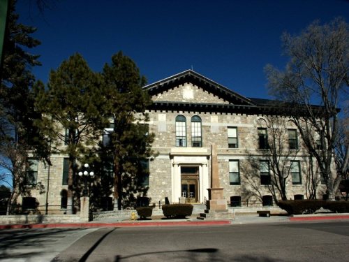
52 listings, 4 of them National Historic Landmarks: 38 buildings, 7 historic districts with 436 contributing buildings, 2 sites, 4 structures, and 1 object. 481 historic buildings in all.
How old are the homes in Santa Fe?
7% of Santa Fe’s homes were built before 1940 (Census estimate), against a typical 2.3% for a New Mexico town; the median home was built in 1986.
Founding dates: Wikidata, Wikipedia, the U.S. post office records of Blevins & Helbock (CC0) and the Census. Homes by year built: Census ACS 2020–24. National Register of Historic Places: National Park Service (list of May 22, 2026). Old photos, postcards and papers: Wikimedia Commons, the Library of Congress and other public archives, credited on each item’s page. Maps: U.S. Geological Survey historical topographic maps (via Esri) and Sanborn fire-insurance maps (Library of Congress). History text and census tables: Wikipedia (CC BY-SA 4.0). Places that used to be: USGS Geographic Names Information System (2021).
From Wikimedia Commons (2), Wikidata (4), the National Register of Historic Places (52), Wikipedia, Wikidata and Wikipedia for famous people, U.S. Geological Survey historical maps, U.S. Census counts (via Wikipedia), the US Post Offices dataset (Blevins & Helbock), the USGS Geographic Names Information System, Sanborn fire insurance maps (Library of Congress) and old county and town histories (Internet Archive). Archive images are copied here with their credits and licenses, shown on each photo’s page. Refreshed monthly.


 ★ Landmark
 ★ Landmark




 c. 1766


