Las Vegas dates to 1835, and 24% of its homes were built before 1940
More historic than 95% of U.S. towns · #1 of 73 in New Mexico. What drives it
87 places in town are on the National Register, among them nine historic districts with 766 buildings between them. Below: 3 old photos and papers, maps from 1883 on, and the census since 1890.
Founding year: Wikidata; Wikipedia’s history section gives the same year. First post office: 1850.The full story ↓
History grade
What drives Las Vegas’ History grade
On its age, its old homes and the National Register, Las Vegas is more historic than 95% of U.S. towns, #1 of 73 in New Mexico. All 3 inputs are above most U.S. towns; its National Register listings ranks highest and its age lowest.
A
HistoryA character grade: shown, never part of Las Vegas’ overall grade.
New Mexico towns list about as much on the Register as the country (a typical New Mexico town has 2.2 per 10,000 residents, the U.S. 2.4), so Las Vegas’ 648 sits above most of its state (99% of New Mexico towns have fewer) while its 842 historic buildings outnumber those of 98% of U.S. towns.
How sure. Graded on any two of the three inputs instead, the letter would range from A− to A+. The pre-1940 share is a Census survey estimate (±3.7 points). Two sources give 1835.
Founding year: Wikidata (other dates in Quick answers). Homes: Census ACS 2020–24. National Register: National Park Service, May 2026 list; each listing counted once (boundary changes and added documentation belong to their listing), and a historic district counts its contributing buildings. How TownRatings grades history →
What stands out about Las Vegas’ past
Read from the archive, the National Register and the record. The page puts what stands out first.
Las Vegas was established in 1835 after a group of settlers received a land grant from the Mexican government. (The land had previously been granted to Luis María Cabeza de Baca, whose family later received a settlement.) The town was laid out in the traditional Spanish Colonial style, with a central plaza surrounded by buildings that could serve as fortifications in case of attack. Las Vegas soon prospered as a stop on the Santa Fe Trail. During the Mexican–American War in 1846, Stephen W. Kearny delivered an address at the Plaza of Las Vegas claiming New Mexico for the United States. In 1847, the town was the site of the Battle of Las Vegas, which was a part of the broader Taos Revolt by local Hispanos and Pueblo peoples against United States occupation. In 1860, the United States Congress passed a law allowing the Cabeza de Baca heirs to choose other grants in lieu of their Las Vegas…
Passages that mention Las Vegas, cut from the printed page as they were published.
Historical sketch of Las Vegas, New Mexico1880 · page 25Read the page →
Read the text
In the way of railroad talk it is expected that the St. Louis and San Francisco railroad, now at Vinita, Indian Territory, will ere long be pushed on to this place. Koads from Las Vegas to Galveston via Pecos Valley, and to San Juan country, in. Utah, via Mora and Toas, are being agitated. The Kansas^ Pacific, and Denver and Kio Grande, may at some near future day extend this way, and Las Vegas will always be an important point on the Atchison, Topeka and Santa Fe.
Text read by machine from the scan; it may contain errors.
Scans and text from the Internet Archive. Books published in 1930 or earlier, which are in the public domain.
Timeline
Las Vegas, 1835 to 1959
Woven from the archive, old maps, post office records, the National Register and the people born here.
Nothing in the archives for these yearsWeddings on Main Street, storms, parades, school pictures, the old store. If it’s in your family album, it belongs here.
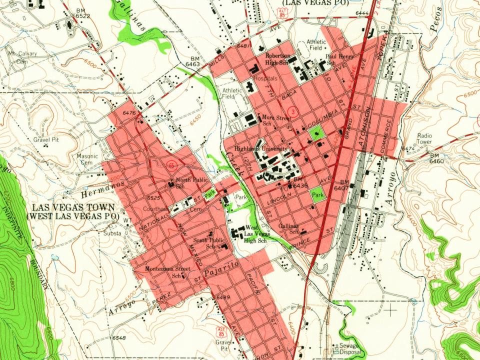
Every edition of the U.S. Geological Survey’s map of Las Vegas. Tap a year, or press play to watch the town change.
1889Las Vegas sheet · 1:125,000
U.S. Geological Survey historical topographic maps (public domain), via Esri’s collection of the scans. The red ring marks the center of Las Vegas.
Every building
Las Vegas, building by building, 1883–1921
Fire insurance maps drew every building, what it was made of and what it was used for, so insurers could price the risk of fire. Pick a year, then a sheet.
Lost post offices, places now gone and burying grounds
Las Vegas’s post office has been open since 1850. Another post office, East Las Vegas, opened and closed inside today’s town.
Las Vegas
1850–today
East Las Vegas
1885–1928
18501940today
Gone or out of use
Marquez Pitmine
6cemeteries and burying grounds inside Las Vegas
International Fellowship of Odd FellowsLas VegasMasonicMasonicMontefioreSan Jose
US Post Offices dataset (Blevins & Helbock, CC0). Places and cemeteries from the USGS Geographic Names Information System (2021).
Questions about Las Vegas’ history
What year was Las Vegas founded?
In 1835, according to Wikidata and Wikipedia’s history of the town. Las Vegas’ post office opened in 1850, and the census of 1890 counted 2,312 people here.
How does Las Vegas rank for history?
Las Vegas is more historic than 95% of U.S. towns, #1 of 73 in New Mexico. The History grade combines the town’s founding era, the share of homes built before 1940 and its National Register listings. It’s a character grade, so it isn’t part of the overall grade. How it works.
What is on the National Register in Las Vegas?
87 listings: 75 buildings, 9 historic districts with 766 contributing buildings, and 3 structures. 842 historic buildings in all.
How old are the homes in Las Vegas?
24% of Las Vegas’ homes were built before 1940 (Census estimate, ±3.7 points), against a typical 2.3% for a New Mexico town; the median home was built in 1969.
Founding dates: Wikidata, Wikipedia, the U.S. post office records of Blevins & Helbock (CC0) and the Census. Homes by year built: Census ACS 2020–24. National Register of Historic Places: National Park Service (list of May 22, 2026). Old photos, postcards and papers: Wikimedia Commons, the Library of Congress and other public archives, credited on each item’s page. Maps: U.S. Geological Survey historical topographic maps (via Esri) and Sanborn fire-insurance maps (Library of Congress). History text and census tables: Wikipedia (CC BY-SA 4.0). Places that used to be: USGS Geographic Names Information System (2021).
From Wikimedia Commons (3), Wikidata (8), the National Register of Historic Places (87), Wikipedia, Wikidata and Wikipedia for famous people, U.S. Geological Survey historical maps, U.S. Census counts (via Wikipedia), the US Post Offices dataset (Blevins & Helbock), the USGS Geographic Names Information System, Sanborn fire insurance maps (Library of Congress) and old county and town histories (Internet Archive). Archive images are copied here with their credits and licenses, shown on each photo’s page. Refreshed monthly.

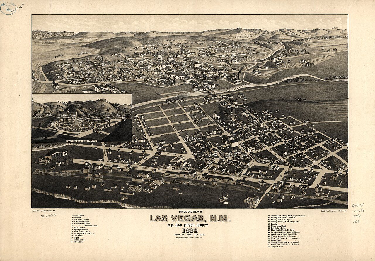


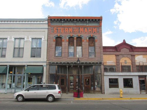

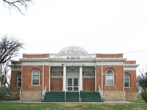


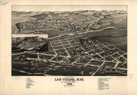 1882
 1885