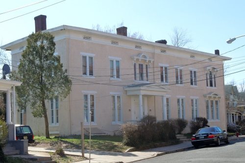
Trenton dates to 1719, and 38% of its homes were built before 1940
Among the most historic 1% of U.S. towns · #7 of 468 in New Jersey. What drives it
44 places in town are on the National Register, among them 2 National Historic Landmarks and eight historic districts with 6,333 buildings between them. Below: 2 old photos and papers, maps from 1890 on, and the census since 1790.
Founding year: Wikidata. First post office: 1889.The full story ↓
History grade
What drives Trenton’s History grade
On its age, its old homes and the National Register, Trenton is among the most historic 1% of U.S. towns, #7 of 468 in New Jersey. All 3 inputs put Trenton near the top nationally; its National Register listings ranks highest.
A+
HistoryA character grade: shown, never part of Trenton’s overall grade.
New Jersey towns list more on the Register than most of the country (a typical New Jersey town has 3.7 per 10,000 residents, the U.S. 2.4), so Trenton’s 706 sits above most of its state (96% of New Jersey towns have fewer) while its 6,379 historic buildings outnumber those of 100% of U.S. towns.
NoteThe founding year comes from Wikidata alone; no second source gives 1719.
How sure. Graded on any two of the three inputs instead, the letter would still be A+. The pre-1940 share (±2.6 points) is firm at this size.
Founding year: Wikidata (other dates in Quick answers). Homes: Census ACS 2020–24. National Register: National Park Service, May 2026 list; each listing counted once (boundary changes and added documentation belong to their listing), and a historic district counts its contributing buildings. How TownRatings grades history →
What stands out about Trenton’s past
Read from the archive, the National Register and the record. The page puts what stands out first.
The country’s official list of buildings and places worth saving. 2 are National Historic Landmarks, the highest tier. Boundary changes and added documentation are counted with their listing.
The earliest known inhabitants of the area that is today Trenton were the Lenape Native Americans, specifically the Axion band who were the largest tribe on the Delaware River in the mid-17th century.
The first European settlement in what would become Trenton was established by Quakers in 1679, in the region then called the Falls of the Delaware, led by Mahlon Stacy from Handsworth, Sheffield, England. Quakers were being persecuted in England at this time, and North America provided an opportunity to exercise their religious freedom.
By 1719, the town adopted the name "Trent-towne", after William Trent, one of its leading landholders who purchased much of the surrounding land from Stacy's family. This name was later shortened to "Trenton".
Passages that mention Trenton, cut from the printed page as they were published.
History of Trenton, New Jersey1895 · page 135Read the page →
Read the text
The Philadelphia and Trenton Railroad Company was incorporated by the Legislature of Pennsylvania in 1.832, to construct a railroad from Kensington to the Trenton bridge, at Morrisville, Avhilst an act of 1835 authorized the construction of a railroad bridge across the Delaware.
Text read by machine from the scan; it may contain errors.
On the seventh of March, 1837, the inhabitants of the city of Trenton were incorporated with full municipal powers. In the new incorporation the rights and estates of the “Mayor Aldermen and Assistants of the City of Trenton,” as well as of the “Inhabitants of the Township of Trenton, in the County of Hunterdon,” were vested in the new corporation. The officers under the new charter were a Mayor, who should be the keeper of the city seal ; Recorder or Acting Mayor, three Aldermen, twelve members of Common Council, one Clerk, one Assessor, one Collector and one Treasurer. The Mayor, Recorder and Aldermen were ex-officio Justices of the
Text read by machine from the scan; it may contain errors.
Scans and text from the Internet Archive. Books published in 1930 or earlier, which are in the public domain.
Timeline
Trenton, 1719 to 1972
Woven from the archive, old maps, post office records, the National Register and the people born here.
Every edition of the U.S. Geological Survey’s map of Trenton. Tap a year, or press play to watch the town change.
1947Trenton East sheet · 1:24,000
U.S. Geological Survey historical topographic maps (public domain), via Esri’s collection of the scans. The red ring marks the center of Trenton.
Every building
Trenton, building by building, 1890–1927
Fire insurance maps drew every building, what it was made of and what it was used for, so insurers could price the risk of fire. Pick a year, then a sheet.
In 1719, according to Wikidata. Trenton’s post office opened in 1889, and the first U.S. census counted 1,946 people here in 1790.
How does Trenton rank for history?
Trenton is among the most historic 1% of U.S. towns, #7 of 468 in New Jersey. The History grade combines the town’s founding era, the share of homes built before 1940 and its National Register listings. It’s a character grade, so it isn’t part of the overall grade. How it works.
What is on the National Register in Trenton?
44 listings, 2 of them National Historic Landmarks: 33 buildings, among them the William Trent House (a National Historic Landmark since 1970), 8 historic districts with 6,333 contributing buildings, 1 structure, and 2 objects. 6,379 historic buildings in all.
How old are the homes in Trenton?
38% of Trenton’s homes were built before 1940 (Census estimate, ±2.6 points), against a typical 15% for a New Jersey town; the median home was built in 1953.
Founding dates: Wikidata, Wikipedia, the U.S. post office records of Blevins & Helbock (CC0) and the Census. Homes by year built: Census ACS 2020–24. National Register of Historic Places: National Park Service (list of May 22, 2026). Old photos, postcards and papers: Wikimedia Commons, the Library of Congress and other public archives, credited on each item’s page. Maps: U.S. Geological Survey historical topographic maps (via Esri) and Sanborn fire-insurance maps (Library of Congress). History text and census tables: Wikipedia (CC BY-SA 4.0). Places that used to be: USGS Geographic Names Information System (2021).
From Wikimedia Commons (2), Wikidata (4), the National Register of Historic Places (44), Wikipedia, Wikidata and Wikipedia for famous people, U.S. Geological Survey historical maps, U.S. Census counts (via Wikipedia), the US Post Offices dataset (Blevins & Helbock), the USGS Geographic Names Information System, Sanborn fire insurance maps (Library of Congress) and old county and town histories (Internet Archive). Archive images are copied here with their credits and licenses, shown on each photo’s page. Refreshed monthly.


 ★ Landmark
 ★ Landmark