Half of Mystic Island’s homes were built after 1982
Most of Mystic Island was built recently: 0.0% of its homes predate 1940 and the median home dates from 1982. Below: maps from 1888 on and the census since 1980.
Photo: Mr. Matté (if there is an issue with this image, contact me using this image's Commons talk page, my Commons user talk page, or my English Wikipedia user talk page; I'll know about it a lot faster) · CC BY-SA 4.0
What stands out about Mystic Island’s past
Read from the archive, the National Register and the record. The page puts what stands out first.
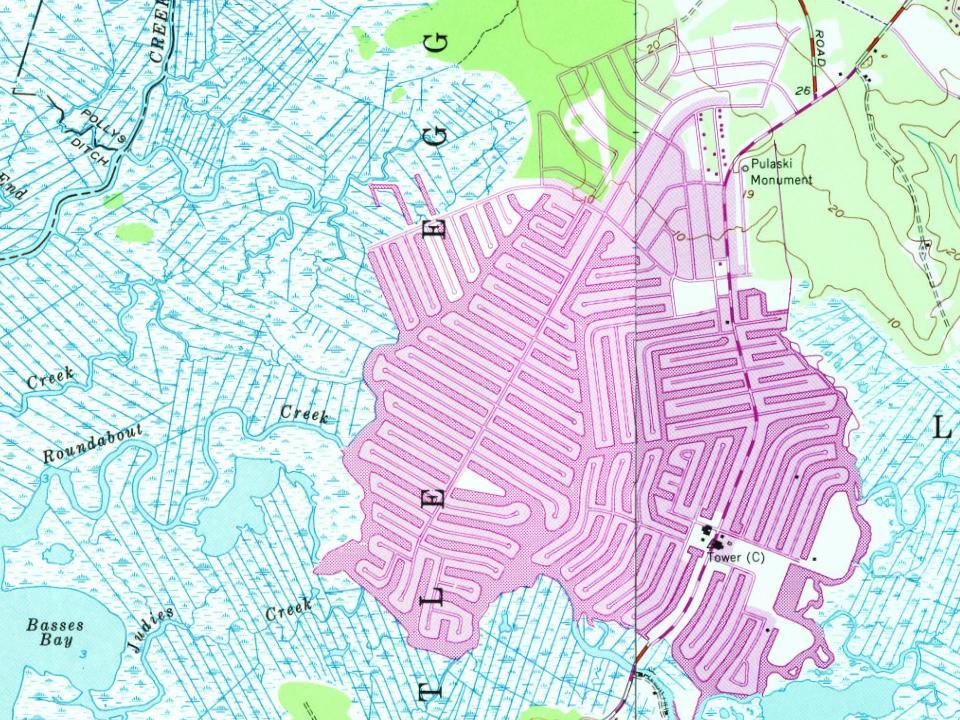
Every edition of the U.S. Geological Survey’s map of Mystic Island. Tap a year, or press play to watch the town change.
1888Little Egg Harbor sheet · 1:62,500
U.S. Geological Survey historical topographic maps (public domain), via Esri’s collection of the scans. The red ring marks the center of Mystic Island.
The story so far
Mystic Island, in brief
Wikipedia doesn’t have a history of Mystic Island yet. The photos, dates and memories neighbors add here are how it gets written.
Mystic Island (also called Mystic Islands or Mystic) is an unincorporated community and census-designated place (CDP) located within Little Egg Harbor Township, in Ocean County, in the U.S. state of New Jersey. As of the 2020 United States census, the CDP's population was 8,301. Mystic Island is a large, mostly waterfront development originally planned as a resort community that started in the early 1960s as a waterfront community with vacation bungalows. In the past few years, however, many of the original bungalows are slowly being replaced with much larger homes on pilings that are popular in nearby beach communities such as Long Beach Island.
Between the 2010 and 2020 censuses its population fell from 8,493 to 8,301 (-2%).
Intro from Wikipedia. Population: U.S. Census Bureau.
Founding dates: Wikidata, Wikipedia, the U.S. post office records of Blevins & Helbock (CC0) and the Census. Homes by year built: Census ACS 2020–24. National Register of Historic Places: National Park Service (list of May 22, 2026). Old photos, postcards and papers: Wikimedia Commons, the Library of Congress and other public archives, credited on each item’s page. Maps: U.S. Geological Survey historical topographic maps (via Esri) and Sanborn fire-insurance maps (Library of Congress). History text and census tables: Wikipedia (CC BY-SA 4.0). Places that used to be: USGS Geographic Names Information System (2021). How TownRatings grades history →
From Wikimedia Commons (6), U.S. Geological Survey historical maps and U.S. Census counts (via Wikipedia). Archive images are copied here with their credits and licenses, shown on each photo’s page. Refreshed monthly.


 2024
 2024
 2024
 2024
 2011
 2011