Millville dates to 1720, and 16% of its homes were built before 1940
More historic than 80% of U.S. towns · #114 of 468 in New Jersey. What drives it
Its Register listings are the Millville's First Bank Building and the Wood Mansion House. Below: 18 old photos and papers, maps from 1886 on, and the census since 1810.
Founding year: Wikidata. First post office: 1802.The full story ↓
History grade
What drives Millville’s History grade
On its age, its old homes and the National Register, Millville is more historic than 80% of U.S. towns, #114 of 468 in New Jersey. Its age holds the grade up; its National Register listings pull it down.
A−
HistoryA character grade: shown, never part of Millville’s overall grade.
New Jersey towns list more on the Register than most of the country (a typical New Jersey town has 3.7 per 10,000 residents, the U.S. 2.4), so Millville’s 1.1 sits below most of its state (33% of New Jersey towns have fewer) while its 3 historic buildings outnumber those of 65% of U.S. towns.
NoteThe founding year comes from Wikidata alone; no second source gives 1720.
How sure. Graded on any two of the three inputs instead, the letter would range from B to A. The pre-1940 share is a Census survey estimate (±3.6 points).
Founding year: Wikidata (other dates in Quick answers). Homes: Census ACS 2020–24. National Register: National Park Service, May 2026 list; each listing counted once (boundary changes and added documentation belong to their listing), and a historic district counts its contributing buildings. How TownRatings grades history →
What stands out about Millville’s past
Read from the archive, the National Register and the record. The page puts what stands out first.
Every edition of the U.S. Geological Survey’s map of Millville. Tap a year, or press play to watch the town change.
1890Bridgeton sheet · 1:62,500
U.S. Geological Survey historical topographic maps (public domain), via Esri’s collection of the scans. The red ring marks the center of Millville.
Every building
Millville, building by building, 1886–1923
Fire insurance maps drew every building, what it was made of and what it was used for, so insurers could price the risk of fire. Pick a year, then a sheet.
Nothing in the archives for these yearsWeddings on Main Street, storms, parades, school pictures, the old store. If it’s in your family album, it belongs here.
Around 1720, a sawmill was believed to have existed at Leaming's Mill, known as "Shingle Landing" in its earliest days. The area also had a public road, a boat landing, and a bridge-like structure.
In 1790, Joseph Smith and Henry Drinker purchased 24,000 acres (97 km2) of land known as the Union Mills Tract. They formed the Union Estates Company, built lumber mills along the Maurice River and established a dam to power these new mills. Joseph Buck, an American Revolutionary War veteran who served under General George Washington, was part of a group that purchased the land in the area in 1795 and laid out the plans for what would become Millville.
Passages that mention Millville, cut from the printed page as they were published.
History of the early settlement and progress of Cumberland County, New Jersey1869 · page 25Read the page →
Read the text
cloth to be dressed. At that time nearly all the clothing and the bedding used by the people was spun in the family, and often woven there also, or by persons who followed the business. The straight road to Millville, now a turnpike, was laid out in 1805, commencing at the bridge; and in 1809 Jeremiah Buck erected the dam and flour and saw-mills now standing, and it may be mentioned that Mr. French, the millwright, from near Bordentowu, lost his life at the raising of the saw-mill, having been crushed by
Text read by machine from the scan; it may contain errors.
Gouldtown, a very remarkable settlement of ancient date1913 · page 12Read the page →
Read the text
The Bridgeton and Millville Traction Company's trolley line passes through Gouldtown, along the beautiful Bridgeton and Millville Turnpike; the distance between the two cities, Bridgeton and Millville, is ten
Text read by machine from the scan; it may contain errors.
History of the early settlement and progress of Cumberland County, New Jersey1869 · page 53Read the page →
Read the text
and contemplated a road from Camden to Cape May; but owing to financial and other difficulties, it was at first completed and put in operation only to Woodbury. But in 1859 the road from Glassboro' to Millville was made, and the impetus thus given to the original West Jersey Company, brought about the completion of their road from Woodbury to Bridgeton, which was opened in Jul}', 1861. The terminus of this road, it is supposed, will always remain at Bridgeton, and the original design of connecting Phila-
Text read by machine from the scan; it may contain errors.
Scans and text from the Internet Archive. Books published in 1930 or earlier, which are in the public domain.
Timeline
Millville, 1720 to 1965
Woven from the archive, old maps, post office records, the National Register and the people born here.
In 1720, according to Wikidata. Millville’s post office opened in 1802, and the census of 1810 counted 1,032 people here.
How does Millville rank for history?
Millville is more historic than 80% of U.S. towns, #114 of 468 in New Jersey. The History grade combines the town’s founding era, the share of homes built before 1940 and its National Register listings. It’s a character grade, so it isn’t part of the overall grade. How it works.
What is on the National Register in Millville?
Two places: the Millville's First Bank Building (listed 1980) and the Wood Mansion House (2013).
How old are the homes in Millville?
16% of Millville’s homes were built before 1940 (Census estimate, ±3.6 points), against a typical 15% for a New Jersey town; the median home was built in 1970.
Founding dates: Wikidata, Wikipedia, the U.S. post office records of Blevins & Helbock (CC0) and the Census. Homes by year built: Census ACS 2020–24. National Register of Historic Places: National Park Service (list of May 22, 2026). Old photos, postcards and papers: Wikimedia Commons, the Library of Congress and other public archives, credited on each item’s page. Maps: U.S. Geological Survey historical topographic maps (via Esri) and Sanborn fire-insurance maps (Library of Congress). History text and census tables: Wikipedia (CC BY-SA 4.0). Places that used to be: USGS Geographic Names Information System (2021).
From Wikimedia Commons (18), the National Register of Historic Places (2), Wikipedia, Wikidata and Wikipedia for famous people, U.S. Geological Survey historical maps, U.S. Census counts (via Wikipedia), the US Post Offices dataset (Blevins & Helbock), the USGS Geographic Names Information System, Sanborn fire insurance maps (Library of Congress) and old county and town histories (Internet Archive). Archive images are copied here with their credits and licenses, shown on each photo’s page. Refreshed monthly.




 1876
 1876
 1876
 1876
 1876
 1876
 1876
 1880
 1880
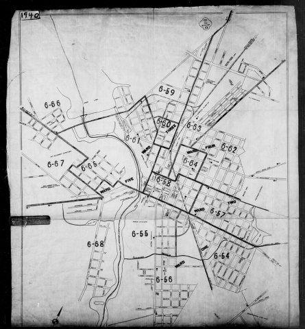 1880
 1880
 1880
 1880
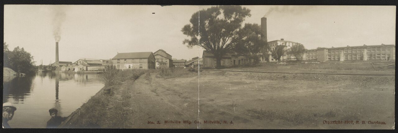
 1907
 1907
 1907
 1907
 1907


