Madison’s post office opened in 1834, and 21% of its homes were built before 1940
More historic than 90% of U.S. towns · #57 of 468 in New Jersey. What drives it
8 places in town are on the National Register, among them two historic districts with 93 buildings between them. Below: 6 old photos and papers, maps from 1886 on, and the census since 1880.
The Madison post office opened in 1834, the earliest record of the town by name. Another post office, Bottle Hill (1812), opened inside today’s town and later closed.
First census: 1,756 in 18802020 census: 16,937192 years
How historic is Madison?
A
More historic than 90% of U.S. towns, on its age, its old homes and the National Register.
Founding year: the first Madison post office (Blevins & Helbock, CC0).The full story ↓
History grade
What drives Madison’s History grade
On its age, its old homes and the National Register, Madison is more historic than 90% of U.S. towns, #57 of 468 in New Jersey. All 3 inputs are above most U.S. towns; its National Register listings ranks highest and its share of homes from before 1940 lowest.
A
HistoryA character grade: shown, never part of Madison’s overall grade.
New Jersey towns list more on the Register than most of the country (a typical New Jersey town has 3.7 per 10,000 residents, the U.S. 2.4), so Madison’s 62.0 sits above most of its state (82% of New Jersey towns have fewer) while its 102 historic buildings outnumber those of 90% of U.S. towns.
How sure. Graded on any two of the three inputs instead, the letter would range from A− to A. The pre-1940 share is a Census survey estimate (±3.8 points). The founding year is the first post office, not a stated founding date.
Founding year: the first post office (other dates in Quick answers). Homes: Census ACS 2020–24. National Register: National Park Service, May 2026 list; each listing counted once (boundary changes and added documentation belong to their listing), and a historic district counts its contributing buildings. How TownRatings grades history →
What stands out about Madison’s past
Read from the archive, the National Register and the record. The page puts what stands out first.
Every edition of the U.S. Geological Survey’s map of Madison. Tap a year, or press play to watch the town change.
1888Morristown sheet · 1:62,500
U.S. Geological Survey historical topographic maps (public domain), via Esri’s collection of the scans. The red ring marks the center of Madison.
Places that used to be
Lost post offices, old corners and burying grounds
Madison’s post office has been open since 1834. Another post office, Bottle Hill, opened and closed inside today’s town.
Bottle Hill
1812–1834
Madison
1834–today
18101920today
Hamlets and corners on the map
CrestviewFairwoodsGlenfieldKnollwoodLoantaka EstatesMadison HeightsRidgedale ParkShady Lawn ManorYardley Village
2cemeteries and burying grounds inside Madison
HillsideSaint Vincent
US Post Offices dataset (Blevins & Helbock, CC0). Places and cemeteries from the USGS Geographic Names Information System (2021).
Every building
Madison, building by building, 1886–1921
Fire insurance maps drew every building, what it was made of and what it was used for, so insurers could price the risk of fire. Pick a year, then a sheet.
Native Americans occupied present-day Madison and most of New Jersey for several thousand years, following the retreat of the Wisconsin Glacier. Lenape settlements in present-day Madison were agriculturally based following matrilineal lines. The protected lands nearby, Jockey Hollow, are what is remaining of the settlement. Occupation changed with the seasons, the variable nature of the climate, and to preserve the fertility of the rich soil. Their fishing and hunting territories were wide-ranging and similarly divided among the three clans of the matrilineal culture in this Eastern Woodland environment. Trade with these native peoples for food and furs was conducted by the Dutch during the period of colonization of New Netherland. Although the European principle of land ownership was not recognized by the Lenape, Dutch West India Company policy required their colonists to purchase land…
Passages that mention Madison, cut from the printed page as they were published.
A history of Morris County, New Jersey1914 · page 301Read the page →
Read the text
attended religious services at Whippany where a Presbyterian church was built in 1718. [History of Presbyterian Church at Madison, p. 10.] In 1748 a church was built in South Hanover, Hanover Neck, which the members of the Whippany church in this part of the township of Hanover attended. The Presbyterian church at Bottle Hill, Madison, was built in 1765, and was largely composed of patrons from the town of Chatham.
Text read by machine from the scan; it may contain errors.
Brief history of Chatham Morris County, New Jersey1914 · page 27Read the page →
Read the text
attended religious services at Whippany where a Presbyterian church was built in 1718. [History of Presbyterian Church at Madison, p. 10.] In 1748 a church was built in South Hanover, Hanover Neck, which the members of the Whippany church in this part of the township of Hanover attended. The Presbyterian church at Bottle Hill, Madison, was built in 1765, and was largely composed of patrons from the town of Chatham.
Text read by machine from the scan; it may contain errors.
A history of Morris County, New Jersey1914 · page 243Read the page →
Read the text
The Church of the Assumption ( Roman Catholic ) — The first Catholic church in Morristown was built in 1847, a wooden structure, seating 300 people. At that time the nearest church was at Madison, to which many living at a distance as great as twenty miles attended, frequently on foot. The parish was unable to support a pastor for several years, priests from Madison supplying them with religious services. Finally a priest was stationed there, also having charge of the churches at Mendham and Baskingridge. In 1871 the congregation had grown so large that these churches
Text read by machine from the scan; it may contain errors.
In the year 1804 the turnpike, or principal • avenue through the village of Madison, was made. About seventy years ago a blacksmith's shop stood on the site of the academy and an old storehouse occupied the site of the Presbyterian lecture room.
Text read by machine from the scan; it may contain errors.
Scans and text from the Internet Archive. Books published in 1930 or earlier, which are in the public domain.
Timeline
Madison, 1788 to 1926
Woven from the archive, old maps, post office records, the National Register and the people born here.
Nothing in the archives for these yearsWeddings on Main Street, storms, parades, school pictures, the old store. If it’s in your family album, it belongs here.
The Madison post office opened in 1834, the earliest record of the town by name (U.S. post office records).
How does Madison rank for history?
Madison is more historic than 90% of U.S. towns, #57 of 468 in New Jersey. The History grade combines the town’s founding era, the share of homes built before 1940 and its National Register listings. It’s a character grade, so it isn’t part of the overall grade. How it works.
What is on the National Register in Madison?
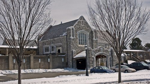
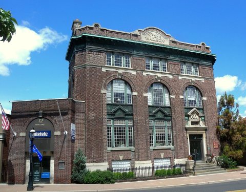
8 listings: 6 buildings, among them the Gibbons Mansion (listed 1977, the first), and 2 historic districts, the Madison Civic Commercial District and the Bottle Hill Historic District, with 93 contributing buildings. 102 historic buildings in all.
How old are the homes in Madison?
21% of Madison’s homes were built before 1940 (Census estimate, ±3.8 points), against a typical 15% for a New Jersey town; the median home was built in 1961.
Founding dates: Wikidata, Wikipedia, the U.S. post office records of Blevins & Helbock (CC0) and the Census. Homes by year built: Census ACS 2020–24. National Register of Historic Places: National Park Service (list of May 22, 2026). Old photos, postcards and papers: Wikimedia Commons, the Library of Congress and other public archives, credited on each item’s page. Maps: U.S. Geological Survey historical topographic maps (via Esri) and Sanborn fire-insurance maps (Library of Congress). History text and census tables: Wikipedia (CC BY-SA 4.0). Places that used to be: USGS Geographic Names Information System (2021).
From Wikimedia Commons (14), the Library of Congress (3), Wikidata (1), the National Register of Historic Places (8), Wikipedia, Wikidata and Wikipedia for famous people, U.S. Geological Survey historical maps, U.S. Census counts (via Wikipedia), the US Post Offices dataset (Blevins & Helbock), the USGS Geographic Names Information System, Sanborn fire insurance maps (Library of Congress) and old county and town histories (Internet Archive). Archive images are copied here with their credits and licenses, shown on each photo’s page. Refreshed monthly.


![Buildings designed by Gilbert and others.] [Elevations; sketch renderings](https://images.townratings.com/story/11139/0cab18777d1258c4b093-s.jpg) 1905
 1914
 2010
 2010
 2010
 2010
 2010
 2010
 2010
 2010
 2010
 2010
 2007