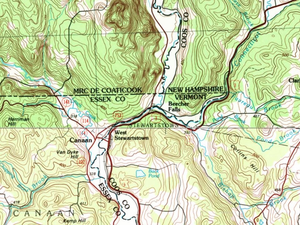
Stewartstown was granted in 1770 and incorporated in 1795. Originally named "Stuart" after Sir John Stuart, 3rd Earl of Bute, it was incorporated as "Stewartstown" after the Revolutionary War, following the original Scottish spelling of the name.
"Pellatiah Nichols Hanry Sallanhim "John Walls Elijah Benton " Call for First. Ton-,, Meeting.—" Whereas, the honorable General Court of the state of New Hampshire at their last session incorjiorai.il a place called Stewartstown by the name of Stewartstown, and vest the same with town privileges ami did appoint and authorize me the subscriber to call a meeting of the inhabitants thereof for the choice of town officers. I do therefore notify the legal voters of said Stewartstown to meet together at my house in Stewartstown on the second Tuesday of March next at one of the clocli in the afternoon Eor the following purposes namely— first to choose a Moderator to govern said meet-
Text read by machine from the scan; it may contain errors.
History of Coos County, New Hampshire .1888 · page 660Read the page →
Read the text
Connected as West Stewartstown is with the wealthy town of Canaan, Vr., by a free bridge, and forming a prominent station on the railroad, and possessing many other advantages, it has an assured future of development and growth. The manufactories will be rebuilt on a larger scale, and new ones will he established. Its mechanics and manufacturers are energetic and intelligent: its merchants shrewd and reliable, carrying good stocks; its hotel, recently enlarged and refitted, is a first-class place of entertainment. A Congregational church, with a good membership and a
Text read by machine from the scan; it may contain errors.
Scans and text from the Internet Archive. Books published in 1930 or earlier, which are in the public domain.
Lost post offices, old corners and places now gone
Stewartstown had its own post office from 1826 to 1905.
Stewartstown
1826–1905
West Stewartstown
1833–today
18201920today
Hamlets and corners on the map
Stewartstown HollowWest Stewartstown
Gone or out of use
Carr CamplocaleCedar Brook SchoolschoolHaines SchoolschoolNorth Hill SchoolschoolPiper Hill SchoolschoolSouth Hill SchoolschoolStewartstown Hollow Schoolschool
US Post Offices dataset (Blevins & Helbock, CC0). Places and cemeteries from the USGS Geographic Names Information System (2021).
Stories next door
History across the town line
Each neighbor’s History grade, on the same three inputs.
Founding dates: Wikidata, Wikipedia, the U.S. post office records of Blevins & Helbock (CC0) and the Census. Homes by year built: Census ACS 2020–24. National Register of Historic Places: National Park Service (list of May 22, 2026). Old photos, postcards and papers: Wikimedia Commons, the Library of Congress and other public archives, credited on each item’s page. Maps: U.S. Geological Survey historical topographic maps (via Esri) and Sanborn fire-insurance maps (Library of Congress). History text and census tables: Wikipedia (CC BY-SA 4.0). Places that used to be: USGS Geographic Names Information System (2021). How TownRatings grades history →
From Wikimedia Commons (10), the Library of Congress (8), Wikipedia, U.S. Geological Survey historical maps, U.S. Census counts (via Wikipedia), the US Post Offices dataset (Blevins & Helbock), the USGS Geographic Names Information System and old county and town histories (Internet Archive). Archive images are copied here with their credits and licenses, shown on each photo’s page. Refreshed monthly.



 2025
 2017
 2017
 2017
 2017
 2017
 2017
 2017
 2017
 2013
 2013
 2013
 2013
 2013
 2013
 2013
 2013
 2013