Guest, Sign inJoin

Post to Fort Totten

We’ll email a one-tap link to publish your post. No password, and nothing is public until you click it.
Already a member? Sign in
Aerial photo of Fort Totten, North Dakota
North Dakota›Benson County

Fort TottenND

A town of 1,038, settled in 1868.

Photo: U.S. Geologicial Survey · Public domain
Photo of Fort Totten

Fort Totten, ND · Photo: U.S. Geologicial Survey · Public domain · Source ↗

Is Fort Totten a good place to live?

The best of Fort Totten’s subject grades is a B for history; the weakest is a D− for incomes. 21% of the land in Fort Totten is conserved, above both the North Dakota town median (2.8%) and the median of U.S. towns (4.3%). Fort Totten is home to Cankdeska Cikana Community College. Fort Totten has fewer than 2,500 residents, so it gets subject grades but no overall grade.

What makes Fort Totten stand out

Where Fort Totten beats most towns, and one thing worth knowing.

Small town

1,038 people, and everyone knows the way

In a town this size, neighbors are the best guide. Ask them anything.

Nearby towns

How Fort Totten grades

Each subject compared with towns across the country (schools within North Dakota), ordered by how far Fort Totten is from typical.

How grading works

Character Graded, but not part of the overall grade.
Described, not graded Taste, not quality: snow or an older crowd is neither good nor bad.

How TownRatings grades towns →

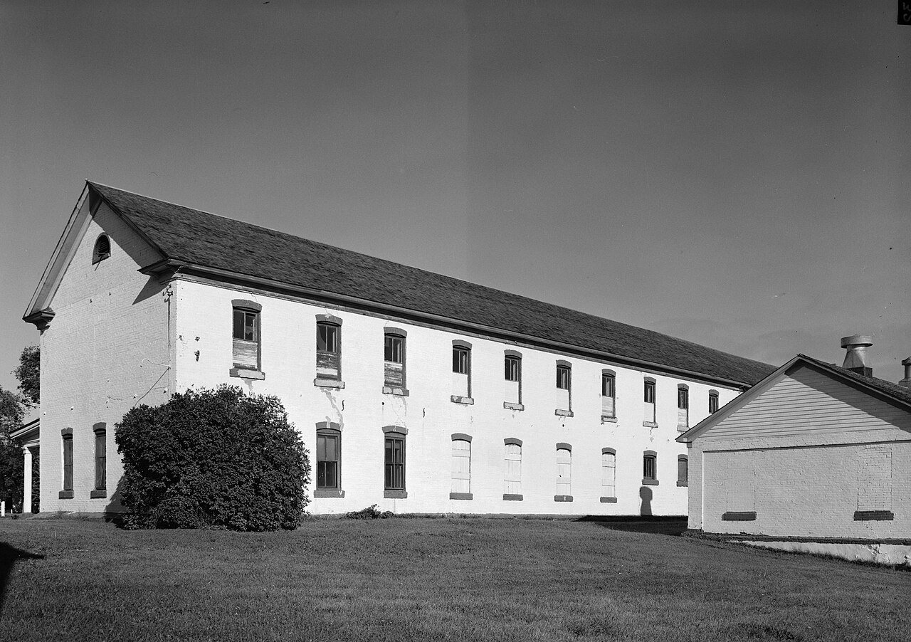
Fort Totten State Historic Site (Additional Documentation)
Fort Totten State Historic Site (Additional Documentation) · National Register of Historic Places
Fort Totten’s story

158 years in pictures

Census counts: 867 in 1990, 1,160 in 2020. The archive holds 4 old photos and papers going back to 1879 and 5 maps from 1928 on.

1 place on the National Register of Historic Places.

  • 1868Fort Totten is settled
Explore the history →
Getting set up

Moving to Fort Totten: who provides what

Fort Totten is unincorporated, so Benson County and regional agencies provide most services.

PowerOtter Tail Power11.1¢/kWh · EIA 2025HIFLD · EIA
WaterSpirit Lake Water Management RWSNo health-based violations in 5 years · EPAEPA
Internet4 providers100% of addresses get 100/20 MbpsFCC
Trash & county servicesBenson CountyBenson County provides services here
SchoolsFort Totten Public School District 30Oberon Public School District 162 districts serve Fort Totten; which school depends on your address and gradeNCES
Register to voteNot requiredNorth Dakota has no voter registration: you show ID at the polls.vote.gov
Who runs elections hereBenson County AuditorBenson County; contacts on the Handbook page.FVAP, Aug 2015
ZIP code5833558335 100%Census 2020

EPA SDWIS (Oct 9, 2026) · HIFLD + EIA-861 2025 · Census 2020 ZCTAs · NCES 2024–25 · registration: vote.gov, updated Jul 30, 2024.

The data

Ordered by what stands out in Fort Totten.

SchoolsD−

Fort Totten’s public schools rank near the bottom of North Dakota

Public schools: Tate Topa Tribal School. Below: Two of its 4 schools, each with why it was picked. The 3 public schools in Fort Totten teach 633 students between them.

1%of ND districts it outscoresD−School Grade
SchoolLevelStudentsLetter
Tate Topa Tribal SchoolLargest public elementary schoolGrades K–8Grades K–8458–
Four Winds Community High SchoolLargest public high schoolGrades 9–12Grades 9–12159D−

NCES · EDFacts · graded within ND on state tests and graduation

HealthD−

A larger share of adults in Fort Totten report frequent mental distress than in the typical North Dakota or U.S. town

Of the 24 North Dakota towns we compare, none has a higher share of adults who have obesity than Fort Totten. Fort Totten: 30% of adults say their health is fair or poor, above both North Dakota’s towns (16%) and U.S. towns (19%). 35% of Fort Totten adults feel lonely. On the CDC’s 32 measures, Fort Totten is ahead of North Dakota on 3 and behind on 24.

5%healthier than U.S. townsD−Health Grade
Fort TottenNorth Dakota townsU.S. towns
Fair or poor health (CDC PLACES)30%16%19%
Smoke cigarettes (CDC PLACES)30%13%14%
Frequent mental distress (CDC PLACES)22%15%17%
Sleep under 7 hours (CDC PLACES)47%33%36%
32 measures vs. North Dakota
3 better5 too close to call24 worse
What stands outFort TottenND
Fewer adults who have had cancer4%8.2%
Fewer adults with high cholesterol28.9%33.8%
More adults facing food insecurity36.9%10.7%
CHI St. Alexius Health Devils Lake
12.6 mi away · emergency room
1 of 3
care shortages: mental health

CDC PLACES 2025 · modeled estimates for adults · CMS · HRSA

Work & commuteJobs & income grade D−

A larger share of residents live below the poverty line in Fort Totten than in most of North Dakota or the rest of the country

Just just over a tenth of Fort Totten’s working residents have a job in town. Only 2 of the 24 North Dakota towns we compare have a lower mean commuting time than Fort Totten. Between 2013 and 2023, jobs here rose by 226, to 301. The top destinations are Oberon (28%), Mission Township (19%) and Devils Lake (6%).

12%work in town
Fort TottenNorth Dakota townsU.S. towns
Below the poverty line40%9.8%9.6%
Average trip to work10 minutes16 minutes25 minutes
Working residents who work in town12%39%8%

Where working residents work

In Fort Totten12%
Oberon28%
Mission Township19%
Devils Lake6%
Fargo6%
10 mi
median commute distance
301
jobs based in Fort Totten
A job hub
jobs vs. working residents

Census LEHD 2023 · ACS

OutdoorsC+

Fort Totten keeps 21.4% of its land conserved

Count the trails in 1 park or preserve and they come to 6.7 miles. The biggest park or preserve is White Horse Hill National Game Preserve, at 957 acres. The trail density for Fort Totten comes to 0.8 miles per square mile.

21.4%conserved
21.4%
conserved · 1,204 of 5,626 acres
6.7 mi
of trails · 0.8 per sq mi
Biggest places to walkTrailsAcres
1. White Horse Hill National Game Preserve0.9 mi957

Trails & parks © OpenStreetMap contributors · Conserved land: USGS PAD-US

Climate

Fort Totten: four seasons and pleasant summers

Among 24 North Dakota towns, just one has a lower typical July afternoon high than Fort Totten. July afternoons reach 80° and January nights drop to -2°.

80°summer high

Typical low → high °F

Winter2–20°
Spring29–51°
Summer55–78°
Fall32–53°
Oct 5
typical first frost
May 6
typical last frost
+1.3°
vs. the 20th-century average
80°
typical summer high

NOAA U.S. Climate Normals, 1991–2020

Natural hazardsHazard risk grade C+

The biggest natural risk in Fort Totten is cold waves, at a moderate overall level

Federal disaster aid has reached households in Fort Totten after 2 declared disasters, most recently in 2011. Expected damage from storms and floods is higher here than in 58% of U.S. communities. 48% of the town’s expected losses from natural hazards come from cold waves, followed by strong winds at 12%.

58risk score of 100
FEMA risk score
58Moderate riskLowerHigher
Cold wavesStrong windInland flooding
2
federal disasters paid out here

FEMA disaster declarations and aid · FEMA National Risk Index · OpenFEMA

Keep exploring

Everything we know about Fort Totten

16pages on Fort Totten
After high school

Colleges nearby

2 within 15 miles of the center of Fort Totten

A job hub

Every workday, about 281 people come to Fort Totten for work

Where Fort Totten’s working residents go each day. Line width shows the share.

28% → Oberon Oberon 28% 19% → Mission Township Mission Township 19% 6% → Devils Lake Devils Lake 6% 6% → Fargo Fargo 6% 3% → Wood Lake Township Wood Lake Township 3% 2% → Minnewaukan Minnewaukan 2% Fort Totten · 12% stay
301jobs based in Fort Totten
12%of working residents work in town
10 mimedian commute distance

Census LEHD 2023

About Fort Totten

CDP in North Dakota, United States

Fort Totten is a census-designated place (CDP) in Benson County, North Dakota, United States. The population was 1,160 at the 2020 census. Fort Totten is located within the Spirit Lake Reservation and is the site of tribal headquarters. The reservation has a total population estimated at 6,000. Although not formally incorporated as a city, Fort Totten has the largest population of any community in Benson County.

From Wikipedia, licensed CC BY-SA 4.0 · facts via Wikidata (CC0)

Area
8.8 sq mi
Elevation
1,490 ft
ZIP code
58335
Area code
701