
MurraysvilleNC
A town of 16,339.
What should you know before moving to Murraysville?
FEMA rates its natural-hazard risk higher than 96% of U.S. communities, with hurricanes at the top. Overall it grades B−, 77th of 286 graded towns in North Carolina. Residents are healthier than 85% of U.S. towns on CDC estimates and it has 7 miles of trail. 12% of the land in Murraysville is conserved, where North Carolina’s towns sit at 3.4% and U.S. towns at 4.3%. The biggest park or preserve is Ogden Park, at 164 acres.
What makes Murraysville stand out
Where Murraysville beats most towns, and one thing worth knowing.
Murraysville has grown 17% from 2010 to 2020
14,215 counted in 2010 and 16,582 in 2020.
U.S. Census 2010 & 2020 counts
How Murraysville grades
Each subject compared with towns across the country (schools within North Carolina), ordered by how far Murraysville is from typical.
How TownRatings grades towns →
Moving to Murraysville: who provides what
Murraysville is unincorporated, so New Hanover County and regional agencies provide most services.
EPA SDWIS (Oct 9, 2026) · HIFLD + EIA-861 2025 · Census 2020 ZCTAs · NCES 2024–25 · registration: vote.gov, updated Nov 18, 2024.
The data
Ordered by what stands out in Murraysville.
Murraysville has more than doubled its jobs in ten years, but it carries more natural-hazard risk than most of North Carolina (mostly hurricanes).
Murraysville earns an A− for the outdoors
Murraysville’s trail density is 0.8 miles per square mile, against 0.2 in North Carolina’s towns and 0.4 across U.S. towns. 7.3 miles of trail in 3 parks and preserves.
| Biggest places to walk | Trails | Acres |
|---|---|---|
| 1. Smith Creek Park | 2.9 mi | 135 |
| 2. Parkwood Recreation Area | 0.5 mi | 7 |
| 3. Ogden Park | — | 164 |
Trails & parks © OpenStreetMap contributors · Conserved land: USGS PAD-US
Public schools in Murraysville beat 63% of North Carolina districts
Its public schools are run by the New Hanover County Schools. Its two schools are below.
| School | Level | Students | Letter |
|---|---|---|---|
| Murrayville ElementaryLargest public elementary schoolGrades PK–5 | Grades PK–5 | 573 | B |
| Dr Hubert Eaton Sr ElemTop results in townGrades K–5 | Grades K–5 | 461 | A |
NCES · EDFacts · graded within NC on state tests and graduation
Very high risk in Murraysville, with hurricanes at the top
FEMA rates its natural-hazard risk higher than 90% of North Carolina towns, with expected losses of about $261 per resident a year; that rating is what its D− for hazard risk is built on.
One flood insurance claim has been paid in Murraysville since 2024.
FEMA flood insurance claims · FEMA National Risk Index · OpenFEMA
Murraysville earns an A for health
19% of Murraysville adults binge drink. Murraysville beats the North Carolina average on 15 of 32 CDC measures and trails it on 2. 11% of Murraysville adults report frequent physical distress.
| Murraysville | North Carolina towns | U.S. towns | |
|---|---|---|---|
| Binge drink (CDC PLACES) | 19% | 14% | 16% |
| Frequent physical distress (CDC PLACES) | 11% | 13% | 14% |
| Diabetes (CDC PLACES) | 9.1% | 13% | 12% |
| High blood pressure (CDC PLACES) | 31% | 38% | 35% |
| What stands out | Murraysville | NC |
|---|---|---|
| Fewer adults facing food insecurity | 10.7% | 15.2% |
| Fewer adults with heart disease | 4.8% | 6.6% |
| More binge drinkers | 19.4% | 14.7% |
CDC PLACES 2025 · modeled estimates for adults · CMS · HRSA
About half of Murraysville’s working residents commute to Wilmington
Jobs based here grew from 979 in 2013 to 4,182.
Most working residents leave Murraysville for work: only 4% work in town. 4.5% of residents live below the poverty line in Murraysville. Jobs based in Murraysville grew to 4,182 in 2023, 3,203 more than in 2013.
| Murraysville | North Carolina towns | U.S. towns | |
|---|---|---|---|
| Below the poverty line | 4.5% | 13% | 9.6% |
| Work from home | 14% | 12% | 11% |
| Working residents who work in town | 4% | 6.8% | 8% |
| Average trip to work | 23 minutes | 24 minutes | 25 minutes |
Where working residents work
Census LEHD 2023 · ACS
Mild winters and hot summers in Murraysville
Murraysville has mild winters and warm summers, with plenty of rain. Murraysville’s July high is 90°F.
Typical low → high °F
NOAA U.S. Climate Normals, 1991–2020
A home in Murraysville sells for about $384K at the median
The median rent in Murraysville is $1,777 a month.
| Murraysville | North Carolina towns | U.S. towns | |
|---|---|---|---|
| Median rent | $1,777 a month | $1,084 a month | $1,185 a month |
| Households that own their home | 77% | 67% | 73% |
Census ACS, 2020–24 · Zillow Home Value Index · Redfin Data Center
Fort Fisher and 10 more within 40 miles
Museums, parks, gardens and other places to visit around Murraysville. Close and well known come first.
 23 mi LandmarkFort Fisher
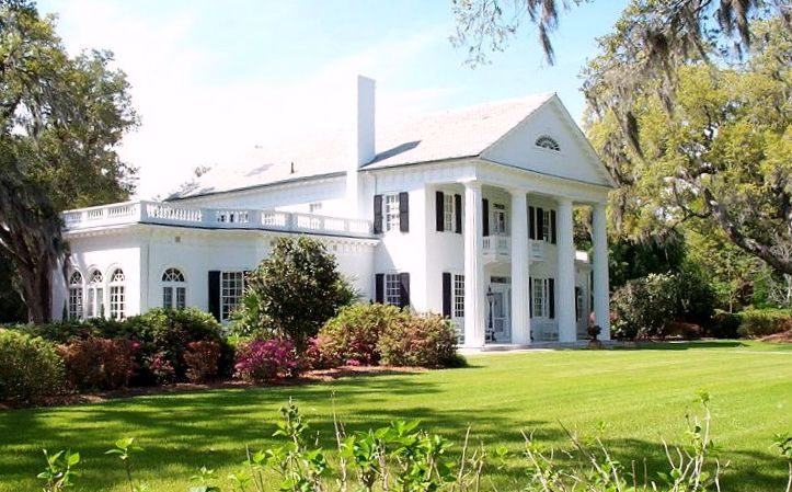 17 mi GardenOrton Plantation
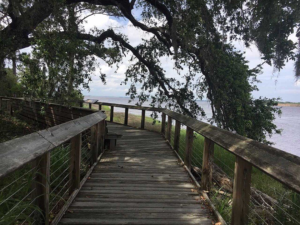 18 mi MuseumBrunswick Town5 mi GardenAirlie Gardens
 19 mi National BattlefieldMoores Creek National Battlefield56K visitors a year
 7 mi TheatreThalian Hall
Photo credits
Fort Fisher: Eric T. Gunther, CC BY 3.0 · Orton Plantation: AgnosticPreachersKid., CC BY-SA 3.0 · Brunswick Town: Brunswick1726, CC BY-SA 4.0 · Moores Creek National Battlefield: Unknown authorUnknown author, Public domain · Thalian Hall: Sanfranman59, CC BY-SA 3.0


Everything we know about Murraysville
Colleges nearby
3 within 15 miles of the center of Murraysville
About 9 of every 100 Murraysville residents are enrolled in college, against 6 across North Carolina.
7 miles of trails in Murraysville
12% of the town is conserved land, across 3 parks and preserves.
About Murraysville
CDP in North Carolina, United States
Murrayville is a census-designated place (CDP) in New Hanover County, North Carolina, United States. The population was 16,582 at the 2020 census, up from 14,215 in 2010. Murrayville is located in the statistical townships of Cape Fear and Harnett. The CDP is part of the Wilmington Metropolitan Statistical Area. Murrayville was first listed as a CDP in the 2000 United States census.
From Wikipedia, licensed CC BY-SA 4.0 · facts via Wikidata (CC0)
- Area
- 8.7 sq mi
- Elevation
- 33 ft
Murraysville’s neighbors
4 towns share a border with Murraysville.
| Town | NC rank | Overall | Cost | Safety | Schools | Health |
|---|---|---|---|---|---|---|
| Murraysville | #77 | B− | C+ | — | B | A |
| Wilmington | #192 | C− | D | D | B | B+ |
| Bayshore | #62 | B | C− | — | B | A |
| Northchase | #208 | C− | C+ | — | B | C+ |
| Kings Grant | #133 | C+ | C+ | — | B | B |
Murraysville, Bayshore, Northchase and Kings Grant report no FBI crime data of their own. Compare Murraysville with a neighbor →
Questions about Murraysville
Short answers, built from the data on this page.
Is Murraysville, NC a good place to live?
Murraysville grades B− overall, better than 55% of U.S. towns and #77 of 286 in North Carolina. It grades A for health and B for schools. Hazard risk is its weak spot, with a D−.
Is Murraysville, NC expensive?
The typical home is worth about $321,000, 3% below the North Carolina typical home. Cost of living, which also weighs rents, property taxes and how many households pay 30% or more of their income for housing, grades C+.