Guest, Sign inJoin

Post to Durham

We’ll email a one-tap link to publish your post. No password, and nothing is public until you click it.
Already a member? Sign in
BHistory
History · Durham

Durham’s post office opened in 1853, and 64 of its places are on the National Register

More historic than 55% of U.S. towns · #122 of 290 in North Carolina. What drives it

Most of Durham was built recently: 5% of its homes predate 1940 and the median home dates from 1995. 64 places in town are on the National Register, among them 4 National Historic Landmarks and ten historic districts with 3,848 buildings between them. Below: 3 old photos and papers, maps from 1884 on, and the census since 1880.

1853first post office
64on the National Register
5%homes built before 1940
3old photos & papers
23famous people
From Durham’s archive · credits on each photo
Quick answers

How Durham began

When was Durham founded?

1853

The Durham post office opened in 1853, the earliest record of the town by name. Wikidata gives 1869. Six smaller post offices, Braggtown (1880), Brassfield (1882) and Carr (1886), opened inside today’s city and later closed.

First census: 2,041 in 18802020 census: 283,506173 years

How historic is Durham?

B

More historic than 55% of U.S. towns, on its age, its old homes and the National Register.

What drives the grade ↓
Founding year: the first Durham post office (Blevins & Helbock, CC0). Wikidata: 1869.The full story ↓
History grade

What drives Durham’s History grade

On its age, its old homes and the National Register, Durham is more historic than 55% of U.S. towns, #122 of 290 in North Carolina. Its National Register listings hold the grade up; its share of homes from before 1940 pulls it down.

B
HistoryA character grade: shown, never part of Durham’s overall grade.
All U.S. towns we grade (21,289)Ahead of 55%
NewerOlder
North Carolina towns of 2,500+ (290)Ahead of 58%

Among the 400 U.S. cities of 100,000 or more, Durham ranks #223 on History.

North Carolina towns list more on the Register than most of the country (a typical North Carolina town has 12.5 per 10,000 residents, the U.S. 2.4), so Durham’s 135 sits above most of its state (80% of North Carolina towns have fewer) while its 3,933 historic buildings outnumber those of 100% of U.S. towns.

How sure. Graded on any two of the three inputs instead, the letter would range from C to B+. The pre-1940 share (±0.4 points) is firm at this size. The founding year is the first post office, not a stated founding date; Wikidata’s 1869 falls in the same era, so the grade doesn’t depend on which one is used.

Founding year: the first post office (other dates in Quick answers). Homes: Census ACS 2020–24. National Register: National Park Service, May 2026 list; each listing counted once (boundary changes and added documentation belong to their listing), and a historic district counts its contributing buildings. How TownRatings grades history →

What stands out about Durham’s past

Read from the archive, the National Register and the record. The page puts what stands out first.

★ What stands out · On the National Register

64 listings protect 3,933 historic buildings

The country’s official list of buildings and places worth saving. 4 are National Historic Landmarks, the highest tier. Boundary changes and added documentation are counted with their listing.

places listed
64
National Historic Landmarks
4
Pauli Murray Family Home
historic buildings protected
3,933
each building in a district counts
first listed
1966
Duke Homestead and Tobacco Factory
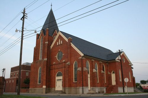
Bennett Place State Historic SiteSt. Joseph's African Methodist Episcopal ChurchDowntown Durham Historic DistrictJohn Sprunt Hill HouseHorton Grove ComplexDurham Hosiery MillDillard-Gamble HousesBassett HouseCranford-Wannamaker HouseCrowell HousePegram HouseWatts Hospital, built 1895GreystoneBullington WarehouseWatts and Yuille WarehousesErwin Cotton Mills Company Mill No. 1 Headquarters BuildingNorth Durham-Duke Park DistrictDurham Cotton Mills Village Historic DistrictEmmanuel AME ChurchEphphatha Church, built 1930Golden Belt Historic DistrictMorehead Hill Historic DistrictPearl Mill Village Historic DistrictPowe HouseScarborough HouseVenable Tobacco Company WarehouseWest Point on the EnoWilliam Thomas O'Brien HouseDuke Memorial United Methodist ChurchSmith WarehouseCleveland Street DistrictHolloway Street DistrictDurham Hosiery Mills No. 2-Service Printing Company BuildingTrinity Historic DistrictWest Durham Historic DistrictNorth Carolina Central UniversityBartlett Mangum HouseRichard D. Blacknall HouseBright Leaf Historic DistrictCity Garage Yard and Fire Drill Tower, built 1928Clark and Sorrell Garage, built 1941American Tobacco Company Manufacturing Plant, built 1899Watts-Hillandale Historic DistrictLakewood Park Historic DistrictVenable Tobacco Company Prizery and Receiving RoomForest Hills Historic DistrictKinchen Holloway HouseBurch Avenue Historic DistrictJohm C. and Binford Carr HouseScott and Roberts Dry Cleaning Plant, Office, and StoreMary Duke Biddle EstateFoster and West Geer Streets Historic DistrictHillside Park High SchoolDurham Hosiery Mills Dye House, built 1921East Durham Historic DistrictStokesdale Historic DistrictCollege Heights Historic DistrictWest End Cemeteries Historic DistrictHarriet Tubman YWCADuke Homestead and Tobacco Factory★Bull Durham Tobacco Factory★North Carolina Mutual Life Insurance Company Building★
BuildingsDistrictsSites★ landmark

Architectural styles listings

Colonial Revival13
Queen Anne12
Tudor Revival9
Bungalow/Craftsman8
Italianate6
Romanesque Revival6
All 64 listings
Horton Grove ComplexBuilding · listed 1978Durham Hosiery MillBuilding · listed 1978Dillard-Gamble HousesBuilding · listed 1979Bassett HouseBuilding · listed 1979Cranford-Wannamaker HouseBuilding · listed 1979Crowell HouseBuilding · listed 1979Pegram HouseBuilding · listed 1979Watts HospitalBuilding · listed 1980GreystoneBuilding · listed 1982Bullington WarehouseBuilding · listed 1982Watts and Yuille WarehousesBuilding · listed 1984Erwin Cotton Mills Company Mill No. 1 Headquarters BuildingBuilding · listed 1984North Durham-Duke Park DistrictDistrict · listed 1985Durham Cotton Mills Village Historic DistrictDistrict · listed 1985Emmanuel AME ChurchBuilding · listed 1985Ephphatha ChurchBuilding · listed 1985Golden Belt Historic DistrictDistrict · listed 1985Morehead Hill Historic DistrictDistrict · listed 1985Pearl Mill Village Historic DistrictDistrict · listed 1985Powe HouseBuilding · listed 1985Scarborough HouseBuilding · listed 1985Venable Tobacco Company WarehouseBuilding · listed 1985West Point on the EnoDistrict · listed 1985William Thomas O'Brien HouseBuilding · listed 1985Duke Memorial United Methodist ChurchBuilding · listed 1985Smith WarehouseBuilding · listed 1985Cleveland Street DistrictDistrict · listed 1985Holloway Street DistrictDistrict · listed 1985Durham Hosiery Mills No. 2-Service Printing Company BuildingBuilding · listed 1985Trinity Historic DistrictDistrict · listed 1986West Durham Historic DistrictDistrict · listed 1986North Carolina Central UniversityDistrict · listed 1986Bartlett Mangum HouseBuilding · listed 1989Richard D. Blacknall HouseBuilding · listed 1990Bright Leaf Historic DistrictDistrict · listed 1999City Garage Yard and Fire Drill TowerBuilding · listed 2000Clark and Sorrell GarageBuilding · listed 2000American Tobacco Company Manufacturing PlantDistrict · listed 2000Watts-Hillandale Historic DistrictDistrict · listed 2001Lakewood Park Historic DistrictDistrict · listed 2003Venable Tobacco Company Prizery and Receiving RoomBuilding · listed 2003Forest Hills Historic DistrictDistrict · listed 2005Kinchen Holloway HouseBuilding · listed 2008Burch Avenue Historic DistrictDistrict · listed 2010Johm C. and Binford Carr HouseBuilding · listed 2011Scott and Roberts Dry Cleaning Plant, Office, and StoreBuilding · listed 2012Mary Duke Biddle EstateBuilding · listed 2013Foster and West Geer Streets Historic DistrictDistrict · listed 2013Hillside Park High SchoolBuilding · listed 2013Durham Hosiery Mills Dye HouseBuilding · listed 2014East Durham Historic DistrictDistrict · listed 2004Stokesdale Historic DistrictDistrict · listed 2010College Heights Historic DistrictDistrict · listed 2019Geer CemeterySite · listed 2024West End Cemeteries Historic DistrictDistrict · listed 2024Harriet Tubman YWCABuilding · listed 2024

National Park Service, National Register of Historic Places. Photos from Wikimedia Commons, credited on each place’s page.

Places that used to be

Lost post offices, old corners, places now gone and burying grounds

Durham’s post office has been open since 1853. Six other post offices opened and closed inside today’s town.

Durham
1853–today
Braggtown
1880–1881
Brassfield
1882–1883
Carr
1886–1888
East Durham
1887–1926
Nelson
1888–1914
West Durham
1894–1926
18501940today
Hamlets and corners on the map
Archer WoodsBethesdaBraggtownBrassfieldChicopee HillsColony ParkEastwood ParkFalconbridgeFewFive OaksForest AcresGenleeHayesHeritage HeightsHickory OaksHope Valley NorthHope Valley WestHuckleberry SpringHuntington PlaceJoylandKeeneLochnoraLowes GroveMarydell
Gone or out of use
Watts Hospitalhospital
6cemeteries and burying grounds inside Durham
Aldersgate Memorial Garden and ColumbariumBeechwoodDuke University Chapel CryptGlenview Memorial ParkMaplewoodWoodlawn Memorial Park

US Post Offices dataset (Blevins & Helbock, CC0). Places and cemeteries from the USGS Geographic Names Information System (2021).

The story

How Durham came to be

From Wikipedia’s history of Durham.

Read it all →

The Eno and the Occoneechi, related to the Sioux and the Shakori, lived in the area and may have established a village named Adshusheer (or Ajusher) in the area which became Durham. The Occaneechi Path, a corridor of trading roads and trails, went through the area. Native Americans expanded the region by establishing settlements and commercial transportation routes.

Text from Wikipedia, licensed CC BY-SA 4.0.

Timeline

Durham, 1853 to 1976

Woven from the archive, old maps, post office records, the National Register and the people born here.

  1. 19th century
  2. 1853Post officeThe Durham post office opens
  3. 1856Born hereJames Buchanan Duke is born here
  4. 1880Post officeThe Braggtown post office opens
  5. 1881Post officeThe Braggtown post office closes
  6. 1882Post officeThe Brassfield post office opens
  7. 1883In the archiveFirst Duke tobacco factory and surrounding buildings 1883
  8. 1883Post officeThe Brassfield post office closes
  9. 1895BuiltWatts Hospital is built
  10. 1898BuiltPauli Murray Family Home is built
  11. 20th century
  12. 1913In the archiveBull Durham Tobacco Advertisement, May 1913
  13. 1928BuiltCity Garage Yard and Fire Drill Tower is built
  14. 1930BuiltEphphatha Church is built
  15. 1931Born hereFred Brooks is born here
  16. 1944Born hereChristopher Browning is born here
  17. 1951On the mapFirst mapped by the U.S. Geological Survey
  18. 1966LandmarkDuke Homestead and Tobacco Factory named a National Historic Landmark
  19. 1975LandmarkNorth Carolina Mutual Life Insurance Company Building named a National Historic Landmark
  20. 1976Born hereSeth Wescott is born here
By decade

Durham, decade by decade

2 decades in the archive, from the 1880s to the 1910s. Scroll each row; tap a photo for its story.

1920s–1990snothing yet
Nothing in the archives for these yearsWeddings on Main Street, storms, parades, school pictures, the old store. If it’s in your family album, it belongs here.
Add from your album
On the map

Durham on the map, 1951 to 1993

Every edition of the U.S. Geological Survey’s map of Durham. Tap a year, or press play to watch the town change.

Durham on the 1951 USGS mapDurham on the 1973 USGS mapDurham on the 1981 USGS mapDurham on the 1993 USGS map1951Durham South sheet · 1:62,500

U.S. Geological Survey historical topographic maps (public domain), via Esri’s collection of the scans. The red ring marks the center of Durham.

Every building

Durham, building by building, 1884–1913

Fire insurance maps drew every building, what it was made of and what it was used for, so insurers could price the risk of fire. Pick a year, then a sheet.

Durham fire insurance map, 1884, sheet 11884Sheet 1 of 5
Edition
BrickWoodStone

Sanborn Map Company, via the Library of Congress. Editions published in 1930 or earlier, which are in the public domain.

Then & now

Stand where they stood

No then-and-now pairs yet. Take a photo from the same spot as an old one and they appear here side by side.

First Duke tobacco factory and surrounding buildings 1883
Retake this viewFirst Duke tobacco factory and surrounding buildings 1883, 1883

Find the spot, match the angle, and add your photo. It becomes the first then-and-now pair on Durham’s page.

Retake this view · +15
People over time

Durham, census by census

020,00040,00060,00080,000100,000120,000140,000160,000180,000200,000220,000240,000260,000280,000300,00018801900192019401960198020002020283,506

Grew from 2,041 people in 1880 to 283,506 in 2020, more than tenfold.

15 censuses, 1880–2020.

U.S. Census Bureau decennial counts, from the census table on Durham’s Wikipedia page.

Famous people

23 famous people were born in Durham

Writers, athletes, leaders and more, ranked by how widely they’re known.

See all →
Help out

Start Durham’s collection

The first neighbors to add old photos shape how Durham’s history is told.

Decades since 1900 with photos
00s10s20s30s40s50s60s70s80s90s
1 of 10 decades. The empty ones are waiting for someone’s album.
Stories next door

History across the town line

Each neighbor’s History grade, on the same three inputs.

Questions about Durham’s history

What year was Durham founded?

The Durham post office opened in 1853, the earliest record of the town by name (U.S. post office records). Wikidata gives 1869.

How does Durham rank for history?

Durham is more historic than 55% of U.S. towns, #122 of 290 in North Carolina. The History grade combines the town’s founding era, the share of homes built before 1940 and its National Register listings. It’s a character grade, so it isn’t part of the overall grade. How it works.

What is on the National Register in Durham?

64 listings, 4 of them National Historic Landmarks: 38 buildings, among them the Duke Homestead and Tobacco Factory (listed 1966, the first), 23 historic districts with 3,848 contributing buildings, and 2 sites. 3,933 historic buildings in all.

How old are the homes in Durham?

5% of Durham’s homes were built before 1940 (Census estimate), against a typical 4.1% for a North Carolina town; the median home was built in 1995.

Memory lane

What the archives can’t tell you, neighbors can.

Town Square →
Start a conversation
Sources

Where this page comes from

Founding dates: Wikidata, Wikipedia, the U.S. post office records of Blevins & Helbock (CC0) and the Census. Homes by year built: Census ACS 2020–24. National Register of Historic Places: National Park Service (list of May 22, 2026). Old photos, postcards and papers: Wikimedia Commons, the Library of Congress and other public archives, credited on each item’s page. Maps: U.S. Geological Survey historical topographic maps (via Esri) and Sanborn fire-insurance maps (Library of Congress). History text and census tables: Wikipedia (CC BY-SA 4.0). Places that used to be: USGS Geographic Names Information System (2021).

From Wikimedia Commons (3), Wikidata (3), the National Register of Historic Places (64), Wikipedia, Wikidata and Wikipedia for famous people, U.S. Geological Survey historical maps, U.S. Census counts (via Wikipedia), the US Post Offices dataset (Blevins & Helbock), the USGS Geographic Names Information System and Sanborn fire insurance maps (Library of Congress). Archive images are copied here with their credits and licenses, shown on each photo’s page. Refreshed monthly.