Cooke City’s post office opened in 1957, and 1 of its places is on the National Register
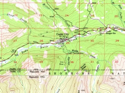
Most of Cooke City was built recently: 0.7% of its homes predate 1940 and the median home dates from 1983. Its Register listing is the Cooke City Store. Below: 5 old photos and papers and maps from 1956 on.
The Cooke City post office opened in 1957, the earliest record of the town by name. Another post office, Cooke (1882), opened inside today’s town and later closed.
2020 census: 7769 years
Founding year: the first Cooke City post office (Blevins & Helbock, CC0).
The story so far
Cooke City, in brief
Wikipedia doesn’t have a history of Cooke City yet. The photos, dates and memories neighbors add here are how it gets written.
Cooke City is an unincorporated community and census-designated place (CDP) in Park County, Montana, United States. As of the 2020 census, it had a population of 77. Prior to 2010, it was part of the Cooke City-Silver Gate CDP. The community sits northeast of Yellowstone National Park on the Beartooth Highway, which leads east to Red Lodge, Montana, on a scenic route climbing to 10,947 feet (3,337 m) in elevation through the Beartooth Mountains and across the Beartooth Plateau. The town's chief industry is tourism, which during the winter includes skiing and snowmobiling. It is named for Jay Cooke, financier of the Northern Pacific Railroad.
Its first post office opened in 1957. Between the 2010 and 2020 censuses its population grew from 75 to 77 (+3%).
Intro from Wikipedia. Population: U.S. Census Bureau.
Timeline
Cooke City, 1882 to 1965
Woven from the archive, old maps, post office records, the National Register and the people born here.
Nothing in the archives for these yearsWeddings on Main Street, storms, parades, school pictures, the old store. If it’s in your family album, it belongs here.
Nothing in the archives for these yearsWeddings on Main Street, storms, parades, school pictures, the old store. If it’s in your family album, it belongs here.
National Park Service, National Register of Historic Places. Photos from Wikimedia Commons, credited on each place’s page.
Places that used to be
Lost post offices, old corners, places now gone and burying grounds
Cooke City’s post office has been open since 1957. Another post office, Cooke, opened and closed inside today’s town.
Cooke
1882–1957
Cooke City
1957–today
18801950today
Hamlets and corners on the map
Ricci Trailer Terraces
Gone or out of use
Erma Number 1 MinemineErma Number 2 MinemineErma Number 3 MinemineErma Number 4 MinemineIrma MinesmineMcLaren TailingsmineMiller Creek Number 1 MinemineMohawk MinemineMohawk Minemine
1cemetery inside Cooke City
Cooke City
US Post Offices dataset (Blevins & Helbock, CC0). Places and cemeteries from the USGS Geographic Names Information System (2021).
Help out
Finish Cooke City’s story
Most archives stop around 1920. The photos from after that are in family albums, not libraries.
Decades since 1900 with photos
00s10s20s30s40s50s60s70s80s90s
2 of 10 decades. The empty ones are waiting for someone’s album.
Founding dates: Wikidata, Wikipedia, the U.S. post office records of Blevins & Helbock (CC0) and the Census. Homes by year built: Census ACS 2020–24. National Register of Historic Places: National Park Service (list of May 22, 2026). Old photos, postcards and papers: Wikimedia Commons, the Library of Congress and other public archives, credited on each item’s page. Maps: U.S. Geological Survey historical topographic maps (via Esri) and Sanborn fire-insurance maps (Library of Congress). History text and census tables: Wikipedia (CC BY-SA 4.0). Places that used to be: USGS Geographic Names Information System (2021). How TownRatings grades history →
From Wikimedia Commons (12), the National Register of Historic Places (1), U.S. Geological Survey historical maps, the US Post Offices dataset (Blevins & Helbock) and the USGS Geographic Names Information System. Archive images are copied here with their credits and licenses, shown on each photo’s page. Refreshed monthly.



 1917
 1917
 1919
 2009
 2009
 2004
 2003
 2003
 2003
 2003


