Columbia’s post office opened in 1821, and 41 of its places are on the National Register
More historic than 76% of U.S. towns · #54 of 247 in Missouri. What drives it
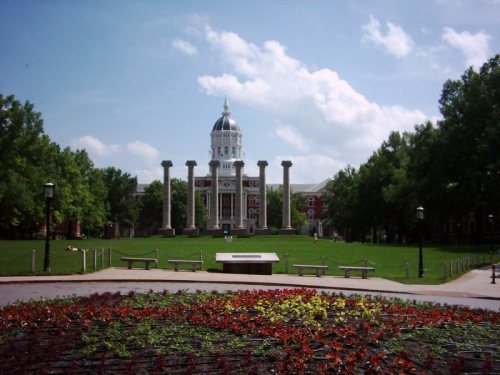
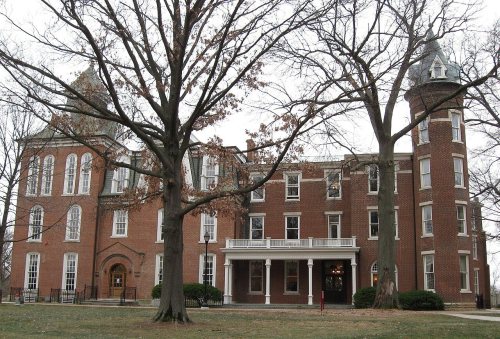
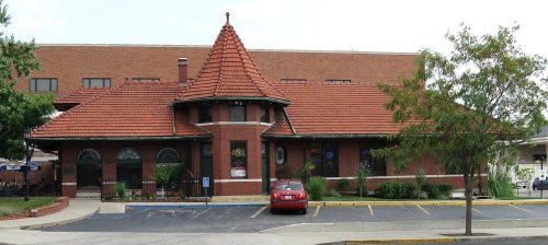
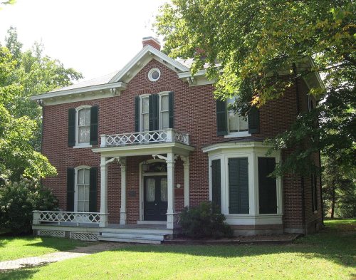
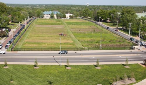
Most of Columbia was built recently: 4% of its homes predate 1940 and the median home dates from 1993. 41 places in town are on the National Register, among them the Sanborn Field and Soil Erosion Plots, a National Historic Landmark, and seven historic districts with 425 buildings between them. Below: 5 old photos and papers, maps from 1883 on, and the census since 1830.
The Columbia post office opened in 1821, the earliest record of the town by name. Two smaller post offices, Stephens (1868) and Switzler (1891), opened inside today’s city and later closed.
First census: 600 in 18302020 census: 126,254205 years
How historic is Columbia?
A−
More historic than 76% of U.S. towns, on its age, its old homes and the National Register.
Founding year: the first Columbia post office (Blevins & Helbock, CC0).The full story ↓
History grade
What drives Columbia’s History grade
On its age, its old homes and the National Register, Columbia is more historic than 76% of U.S. towns, #54 of 247 in Missouri. Its National Register listings hold the grade up; its share of homes from before 1940 pulls it down.
A−
HistoryA character grade: shown, never part of Columbia’s overall grade.
Among the 400 U.S. cities of 100,000 or more, Columbia ranks #145 on History.
Missouri towns list about as much on the Register as the country (a typical Missouri town has 2.4 per 10,000 residents, the U.S. 2.4), so Columbia’s 36.6 sits above most of its state (86% of Missouri towns have fewer) while its 471 historic buildings outnumber those of 97% of U.S. towns.
How sure. Graded on any two of the three inputs instead, the letter would range from B− to A. The pre-1940 share (±0.7 points) is firm at this size. The founding year is the first post office, not a stated founding date.
Founding year: the first post office (other dates in Quick answers). Homes: Census ACS 2020–24. National Register: National Park Service, May 2026 list; each listing counted once (boundary changes and added documentation belong to their listing), and a historic district counts its contributing buildings. How TownRatings grades history →
What stands out about Columbia’s past
Read from the archive, the National Register and the record. The page puts what stands out first.
The country’s official list of buildings and places worth saving. One is a National Historic Landmark, the highest tier. Boundary changes and added documentation are counted with their listing.
Columbia's origins begin with the settlement of American pioneers from Kentucky and Virginia in an early 1800s region known as the Boonslick. Before 1815, settlement in the region was confined to small log forts due to the threat of Native American attack during the War of 1812. When the war ended, settlers came on foot, horseback, and wagon, often moving entire households along the Boone's Lick Road and often bringing enslaved African Americans. By 1818, the increased population clearly would necessitate a new county be created from territorial Howard County. The Moniteau Creek on the west and Cedar Creek on the east were obvious natural boundaries.
Passages that mention Columbia, cut from the printed page as they were published.
History of the expedition under the command of Lewis and Clark, to the sources of the Missouri River, thence across the Rocky Mountains and down the Columbia River to the Pacific Ocean, performed during the years 1804-5-6, by order of the Government of th1893 · page 1344Read the page →
Read the text
Portage cr. or r., 376, 377; 398, 1084, 1260 des Sioux, Ixix from Missouri to Columbia waters, 572, 573, 574 of cascades of Columbia r., 941, 942, 944 ef great chute, 684
Text read by machine from the scan; it may contain errors.
History of the expedition under the command of Lewis and Clark, to the sources of the Missouri River, thence across the Rocky Mountains and down the Columbia River to the Pacific Ocean, performed during the years 1804-5-6, by order of the Government of th1893 · page 1323Read the page →
Read the text
Guy's bluffs, 1156 greasewood, 325, 869 great African serpent, cxvii buzzard of Columbia r,, 873 Great bend of Mo. r,, 123, 124, 125 Columbia r,, 637 Dalles, 955 Divide, 472, 485, 1123
Text read by machine from the scan; it may contain errors.
New light on the early history of the greater Northwest. The manuscript journals of Alexander Henry ... and of David Thompson ... 1799-1814. Exploration and adventure among the Indians on the Red, Saskatchewan, Missouri and Columbia rivers1897 · page 936Read the page →
Read the text
Columbia brigades or canoes, 547, 569, 604, 622, 626, 642, 645, 646, 647, 648, 653, 654, 677 Columbia dept., 752, 895, 896, 899 Columbia falls, 844 Columbia Fur Co., 146 Columbia ho., 616, 626 Columbia lakes, 300, 440, 606,
Text read by machine from the scan; it may contain errors.
Scans and text from the Internet Archive. Books published in 1930 or earlier, which are in the public domain.
Timeline
Columbia, 1821 to 1970
Woven from the archive, old maps, post office records, the National Register and the people born here.
Nothing in the archives for these yearsWeddings on Main Street, storms, parades, school pictures, the old store. If it’s in your family album, it belongs here.
Every edition of the U.S. Geological Survey’s map of Columbia. Tap a year, or press play to watch the town change.
1935Columbia sheet · 1:24,000
U.S. Geological Survey historical topographic maps (public domain), via Esri’s collection of the scans. The red ring marks the center of Columbia.
Every building
Columbia, building by building, 1883–1925
Fire insurance maps drew every building, what it was made of and what it was used for, so insurers could price the risk of fire. Pick a year, then a sheet.
The Columbia post office opened in 1821, the earliest record of the town by name (U.S. post office records).
How does Columbia rank for history?
Columbia is more historic than 76% of U.S. towns, #54 of 247 in Missouri. The History grade combines the town’s founding era, the share of homes built before 1940 and its National Register listings. It’s a character grade, so it isn’t part of the overall grade. How it works.
What is on the National Register in Columbia?
41 listings: 32 buildings, 7 historic districts with 425 contributing buildings, and 2 sites. 471 historic buildings in all.
How old are the homes in Columbia?
4% of Columbia’s homes were built before 1940 (Census estimate), against a typical 8.4% for a Missouri town; the median home was built in 1993.
Founding dates: Wikidata, Wikipedia, the U.S. post office records of Blevins & Helbock (CC0) and the Census. Homes by year built: Census ACS 2020–24. National Register of Historic Places: National Park Service (list of May 22, 2026). Old photos, postcards and papers: Wikimedia Commons, the Library of Congress and other public archives, credited on each item’s page. Maps: U.S. Geological Survey historical topographic maps (via Esri) and Sanborn fire-insurance maps (Library of Congress). History text and census tables: Wikipedia (CC BY-SA 4.0). Places that used to be: USGS Geographic Names Information System (2021).
From Wikimedia Commons (5), Wikidata (1), the National Register of Historic Places (41), Wikipedia, Wikidata and Wikipedia for famous people, U.S. Geological Survey historical maps, U.S. Census counts (via Wikipedia), the US Post Offices dataset (Blevins & Helbock), the USGS Geographic Names Information System, Sanborn fire insurance maps (Library of Congress) and old county and town histories (Internet Archive). Archive images are copied here with their credits and licenses, shown on each photo’s page. Refreshed monthly.


 ★ Landmark