Guest, Sign inJoin

Post to Blue Earth City Township

We’ll email a one-tap link to publish your post. No password, and nothing is public until you click it.
Already a member? Sign in
–Not graded
History · Blue Earth City Township

24% of Blue Earth City Township’s homes were built before 1940

Below: 11 old photos and papers, maps from 1967 on, and the census since 1880.

0on the National Register
24%homes built before 1940
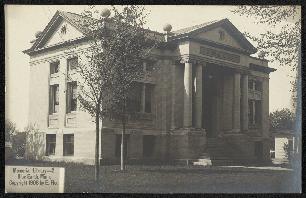
11old photos & papers
7famous people
From Blue Earth City Township’s archive · credits on each photo
The story

How Blue Earth City Township came to be

From Wikipedia’s history of Blue Earth City Township.

Read it all →

Blue Earth was platted in 1856. The city took its name from the Blue Earth River which surrounds the town. The river was given the Dakota language name makȟátȟo (meaning "blue earth") for the blue-green clay found in the river banks, from the phrase makato osa watapa: "the river where blue earth is gathered".

A post office has been in operation at Blue Earth since 1856.

The city celebrated its sesquicentennial in the summer of 2006 with community events, including a concert headlined by Peter Noone of Herman's Hermits.

Text from Wikipedia, licensed CC BY-SA 4.0.

Timeline

Blue Earth City Township, 1905 to 1967

Woven from the archive, old maps, post office records, the National Register and the people born here.

  1. 20th century
  2. 1905In the archivePresbyterian Church
  3. 1931Born hereArlen Erdahl is born here
  4. 1941Born hereBuddy Wolfe is born here
  5. 1943Born hereTom Hagedorn is born here
  6. 1962Born hereJim Hagedorn is born here
  7. 1967On the mapFirst mapped by the U.S. Geological Survey
By decade

Blue Earth City Township, decade by decade

One decade in the archive so far: the 1900s. Scroll each row; tap a photo for its story.

1910s–1990snothing yet
Nothing in the archives for these yearsWeddings on Main Street, storms, parades, school pictures, the old store. If it’s in your family album, it belongs here.
Add from your album
On the map

Blue Earth City Township on the map, 1967 to 1985

Every edition of the U.S. Geological Survey’s map of Blue Earth City Township. Tap a year, or press play to watch the town change.

Blue Earth City Township on the 1967 USGS mapBlue Earth City Township on the 1985 USGS map1967Blue Earth sheet · 1:24,000

U.S. Geological Survey historical topographic maps (public domain), via Esri’s collection of the scans. The red ring marks the center of Blue Earth City Township.

Then & now

Stand where they stood

No then-and-now pairs yet. Take a photo from the same spot as an old one and they appear here side by side.

Presbyterian Church
Retake this viewPresbyterian Church, 1905

Find the spot, match the angle, and add your photo. It becomes the first then-and-now pair on Blue Earth City Township’s page.

Retake this view · +15
People over time

Blue Earth City Township, census by census

05001,0001,5002,0002,5003,0003,5004,0004,50018801900192019401960198020002020Peak: 4,200

Between 1,066 and 4,200 people in every census since 1880.

15 censuses, 1880–2020.

U.S. Census Bureau decennial counts, from the census table on Blue Earth City Township’s Wikipedia page.

Famous people

7 famous people were born in Blue Earth City Township

Writers, athletes, leaders and more, ranked by how widely they’re known.

See all →
Places that used to be

Old corners

Old hamlets and crossroads still carry their names on the map.

Hamlets and corners on the map
Riverside Heights

Places and cemeteries from the USGS Geographic Names Information System (2021).

Help out

Finish Blue Earth City Township’s story

Most archives stop around 1920. The photos from after that are in family albums, not libraries.

Decades since 1900 with photos
00s10s20s30s40s50s60s70s80s90s
1 of 10 decades. The empty ones are waiting for someone’s album.
Stories next door

History across the town line

Each neighbor’s History grade, on the same three inputs.

Questions about Blue Earth City Township’s history

Memory lane

What the archives can’t tell you, neighbors can.

Town Square →
Start a conversation
Sources

Where this page comes from

Founding dates: Wikidata, Wikipedia, the U.S. post office records of Blevins & Helbock (CC0) and the Census. Homes by year built: Census ACS 2020–24. National Register of Historic Places: National Park Service (list of May 22, 2026). Old photos, postcards and papers: Wikimedia Commons, the Library of Congress and other public archives, credited on each item’s page. Maps: U.S. Geological Survey historical topographic maps (via Esri) and Sanborn fire-insurance maps (Library of Congress). History text and census tables: Wikipedia (CC BY-SA 4.0). Places that used to be: USGS Geographic Names Information System (2021). How TownRatings grades history →

From the Library of Congress (11), Wikipedia, Wikidata and Wikipedia for famous people, U.S. Geological Survey historical maps, U.S. Census counts (via Wikipedia) and the USGS Geographic Names Information System. Archive images are copied here with their credits and licenses, shown on each photo’s page. Refreshed monthly.