Most of Standish Township was built recently: 7% of its homes predate 1940 and the median home dates from 1976. Below: maps from 1967 on and the census since 1880.
The town was platted by John D. Standish in 1871, who owned all of the land in the vicinity. Before the plat was formally recorded, Standish sold off some of his land in the area. The town was initially named Granton. John Standish owned the town's first business, a sawmill. He later had the town name changed back to Standish. Jackson and Lansing Railroad reached the community in 1871. The first hotel was built in Standish in 1871 and named The Standish House, by a sheriff of Bay County. The hotel went through several owners before it burned down in March 1902. In 1888 the railroad depot was built by local farmers in the area, each bringing their own materials to help with the construction. In 1898 the State Bank of Standish opened, (now Citizens Bank). Standish was incorporated as a village in 1893 with James Austin as its president, and later a city in 1903, with Mr. H. Randall as it…
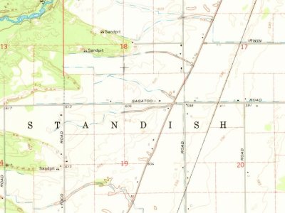
Every edition of the U.S. Geological Survey’s map of Standish Township. Tap a year, or press play to watch the town change.
1967Standish sheet · 1:24,000
U.S. Geological Survey historical topographic maps (public domain), via Esri’s collection of the scans. The red ring marks the center of Standish Township.
People over time
Standish Township, census by census
Between 246 and 1,581 people in every census since 1880.
15 censuses, 1880–2020.
U.S. Census Bureau decennial counts, from the census table on Standish Township’s Wikipedia page.
Stories next door
History across the town line
Each neighbor’s History grade, on the same three inputs.
Founding dates: Wikidata, Wikipedia, the U.S. post office records of Blevins & Helbock (CC0) and the Census. Homes by year built: Census ACS 2020–24. National Register of Historic Places: National Park Service (list of May 22, 2026). Old photos, postcards and papers: Wikimedia Commons, the Library of Congress and other public archives, credited on each item’s page. Maps: U.S. Geological Survey historical topographic maps (via Esri) and Sanborn fire-insurance maps (Library of Congress). History text and census tables: Wikipedia (CC BY-SA 4.0). Places that used to be: USGS Geographic Names Information System (2021). How TownRatings grades history →
From Wikimedia Commons (5), Wikidata (1), Wikipedia, U.S. Geological Survey historical maps, U.S. Census counts (via Wikipedia), the US Post Offices dataset (Blevins & Helbock) and the USGS Geographic Names Information System. Archive images are copied here with their credits and licenses, shown on each photo’s page. Refreshed monthly.
 2025
 2019
 2017
 2008
 2005

