Southfield dates to 1823, and 3 of its places are on the National Register
More historic than 74% of U.S. towns · #169 of 701 in Michigan. What drives it
Most of Southfield was built recently: 4% of its homes predate 1940 and the median home dates from 1969. 3 places in town are on the National Register, among them two historic districts with 191 buildings between them. Below: 4 old photos and papers, maps from 1905 on, and the census since 1960.
Founding year: Wikidata. First post office: 1833.The full story ↓
History grade
What drives Southfield’s History grade
On its age, its old homes and the National Register, Southfield is more historic than 74% of U.S. towns, #169 of 701 in Michigan. Its National Register listings hold the grade up; its share of homes from before 1940 pulls it down.
B+
HistoryA character grade: shown, never part of Southfield’s overall grade.
Few Michigan towns list much on the Register (a typical Michigan town has 0.0 per 10,000 residents, the U.S. 2.4), so Southfield’s 25.2 sits above most of its state (87% of Michigan towns have fewer) while its 192 historic buildings outnumber those of 93% of U.S. towns.
How sure. Graded on any two of the three inputs instead, the letter would range from B− to A. The pre-1940 share (±0.9 points) is firm at this size. Two sources give 1823.
Founding year: Wikidata (other dates in Quick answers). Homes: Census ACS 2020–24. National Register: National Park Service, May 2026 list; each listing counted once (boundary changes and added documentation belong to their listing), and a historic district counts its contributing buildings. How TownRatings grades history →
What stands out about Southfield’s past
Read from the archive, the National Register and the record. The page puts what stands out first.
Southfield was surveyed in 1817 according to the plan by Michigan territorial governor Lewis Cass. The first settlers came from nearby Birmingham and Royal Oak, Michigan, as well as New York and Vermont. The area that became Southfield was settled by John Daniels in 1823. Among the founders were the Heth, Stephens, Harmon, McClelland and Thompson families.
Town 1 north, 10 east was first organized as Ossewa Township on July 12, 1830, but the name was changed to Southfield Township 17 days later. The township took its name from its location in the "south fields" of Bloomfield Township. A US post office was established in 1833 and the first town hall built in 1873.
Passages that mention Southfield, cut from the printed page as they were published.
History of Oakland County, Michigan1912 · page 492Read the page →
Read the text
What was once known as the village of Southfield, or Southfield Centre, which was located on both sides of the road running from the quarter-post on the east line of section 20 to the Rouge river, is now Scene ox tiie Rori.E River not even a postoffice. In 1829 Archibald H. Green made the first settlement in the northern part of the old village, and in 1833 the number of families who had located there and in the vicinity warranted the establishment of the postoffice of Southfield, with John Thomas as post-
Text read by machine from the scan; it may contain errors.
Scans and text from the Internet Archive. Books published in 1930 or earlier, which are in the public domain.
Timeline
Southfield, 1823 to 1996
Woven from the archive, old maps, post office records, the National Register and the people born here.
In 1823, according to Wikidata. Southfield’s post office opened in 1833, and the census of 1960 counted 31,531 people here.
How does Southfield rank for history?
Southfield is more historic than 74% of U.S. towns, #169 of 701 in Michigan. The History grade combines the town’s founding era, the share of homes built before 1940 and its National Register listings. It’s a character grade, so it isn’t part of the overall grade. How it works.
What is on the National Register in Southfield?
Three places: the Grace, John, School (listed 2023), the Plumbrooke Estates (2019) and the Northland Gardens (2020).
How old are the homes in Southfield?
4% of Southfield’s homes were built before 1940 (Census estimate), against a typical 12% for a Michigan town; the median home was built in 1969.
Founding dates: Wikidata, Wikipedia, the U.S. post office records of Blevins & Helbock (CC0) and the Census. Homes by year built: Census ACS 2020–24. National Register of Historic Places: National Park Service (list of May 22, 2026). Old photos, postcards and papers: Wikimedia Commons, the Library of Congress and other public archives, credited on each item’s page. Maps: U.S. Geological Survey historical topographic maps (via Esri) and Sanborn fire-insurance maps (Library of Congress). History text and census tables: Wikipedia (CC BY-SA 4.0). Places that used to be: USGS Geographic Names Information System (2021).
From Wikimedia Commons (12), the National Register of Historic Places (3), Wikipedia, Wikidata and Wikipedia for famous people, U.S. Geological Survey historical maps, U.S. Census counts (via Wikipedia), the US Post Offices dataset (Blevins & Helbock), the USGS Geographic Names Information System and old county and town histories (Internet Archive). Archive images are copied here with their credits and licenses, shown on each photo’s page. Refreshed monthly.


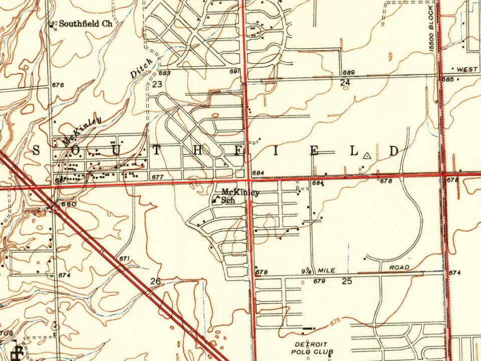


 1976
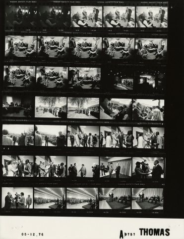 1976
 2012
 2012
 2012
 2011
 2011
 2009
 2005
 2005