
K. I. SawyerMI
Settled in 1944, this town now has 2,817 residents.
Is K. I. Sawyer a good place to live?
31% of residents are under 18 in K. I. Sawyer, where Michigan’s towns sit at 21% and U.S. towns at 22%. Among 702 Michigan towns, just 7 have a lower share of households owning their home than K. I. Sawyer. K. I. Sawyer’s trail density is 2.8 miles per square mile, above both the Michigan town median (0.3) and the median of U.S. towns (0.4). Little Trout Lake Park, at 174 acres with 1.2 miles of trail, is the biggest park or preserve. We don’t grade K. I. Sawyer yet; the figures below are still real.
K. I. Sawyer has grown 17% from 2010 to 2020
2,624 counted in 2010 and 3,064 in 2020.
U.S. Census 2010 & 2020 counts
The data
Ordered by what stands out in K. I. Sawyer.
Very low risk in K. I. Sawyer, with cold waves at the top
Of the losses FEMA expects in K. I. Sawyer, 59% come from cold waves and 19% from inland flooding. Compared with 93% of U.S. communities, expected storm and flood damage in the town is lower.
FEMA National Risk Index · OpenFEMA
K. I. Sawyer has 0.3 jobs per working resident, so most workers leave town for work
Half the trips to work are shorter than 15 miles. For residents in K. I. Sawyer, the share who live below the poverty line is 14%. Also worth knowing: since 2011, K. I. Sawyer has added 221 jobs, to 236 in 2021. Its average trip to work is put at 20 minutes.
| K. I. Sawyer | Typical Michigan town | Typical U.S. town | |
|---|---|---|---|
| Average trip to work | 20 minutes | 25 minutes | 25 minutes |
| Below the poverty line | 14% | 8.9% | 9.6% |
| Median household income | $61,000 | $77,000 | $80,000 |
| Working residents who work in town | 3.2% | 5.9% | 8% |
Where working residents work
Census LEHD 2021 · ACS
Snowy winters and pleasant summers: that is K. I. Sawyer’s year
A winter brings about 197 inches of snow, with January nights at 7° and July afternoons at 79°.
Typical low → high °F
NOAA U.S. Climate Normals, 1991–2020
More of K. I. Sawyer’s adults binge drink than in the typical Michigan or U.S. town
Among adults in K. I. Sawyer, 18% smoke cigarettes. Of 32 CDC measures, K. I. Sawyer beats the Michigan average on 7 and trails it on 10.
| K. I. Sawyer | Typical Michigan town | Typical U.S. town | |
|---|---|---|---|
| Binge drink (CDC PLACES) | 20% | 17% | 16% |
| Smoke cigarettes (CDC PLACES) | 18% | 15% | 14% |
| Obesity (CDC PLACES) | 40% | 37% | 35% |
| Diabetes (CDC PLACES) | 9.8% | 12% | 12% |
| What stands out | K. I. Sawyer | MI |
|---|---|---|
| Fewer adults who have had cancer | 6.7% | 8.9% |
| Fewer adults with heart disease | 5.5% | 7% |
| More adults in frequent mental distress | 21.7% | 17.6% |
CDC PLACES 2025 · modeled estimates for adults · CMS · HRSA
Homes in K. I. Sawyer sell for about $158K
The midpoint rent for K. I. Sawyer is $782 a month.
Census ACS, 2020–24 · Zillow Home Value Index · Redfin Data Center
0% of K. I. Sawyer is conserved land
Trails run 4.8 miles in 3 parks and preserves. K. I. Sawyer’s parks and preserves take up 304 acres in all.
| Biggest places to walk | Trails | Acres |
|---|---|---|
| 1. Little Trout Lake Park | 1.2 mi | 174 |
| 2. Silver Lead Creek Greenway | — | 105 |
| 3. Escanaba River State Forest - Gwinn Unit (South) | — | 25 |
Trails & parks © OpenStreetMap contributors · Conserved land: USGS PAD-US
Everything we know about K. I. Sawyer
Pictured Rocks National Lakeshore and 4 more within 40 miles
Museums, parks, gardens and other places to visit around K. I. Sawyer. Close and well known come first.
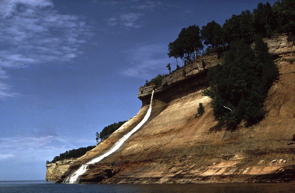 36 mi National LakeshorePictured Rocks National Lakeshore934K visitors a year
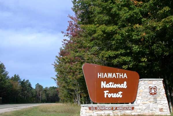 36 mi National forestHiawatha National Forest
 19 mi MuseumCliffs Shaft Mine Museum
 15 mi MuseumLakenenlandin town MuseumK. I. Sawyer Heritage Air Museum
Photo credits
Pictured Rocks National Lakeshore: National Park Service, Public domain · Hiawatha National Forest: © 2004 Matthew Trump, CC BY-SA 3.0 · Cliffs Shaft Mine Museum: Andrew Jameson, CC BY-SA 3.0 · Lakenenland: Skvader, CC BY-SA 4.0


Moving to K. I. Sawyer: who provides what
K. I. Sawyer is unincorporated, so Marquette County and regional agencies provide most services.
EPA SDWIS (Oct 9, 2026) · HIFLD + EIA-861 2025 · Census 2020 ZCTAs · NCES 2024–25 · registration: vote.gov, updated Sep 12, 2025.
97% of working residents leave K. I. Sawyer for work
Where K. I. Sawyer’s working residents go each day. Line width shows the share.
Census LEHD 2021
Colleges nearby
None within 15 miles of K. I. Sawyer; the nearest are
About 4 of every 100 K. I. Sawyer residents are enrolled in college, against 6 across Michigan.
About K. I. Sawyer
Census-designated place & unincorporated community in Michigan, United States
K. I. Sawyer Air Force Base is a decommissioned United States Air Force (USAF) installation in Marquette County, Michigan, south of Marquette. Near the center of Michigan's Upper Peninsula, the base operated for nearly 40 years and closed in 1995. The county airport, Marquette Sawyer Regional Airport, now occupies a portion of the base and has scheduled airline flights and some general aviation activity. The area of the former base is now an unincorporated community and census-designated place (CDP) for statistical purposes. The CDP is known as K. I. Sawyer and had a population of 3,064 at the 2020 census, up from 2,624 in 2010. It is located within Forsyth Township and West Branch Township.
From Wikipedia, licensed CC BY-SA 4.0 · facts via Wikidata (CC0)
- Established
- 1944
- Area
- 1.7 sq mi
- Elevation
- 1,221 ft
Questions about K. I. Sawyer
Short answers, built from the data on this page.
Is K. I. Sawyer, MI a good place to live?
We don’t grade K. I. Sawyer yet; the figures below are still real.
Say something about K. I. Sawyer.
Ask a question, answer one, post a photo or an event. Free, and the parts only a neighbor would know are the parts worth reading.