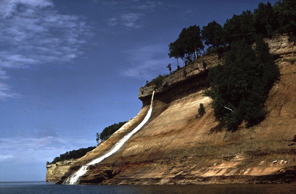
Pictured Rocks National Lakeshore
Pictured Rocks National Lakeshore is a U.S. National Lakeshore in the Upper Peninsula of Michigan, United States. Head to Burt Township to see it. It is managed by the National Park Service.

A national lakeshore inside Burt Township
75% of visits come in Jun–Sep
July is the busiest month, with about 221,385 visitors. December sees about 4,430. When to go ↓
Winters are cold
January nights drop to 9°. When to go ↓
You can sleep inside the park
5 places to stay are inside the park: The Greenland Motel and Little Beaver Lake Campground Trailhead. The nearest town with more is Burt Township. Where to stay ↓
Munising is inside the park
Munising sits inside the park’s boundary. Where to stay ↓
Best months: Jun, Jul, Aug and Sep
June, July, August and September are the mild months, with highs of 66–76°. When to go ↓
Written from National Park Service visitor counts, NOAA 1991–2020 normals, Overture places to stay, Census town figures, Wikidata and Wikipedia. Updated when the Park Service posts a new month.
Visitors and weather through the year
Pick a quieter month for Pictured Rocks from the chart below.
Pictured Rocks National Lakeshore
Pictured Rocks National Lakeshore is a U.S. National Lakeshore in the Upper Peninsula of Michigan, United States. It extends for 42 mi (68 km) along the shore of Lake Superior and covers 73,236 acres (114 sq mi; 296 km2). The park has extensive views of the hilly shoreline between Munising and Grand Marais in Alger County, with picturesque rock formations, waterfalls, and sand dunes.
Pictured Rocks derives its name from the 13 miles (24 km) of colorful sandstone cliffs northeast of Munising. The cliffs reach up to 200 feet (60 m) above lake level. They have been naturally sculptured into a variety of shallow caves, arches, and formations resembling castle turrets and human profiles. Near Munising, visitors can also visit Grand Island, most of which are included in the separate Grand Island National Recreation Area.
- Type
- National Lakeshore
- Run by
- National Park Service
- Wikipedia readers
- 40K a year
- Official site
- nps.gov/piro
Visit details
- Private Vehicle$25
- Motorcycle$20
- Snowmobile$15
- Per Person$15
Towns to stay in near Pictured Rocks National Lakeshore
You can sleep inside the park (5 places). The first towns with rooms are Burt Township (23) and Au Train Township (38).
Stay in the park
- The Greenland Motel motel
- Little Beaver Lake Campground Trailhead campground
- Mosquito River Campground campground
- Twelvemile Beach Campground campground
- JoeIda Campground, LLC RV park
Au Train Township
1,007 people · 49% vacation homes
9 mi southwest of Munising Falls Visitor Center · 9 mi to the park
Compare 8 towns
| Town | From the visitor center | Drive | Places to stay | People | Typical home | Safety |
|---|---|---|---|---|---|---|
| Burt Township 71% vacation homes | in town | — | 23 5 hotels · 3 motels · 1 inn or B&B · 5 lodges & cabins · 8 campgrounds · 1 RV park | 401 | $165K | — |
| Au Train Township 49% vacation homes | 9 mi southwest | 15 min | 38 5 hotels · 2 motels · 2 inns & B&Bs · 16 lodges & cabins · 10 campgrounds · 3 RV parks | 1,007 | $246K | — |
| Munising | inside the park | — | 21 6 hotels · 5 motels · 3 inns & B&Bs · 1 lodge or cabins · 5 campgrounds · 1 RV park | 1,938 | $117K | — |
| Munising Township 29% vacation homes | 6 mi east | 10 min | 24 6 hotels · 2 motels · 9 lodges & cabins · 7 campgrounds | 2,759 | $175K | — |
| Onota Township 58% vacation homes | 16 mi west | 25 min | 6 1 hotel · 5 lodges & cabins | 368 | $331K | — |
| Hiawatha Township 32% vacation homes | 19 mi southeast | 30 min | 4 1 hotel · 2 lodges & cabins · 1 campground | 1,326 | $185K | — |
| Inwood Township 49% vacation homes | 23 mi south | 35 min | 5 1 hotel · 2 lodges & cabins · 2 campgrounds | 666 | $229K | — |
| Marquette | 38 mi west | 1 hr | 21 16 hotels · 2 motels · 2 inns & B&Bs · 1 hostel | 21,944 | $275K | B+ |
Getting there
Nearest airports with airline service, from the visitor center
Also near Pictured Rocks
These well-known sights sit within 66 miles.
 50 mi WaterfallTahquamenon Falls
 61 mi LighthouseStannard Rock Light
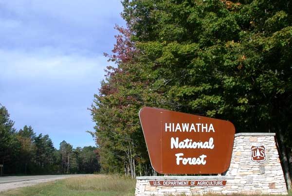 134 mi National forestHiawatha National Forest
 66 mi MuseumGreat Lakes Shipwreck Museum
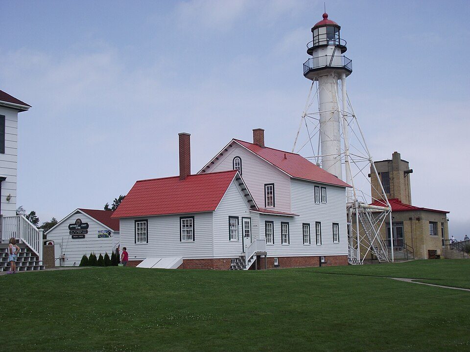 66 mi LighthouseWhitefish Point Light
 65 mi MuseumCliffs Shaft Mine Museum
 240 mi MuseumLakenenland53 mi MuseumK. I. Sawyer Heritage Air Museum
Photo credits
Tahquamenon Falls: Bobak Ha'Eri, CC BY 3.0 · Stannard Rock Light: Unknown authorUnknown author, Public domain · Hiawatha National Forest: © 2004 Matthew Trump, CC BY-SA 3.0 · Great Lakes Shipwreck Museum: Doug Coldwell, CC BY-SA 4.0 · Whitefish Point Light: Browermd, CC BY-SA 3.0 · Cliffs Shaft Mine Museum: Andrew Jameson, CC BY-SA 3.0 · Lakenenland: Skvader, CC BY-SA 4.0


The 2025 count: 933,966
From 2016 to 2025, these are the yearly visits.
Questions before you go
Is Pictured Rocks National Lakeshore in Burt Township?
Yes. It’s inside Burt Township, MI. The address is 1505 Sand Point Road, Munising, MI 49862.
When is the best time to visit Pictured Rocks National Lakeshore?
June, July, August and September, with highs of 66–76°. July is the busiest month (about 221,385 visitors).
How many people visit Pictured Rocks National Lakeshore each year?
933,966 in 2025, according to the National Park Service. The record is 1,313,179, set in 2021.
What is the closest airport to Pictured Rocks National Lakeshore?
Marquette Sawyer Regional (MQT), about 37 miles away. The nearest big hub is General Mitchell (MKE), about 248 miles.
Where should I stay near Pictured Rocks National Lakeshore?
Inside the park: The Greenland Motel, Little Beaver Lake Campground Trailhead and Mosquito River Campground. Nearby: Burt Township (in town, 23 places to stay), Au Train Township (9 mi, 38 places to stay) and Munising (1 mi, 21 places to stay).
Locals’ advice in Burt Township
Ask a question, or answer one, in Burt Township’s Town Square.
Sources: National Park Service · ski areas © OpenSkiMap / OpenStreetMap contributors · Wikidata · Wikipedia readership · National Park Service visitor use statistics · NOAA climate normals · U.S. Census.