Ann Arbor’s post office opened in 1824, and 15% of its homes were built before 1940
More historic than 90% of U.S. towns · #65 of 701 in Michigan. What drives it
35 places in town are on the National Register, among them two historic districts with 1,330 buildings between them. Below: 18 old photos and papers, maps from 1888 on, and the census since 1860.
Founding year: the first Ann Arbor post office (Blevins & Helbock, CC0).The full story ↓
History grade
What drives Ann Arbor’s History grade
On its age, its old homes and the National Register, Ann Arbor is more historic than 90% of U.S. towns, #65 of 701 in Michigan. All 3 inputs are above most U.S. towns; its National Register listings ranks highest and its share of homes from before 1940 lowest.
A
HistoryA character grade: shown, never part of Ann Arbor’s overall grade.
Among the 400 U.S. cities of 100,000 or more, Ann Arbor ranks #67 on History.
Few Michigan towns list much on the Register (a typical Michigan town has 0.0 per 10,000 residents, the U.S. 2.4), so Ann Arbor’s 112 sits above most of its state (94% of Michigan towns have fewer) while its 1,368 historic buildings outnumber those of 99% of U.S. towns.
How sure. Graded on any two of the three inputs instead, the letter would range from B+ to A+. The pre-1940 share (±1.1 points) is firm at this size. The founding year is the first post office, not a stated founding date.
Founding year: the first post office (other dates in Quick answers). Homes: Census ACS 2020–24. National Register: National Park Service, May 2026 list; each listing counted once (boundary changes and added documentation belong to their listing), and a historic district counts its contributing buildings. How TownRatings grades history →
What stands out about Ann Arbor’s past
Read from the archive, the National Register and the record. The page puts what stands out first.
National Park Service, National Register of Historic Places. Photos from Wikimedia Commons, credited on each place’s page.
Every building
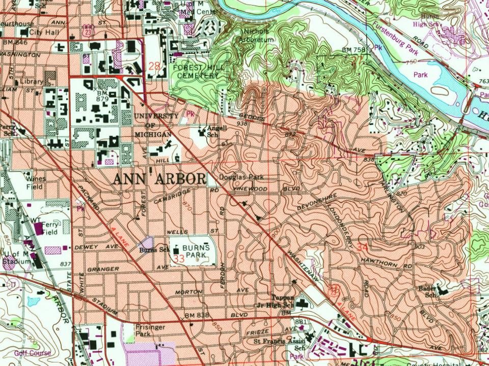
Ann Arbor, building by building, 1888–1925
Fire insurance maps drew every building, what it was made of and what it was used for, so insurers could price the risk of fire. Pick a year, then a sheet.
The region was once inhabited by several Native American tribes, the most prominent being the Anishinaabe people of the Three Fires: the Odawa, Ojibwe, and Potawatomi. The Potawatomi founded two villages in the area of what is now Ann Arbor in about 1774. Other tribes that inhabited the area included the Wyandots and Sauk. These peoples established several trails that converged on present-day Ann Arbor. The land that included Washtenaw County was ceded to the U.S. by the Odawa, Ojibwe, Potawatomi, and Wyandot in the Treaty of Detroit of 1807.
Passages that mention Ann Arbor, cut from the printed page as they were published.
History of Washtenaw County, Michigan1881 · page 155Read the page →
Read the text
superficies intersected by valleys, and relieved by numberless hills and ranges of hills. This configuration is conspicuously seen along the whole valley of the Huron and all the southwestern part of the town of Ann Arbor, the eastern part of Scio, the northwestern part of Sharon, the central part of Sylvan on each side of the great marsh, the soiitheastern, central and northern parts of Lyndon, and the western part of Dexter. These hillsides, especially in the town of Ann Arbor, have been extensively planted to peach-trees
Text read by machine from the scan; it may contain errors.
History of Washtenaw County, Michigan1881 · page 901Read the page →
Read the text
The boundaries of the village, under the amended act of 1846, were enlarged and were as follows: "So much of that tract of country situated in the township of Ann Arbor, in the county of Washtenaw, known as the south half of sec. 20, the southwest one-quarter of sec. 21, the west half of sec. 28, and sec. 29, lying south of the railroad, except that part of sec. 28 belonging to Dwight Kellogg, be, and the same is, hereby constituted a town, corporate by the name of the village of Ann Arbor."
Text read by machine from the scan; it may contain errors.
Scans and text from the Internet Archive. Books published in 1930 or earlier, which are in the public domain.
Timeline
Ann Arbor, 1824 to 1978
Woven from the archive, old maps, post office records, the National Register and the people born here.
Nothing in the archives for these yearsWeddings on Main Street, storms, parades, school pictures, the old store. If it’s in your family album, it belongs here.
Arborcrest Memorial ParkBethlehemFairviewForest HillPioneerSaint Andrew's Memorial Cloister GardenSaint Clare's Episcopal Church Chapel ColumbariumSaint Thomas' Catholic
US Post Offices dataset (Blevins & Helbock, CC0). Places and cemeteries from the USGS Geographic Names Information System (2021).
Help out
Finish Ann Arbor’s story
Most archives stop around 1920. The photos from after that are in family albums, not libraries.
Decades since 1900 with photos
00s10s20s30s40s50s60s70s80s90s
0 of 10 decades. The empty ones are waiting for someone’s album.
The Ann Arbor post office opened in 1824, the earliest record of the town by name (U.S. post office records).
How does Ann Arbor rank for history?
Ann Arbor is more historic than 90% of U.S. towns, #65 of 701 in Michigan. The History grade combines the town’s founding era, the share of homes built before 1940 and its National Register listings. It’s a character grade, so it isn’t part of the overall grade. How it works.
What is on the National Register in Ann Arbor?
35 listings: 33 buildings, among them the President's House, University Of Michigan (listed 1970, the first), and 2 historic districts, the Old West Side Historic District and the University Of Michigan Central Campus Historic District, with 1,330 contributing buildings. 1,368 historic buildings in all.
How old are the homes in Ann Arbor?
15% of Ann Arbor’s homes were built before 1940 (Census estimate, ±1.1 points), against a typical 12% for a Michigan town; the median home was built in 1971.
Founding dates: Wikidata, Wikipedia, the U.S. post office records of Blevins & Helbock (CC0) and the Census. Homes by year built: Census ACS 2020–24. National Register of Historic Places: National Park Service (list of May 22, 2026). Old photos, postcards and papers: Wikimedia Commons, the Library of Congress and other public archives, credited on each item’s page. Maps: U.S. Geological Survey historical topographic maps (via Esri) and Sanborn fire-insurance maps (Library of Congress). History text and census tables: Wikipedia (CC BY-SA 4.0). Places that used to be: USGS Geographic Names Information System (2021).
From Wikimedia Commons (4), the Library of Congress (14), Wikidata (6), the National Register of Historic Places (35), Wikipedia, Wikidata and Wikipedia for famous people, U.S. Geological Survey historical maps, U.S. Census counts (via Wikipedia), the US Post Offices dataset (Blevins & Helbock), the USGS Geographic Names Information System, Sanborn fire insurance maps (Library of Congress) and old county and town histories (Internet Archive). Archive images are copied here with their credits and licenses, shown on each photo’s page. Refreshed monthly.


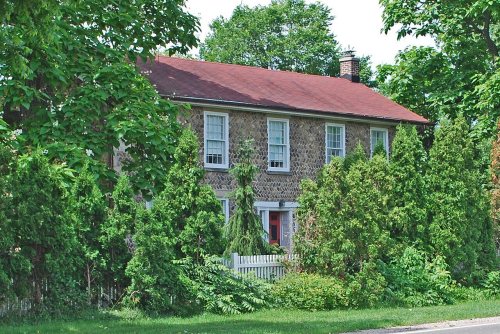


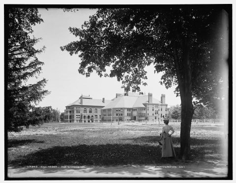


 1883
 1890
 1890
 1890
 1890
 1890
 1890
 1890
 1890
 1890
 1890
 1895
 1898
 1898