Vassalboro dates to 1760, and 14% of its homes were built before 1940
More historic than 88% of U.S. towns · #51 of 143 in Maine. What drives it
8 places in town are on the National Register, among them two historic districts with 10 buildings between them. Below: 1 old photo or paper, maps from 1893 on, and the census since 1790.
On its age, its old homes and the National Register, Vassalboro is more historic than 88% of U.S. towns, #51 of 143 in Maine. All 3 inputs are above most U.S. towns; its age ranks highest and its share of homes from before 1940 lowest.
A
HistoryA character grade: shown, never part of Vassalboro’s overall grade.
Maine towns list more on the Register than most of the country (a typical Maine town has 15.9 per 10,000 residents, the U.S. 2.4), so Vassalboro’s 37.0 sits above most of its state (69% of Maine towns have fewer) while its 17 historic buildings outnumber those of 79% of U.S. towns.
How sure. Graded on any two of the three inputs instead, the letter would range from B+ to A. The pre-1940 share is a Census survey estimate (±4.2 points). Two sources give 1760.
Founding year: Wikipedia (other dates in Quick answers). Homes: Census ACS 2020–24. National Register: National Park Service, May 2026 list; each listing counted once (boundary changes and added documentation belong to their listing), and a historic district counts its contributing buildings. How TownRatings grades history →
What stands out about Vassalboro’s past
Read from the archive, the National Register and the record. The page puts what stands out first.
Vassalboro was first settled by colonists in 1760 and incorporated in 1771. It was named for one of the settlement's proprietors, William Vassall.
William Vassall was born in 1715 on his family's Jamaican sugar plantation.
Slavery had formed an "integral part" of the Vassalls' fortune since 1648, when William's great-grandfather moved to Barbados and launched the family into the sugar business.
As a boy, Vassall moved first to Philadelphia, then Boston. He earned a BA (1733) and an MA (1743) from Harvard. A Loyalist during the Revolution, he fled to England, where he died in 1800, having spent many years arguing for "compensation for what he deemed the illegal confiscation of his properties in Massachusetts and Rhode Island."
1816 — Congregational meeting house built in Vassalboro. 1820 — Congregational Society permanently organized. 1828 — North Vassalboro post office established.
Text read by machine from the scan; it may contain errors.
Illustrated history of Kennebec County, Maine1892 · page 1095Read the page →
Read the text
porated within Vassalboro's first limits. April 26, 1771, it was first recognized as a corporate body, and January 30, 1792, Sidney, the part west of the river, was incorporated a town by itself, leaving the present Vassalboro. The three ranges of lots between the river and the gore were surveyed and numbered by Nathan Winslow in 1761. The lots east of it, shown on the map, page 1096, were surveyed and plotted by John Jones in 1774, and designated as the fourth and fifth ranges.
Text read by machine from the scan; it may contain errors.
Illustrated history of Kennebec County, Maine1892 · page 1139Read the page →
Read the text
WHEN the Kennebec Purchasers in the fall of 1773 sent John Jones and Abraham Burrell to survey a plantation east of Vassalboro and plot it into lots for settlement, they laid the foundation for the present thrifty town of China. They laid out 32,000 acres, including the waters, into farms of substantially 200 acres each; and to this fifty square miles the proprietors and their purchasers, alluding to the old surveyor, and not to the first settler, applied the title of "Jones' Plantation." They finished the survey in
Text read by machine from the scan; it may contain errors.
Town incorporated January 30, 1792, seventy-sixth town, Named for Sir Phillip Sidney, noted English gentleman and scholar; formerly part of Vassalboro. Population— 1850, 1955; 1860, 1784; 1870, 1471; 1880, 1396; 1890, 1334; 1900, 1068.
Text read by machine from the scan; it may contain errors.
Scans and text from the Internet Archive. Books published in 1930 or earlier, which are in the public domain.
Timeline
Vassalboro, 1760 to 2020
Woven from the archive, old maps, post office records, the National Register and the people born here.
Nothing in the archives for these yearsWeddings on Main Street, storms, parades, school pictures, the old store. If it’s in your family album, it belongs here.
In 1760, according to Wikipedia’s history of the town. Vassalboro’s post office opened in 1795, and the first U.S. census counted 1,253 people here in 1790.
How does Vassalboro rank for history?
Vassalboro is more historic than 88% of U.S. towns, #51 of 143 in Maine. The History grade combines the town’s founding era, the share of homes built before 1940 and its National Register listings. It’s a character grade, so it isn’t part of the overall grade. How it works.
What is on the National Register in Vassalboro?
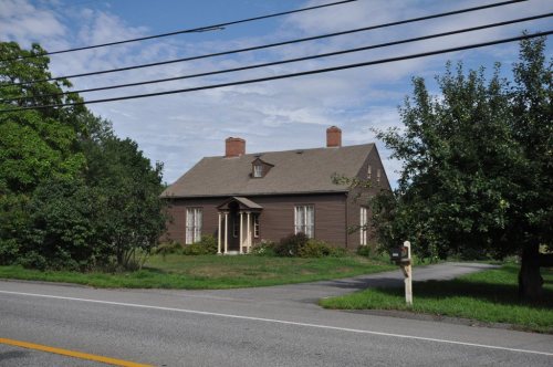
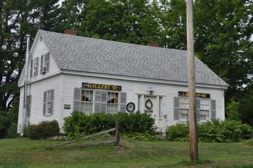
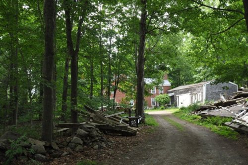
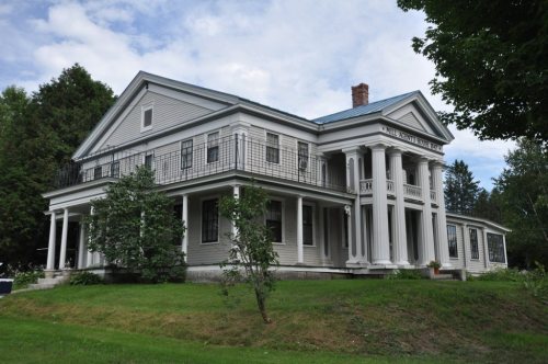
8 listings: 6 buildings, among them the River Meetinghouse (listed 1977, the first), and 2 historic districts, the Dutton-Small House and the Vassalboro Mill, with 10 contributing buildings. 17 historic buildings in all.
How old are the homes in Vassalboro?
14% of Vassalboro’s homes were built before 1940 (Census estimate, ±4.2 points), against a typical 19% for a Maine town; the median home was built in 1988.
Founding dates: Wikidata, Wikipedia, the U.S. post office records of Blevins & Helbock (CC0) and the Census. Homes by year built: Census ACS 2020–24. National Register of Historic Places: National Park Service (list of May 22, 2026). Old photos, postcards and papers: Wikimedia Commons, the Library of Congress and other public archives, credited on each item’s page. Maps: U.S. Geological Survey historical topographic maps (via Esri) and Sanborn fire-insurance maps (Library of Congress). History text and census tables: Wikipedia (CC BY-SA 4.0). Places that used to be: USGS Geographic Names Information System (2021).
From Wikimedia Commons (13), Wikidata (4), the National Register of Historic Places (8), Wikipedia, Wikidata and Wikipedia for famous people, U.S. Geological Survey historical maps, U.S. Census counts (via Wikipedia), the US Post Offices dataset (Blevins & Helbock), the USGS Geographic Names Information System and old county and town histories (Internet Archive). Archive images are copied here with their credits and licenses, shown on each photo’s page. Refreshed monthly.





 2018
 2018
 2018
 2018
 2018
 2018
 2018
 2018
 2018
 2013
 2012
 2012


