Southport dates to 1842, and 47% of its homes were built before 1940
3 places in town are on the National Register, among them a historic district with 2 buildings. Below: 5 old photos and papers, maps from 1893 on, and the census since 1850.
The Abenaki people who originally inhabited the island called it Capanewagen. Cape Newagen, an English corruption of the Abenaki name, was the name of an early English fishing outpost at the southern tip of the island. The island would later be known as Newagen Island by Europeans.
While the first European settlement was established in 1623, the island was abandoned by the English when they were driven from the region by the Abenaki during King Phillip's War in 1676. After the war, colonists returned to the island, only to be driven out again during King William's War in 1689.
Passages that mention Southport, cut from the printed page as they were published.
History of Boothbay, Southport and Boothbay Harbor, Maine. 1623-1905. With family genealogies1906 · page 199Read the page →
Read the text
ciated themselves together for tlie purpose of " building a meeting house that shall be more convenient and upon more modern plans," at the same time mentioning that "the meetinghouse in the town of Southport is much impaired by time, and the pews uncomfortable to sit upon, and the house quite ancient in its structure." The first meeting was held February 4, 1864. The organization was perfected and a building committee selected. On February 18th by-laws were adopted and a
Text read by machine from the scan; it may contain errors.
History of Boothbay, Southport and Boothbay Harbor, Maine. 1623-1905. With family genealogies1906 · page 401Read the page →
Read the text
The town of Southport has labored under disadvantages in the matter of ability to support a high-school system, largely on account of its three principal settlements being located at considerable distance from each other, neither being large enough to maintain the entire support, or convenient for attendance at the other parts. A very progressive movement was taken, however, in 1904, as noticed in Chapter XVII, in the erection of new buildings and making preparations to
Text read by machine from the scan; it may contain errors.
Scans and text from the Internet Archive. Books published in 1930 or earlier, which are in the public domain.
Timeline
Southport, 1821 to 1963
Woven from the archive, old maps, post office records, the National Register and the people born here.
Nothing in the archives for these yearsWeddings on Main Street, storms, parades, school pictures, the old store. If it’s in your family album, it belongs here.
Founding dates: Wikidata, Wikipedia, the U.S. post office records of Blevins & Helbock (CC0) and the Census. Homes by year built: Census ACS 2020–24. National Register of Historic Places: National Park Service (list of May 22, 2026). Old photos, postcards and papers: Wikimedia Commons, the Library of Congress and other public archives, credited on each item’s page. Maps: U.S. Geological Survey historical topographic maps (via Esri) and Sanborn fire-insurance maps (Library of Congress). History text and census tables: Wikipedia (CC BY-SA 4.0). Places that used to be: USGS Geographic Names Information System (2021). How TownRatings grades history →
From Wikimedia Commons (7), the Library of Congress (1), the National Register of Historic Places (3), Wikipedia, Wikidata and Wikipedia for famous people, U.S. Geological Survey historical maps, U.S. Census counts (via Wikipedia), the US Post Offices dataset (Blevins & Helbock), the USGS Geographic Names Information System and old county and town histories (Internet Archive). Archive images are copied here with their credits and licenses, shown on each photo’s page. Refreshed monthly.


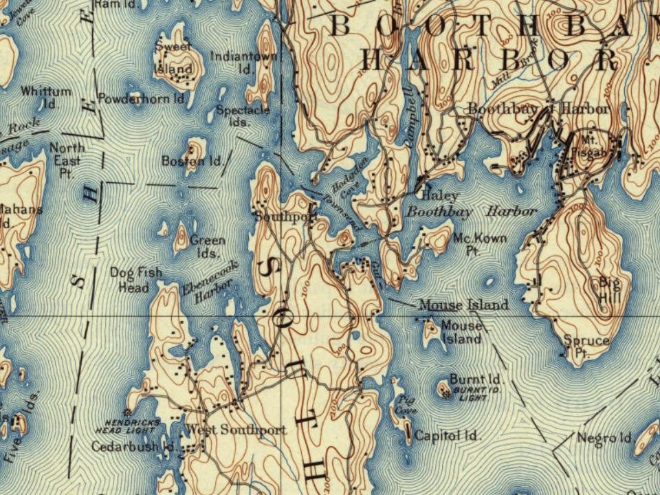
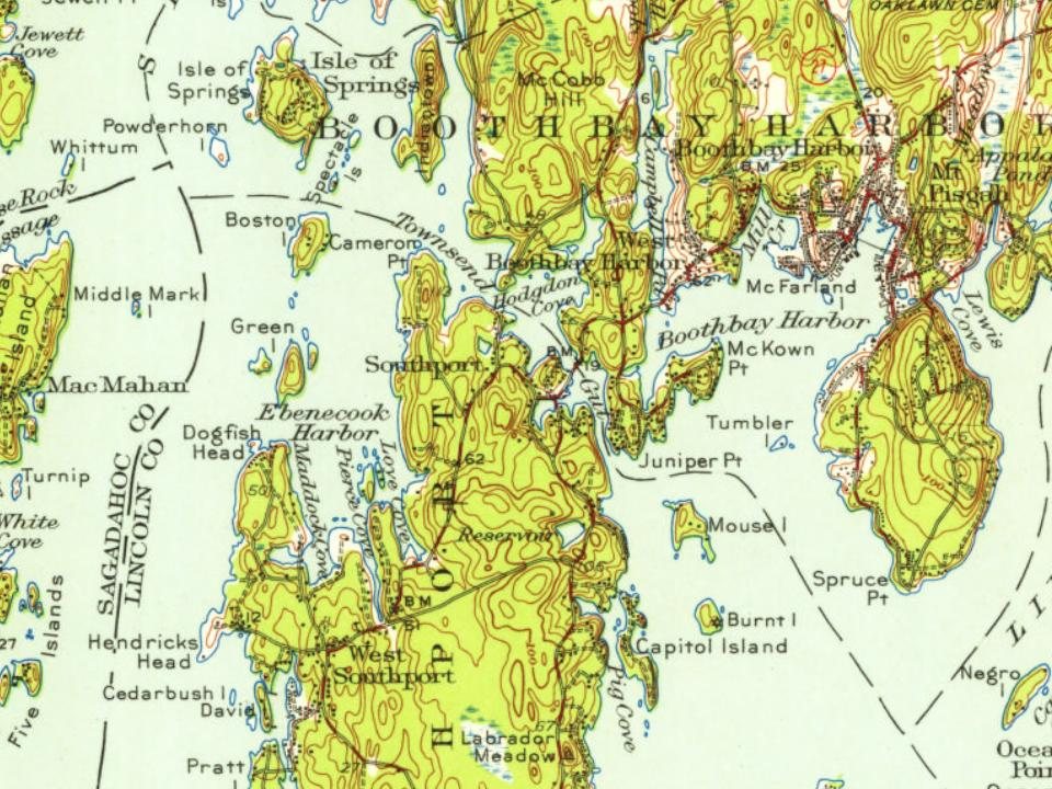
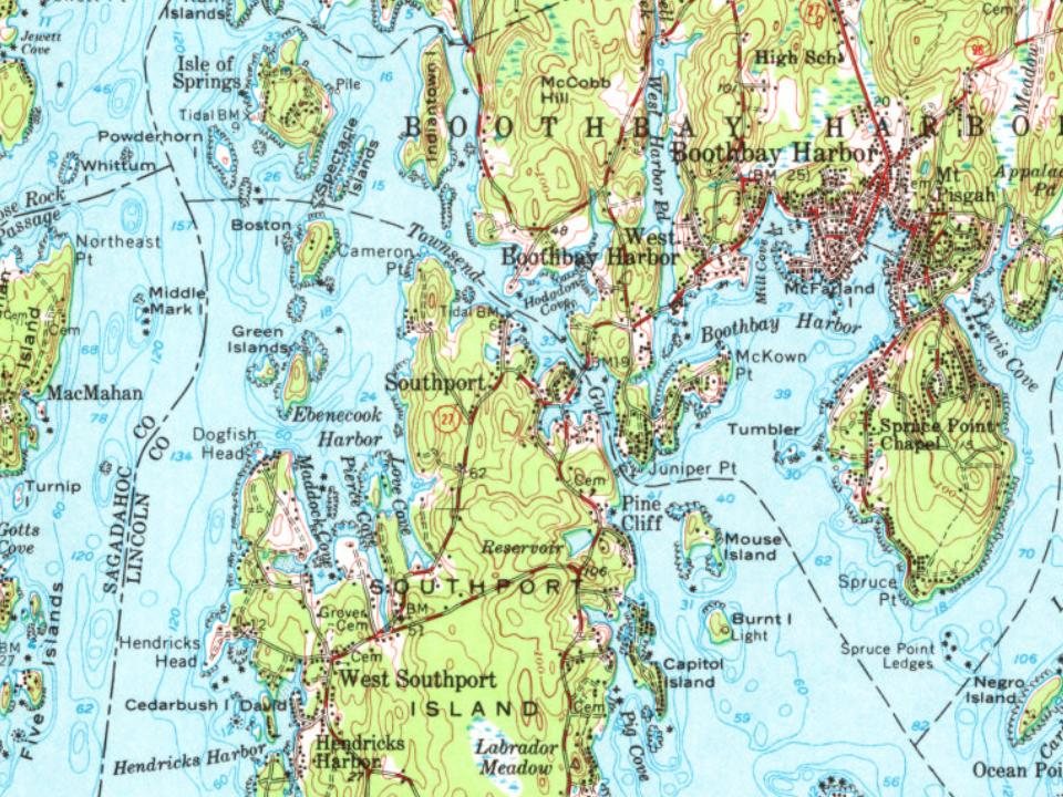




 c. 1930
 Date?
 Date?
 2018
 2018
 2016