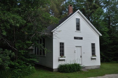
Newry dates to 1805, and 3 of its places are on the National Register
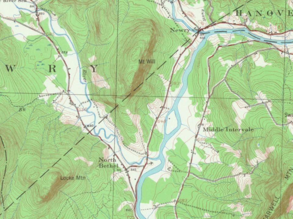
Most of Newry was built recently: 4% of its homes predate 1940 and the median home dates from 1986. Below: 4 old photos and papers, maps from 1914 on, and the census since 1810.
First called Sunday River Plantation, it was settled in 1781 by Benjamin Barker and his two brothers from Methuen, Massachusetts, together with Ithiel Smith of Cape Elizabeth. But the settlement was plundered in 1782 by Indians and abandoned. Then John J. Holmes of New Jersey purchased the land in 1794 with his sister's surname on the deed: Bostwick. On June 15, 1805, Bostwick Plantation was renamed by settlers that had come from Newry in what is now Northern Ireland. The name Newry is an anglicization of An Iúraigh, an oblique form of An Iúrach, which means "the grove of yew trees".
Text read by machine from the scan; it may contain errors.
History of Bethel, formerly Sudbury, Canada, Oxford County, Maine, 1768-18901891 · page 172Read the page →
Read the text
Elijah Bartlett. Voted a committee to examine the place for a road round by Mr. Locke's and across by Col. Hastings, consisting of Timothy Carter, Capt. Daniel Grout and Deacon Asa Kimball, Voted to ask the town of Newry to build a road to meet the road built by Bethel to Bear river. Voted to raise a committee to meet a committee from Rumford to settle the legal settlement of Ephraim Colby. John Burk and family having become paupers were variously disposed of.
Text read by machine from the scan; it may contain errors.
History of Bethel, formerly Sudbury, Canada, Oxford County, Maine, 1768-18901891Read the page →
Read the text
A delightful trip is down the Androscoggin to Newry Corner, and up Bear river to Grafton notch. Leaving the Sunday river road at Hastings Corner and crossing Sunday river by the covered bridge near its mouth, we pass the Ebenezer Eames place ; the farm once occupied by Peter York and later by Leander Jewett, then on by where the Smiths lived, we cross Bear river near where it flows into the Androscoggin and are in Newry. Bear river is bordered by fine farms, but back of these is the forest primeval. Except on the two
Text read by machine from the scan; it may contain errors.
History of Rumford, Oxford County, Maine, from its first settlement in 1779, to the present time1890 · page 112Read the page →
Read the text
as Postmaster; in Hanover in 1850, with Phineas H. Howe as Postmaster ; in Peru in 1833, with Hezekiah Walker as Postmaster ; at North Bethel (Bean's Corner) in 1831, with Phineas Frost as Postmaster ; in Newry in 1828, with John Kilgore as Postmaster. The first Post Office in this town was near Rumford Point, which was then the prhicipal business center. It continued to be kept here until 1849, when it was moved across the river to Rumford Corner.
Text read by machine from the scan; it may contain errors.
Scans and text from the Internet Archive. Books published in 1930 or earlier, which are in the public domain.
Timeline
Newry, 1805 to 1918
Woven from the archive, old maps, post office records, the National Register and the people born here.
Nothing in the archives for these yearsWeddings on Main Street, storms, parades, school pictures, the old store. If it’s in your family album, it belongs here.
Founding dates: Wikidata, Wikipedia, the U.S. post office records of Blevins & Helbock (CC0) and the Census. Homes by year built: Census ACS 2020–24. National Register of Historic Places: National Park Service (list of May 22, 2026). Old photos, postcards and papers: Wikimedia Commons, the Library of Congress and other public archives, credited on each item’s page. Maps: U.S. Geological Survey historical topographic maps (via Esri) and Sanborn fire-insurance maps (Library of Congress). History text and census tables: Wikipedia (CC BY-SA 4.0). Places that used to be: USGS Geographic Names Information System (2021). How TownRatings grades history →
From Wikimedia Commons (5), the Library of Congress (1), Wikidata (1), the National Register of Historic Places (3), Wikipedia, U.S. Geological Survey historical maps, U.S. Census counts (via Wikipedia), the US Post Offices dataset (Blevins & Helbock), the USGS Geographic Names Information System and old county and town histories (Internet Archive). Archive images are copied here with their credits and licenses, shown on each photo’s page. Refreshed monthly.


 Date?
 Date?
 2017
 2012