Houlton dates to 1807, and 30% of its homes were built before 1940
More historic than 93% of U.S. towns · #33 of 143 in Maine. What drives it
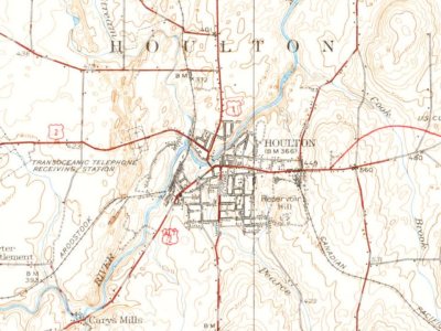
13 places in town are on the National Register, among them two historic districts with 33 buildings between them. Below: 10 old photos and papers, maps from 1884 on, and the census since 1820.
On its age, its old homes and the National Register, Houlton is more historic than 93% of U.S. towns, #33 of 143 in Maine. All 3 inputs are above most U.S. towns; its share of homes from before 1940 ranks highest and its age lowest.
A
HistoryA character grade: shown, never part of Houlton’s overall grade.
Maine towns list more on the Register than most of the country (a typical Maine town has 15.9 per 10,000 residents, the U.S. 2.4), so Houlton’s 72.7 sits above most of its state (82% of Maine towns have fewer) while its 44 historic buildings outnumber those of 84% of U.S. towns.
How sure. Graded on any two of the three inputs instead, the letter would still be A. The pre-1940 share is a Census survey estimate (±7.3 points). Two sources give 1807.
Founding year: Wikidata (other dates in Quick answers). Homes: Census ACS 2020–24. National Register: National Park Service, May 2026 list; each listing counted once (boundary changes and added documentation belong to their listing), and a historic district counts its contributing buildings. How TownRatings grades history →
What stands out about Houlton’s past
Read from the archive, the National Register and the record. The page puts what stands out first.
Fire insurance maps drew every building, what it was made of and what it was used for, so insurers could price the risk of fire. Pick a year, then a sheet.
The area was occupied for thousands of years by varying cultures of indigenous peoples. In historic times, these were the Algonquian-speaking Wolastoqiyik. When Maine was part of Massachusetts, parcels of land were dealt out to schools and colleges. The area that was to become Houlton was deeded to the Academy of New Salem, Massachusetts. Thirteen men from New Salem bought the land from the academy, though only three settled there.
Decades after the American Revolutionary War, Anglo-American pioneers Aaron Putnam and Joseph Houlton started a village. They named it for Houlton, who had moved to Maine in 1807 from the more populated part of Massachusetts. Maine separated from Massachusetts in 1820 and became an independent state.
Passages that mention Houlton, cut from the printed page as they were published.
History of the town of Houlton, Maine, from 1804 to 18831884 · page 33Read the page →
Read the text
about three miles in length, averaging half a mile in width. Upon the thoroughfai'e between the lakes there is a saw-mill, the property of Mr. Moses Drew, some nine miles from the village of Houlton, and a valuable quarry of limestone, where are two kilns, from which Houlton and the adjacent country are supplied with lime. The eastern lake is separated from the west branch of the Meduxnakeag by a swell of land, running
Text read by machine from the scan; it may contain errors.
At the close of this period of infancy in the settlement, Mr. Houlton had his flour mill on the Cook Brook; Aaron Putuam had a saw and grist mill at the bridge, and Ebenezer Warner had a saw mill at the West Houlton Falls. ee eed
Text read by machine from the scan; it may contain errors.
History of the town of Houlton, Maine, from 1804 to 18831884 · page 23Read the page →
Read the text
In the summer of 1815 Joshua Putnam, 2d, a proprietor of Houlton, and Edmund. Cone, came from New Salem to reside at Houlton. At this time, with the exception of three families, the inhabitants of Houlton consisted principally of Houltons and Putnaras ; if not all of those names, they were connected by marriage.
Text read by machine from the scan; it may contain errors.
any possibility of complying with the requirements. The records show some steps taken toward developement of the land; and the one step out of which all the future course became possible was the appointment of Joseph Houlton as surveyor of the Grant. The New Salem Academy and the purchasers of the Grant had common reason to think well of their townsman and associate, and the people of the Town of Houlton, to-day, caa revere the memory of their large viewe”, large hearted founder. When his name
Text read by machine from the scan; it may contain errors.
Scans and text from the Internet Archive. Books published in 1930 or earlier, which are in the public domain.
Timeline
Houlton, 1807 to 1973
Woven from the archive, old maps, post office records, the National Register and the people born here.
Nothing in the archives for these yearsWeddings on Main Street, storms, parades, school pictures, the old store. If it’s in your family album, it belongs here.
In 1807, according to Wikidata. the census of 1820 counted 115 people here.
How does Houlton rank for history?
Houlton is more historic than 93% of U.S. towns, #33 of 143 in Maine. The History grade combines the town’s founding era, the share of homes built before 1940 and its National Register listings. It’s a character grade, so it isn’t part of the overall grade. How it works.
What is on the National Register in Houlton?
13 listings: 10 buildings, among them the First National Bank of Houlton (listed 1973, the first), 2 historic districts, the Market Square Historic District and the Donovan-Hussey Farms Historic District, with 33 contributing buildings, and 1 site. 44 historic buildings in all.
How old are the homes in Houlton?
30% of Houlton’s homes were built before 1940 (Census estimate, ±7.3 points), against a typical 19% for a Maine town; the median home was built in 1957.
Founding dates: Wikidata, Wikipedia, the U.S. post office records of Blevins & Helbock (CC0) and the Census. Homes by year built: Census ACS 2020–24. National Register of Historic Places: National Park Service (list of May 22, 2026). Old photos, postcards and papers: Wikimedia Commons, the Library of Congress and other public archives, credited on each item’s page. Maps: U.S. Geological Survey historical topographic maps (via Esri) and Sanborn fire-insurance maps (Library of Congress). History text and census tables: Wikipedia (CC BY-SA 4.0). Places that used to be: USGS Geographic Names Information System (2021).
From Wikimedia Commons (10), Wikidata (1), the National Register of Historic Places (13), Wikipedia, Wikidata and Wikipedia for famous people, U.S. Geological Survey historical maps, U.S. Census counts (via Wikipedia), the USGS Geographic Names Information System, Sanborn fire insurance maps (Library of Congress) and old county and town histories (Internet Archive). Archive images are copied here with their credits and licenses, shown on each photo’s page. Refreshed monthly.




 1880
 1880
 1880
 1880
 1887
 c. 1895
 1895
 1898


