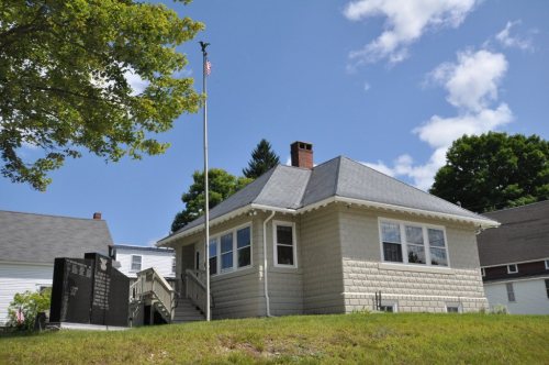
On its age, its old homes and the National Register, Hiram is more historic than 86% of U.S. towns. All 2 inputs are above most U.S. towns; its share of homes from before 1940 ranks highest and its National Register listings lowest.
A
HistoryA character grade: shown, never part of Hiram’s overall grade.
Maine towns list more on the Register than most of the country (a typical Maine town has 15.9 per 10,000 residents, the U.S. 2.4), so Hiram’s 28.6 sits above most of its state (66% of Maine towns have fewer) while its 5 historic buildings outnumber those of 70% of U.S. towns.
How sure. Graded on two of the three inputs, so a change in either one moves the letter more than it would with three. The pre-1940 share is a Census survey estimate (±6.0 points).
Founding year: our sources. Homes: Census ACS 2020–24. National Register: National Park Service, May 2026 list; each listing counted once (boundary changes and added documentation belong to their listing), and a historic district counts its contributing buildings. How TownRatings grades history →
What stands out about Hiram’s past
Read from the archive, the National Register and the record. The page puts what stands out first.
Lost half of its people between 1880 and 1970, then more than doubled.
24 censuses, 1790–2020.
U.S. Census Bureau decennial counts, from the census table on Hiram’s Wikipedia page.
Places that used to be
Lost post offices, old corners and burying grounds
Hiram’s post office has been open since 1797. Three other post offices opened and closed inside today’s town.
Hiram
1797–today
East Hiram
1875–1971
South Hiram
1879–today
Stanley
1899–1906
Wadsworth
1899–1903
17901910today
Hamlets and corners on the map
DurgintownEast HiramRankins MillSouth Hiram
17cemeteries and burying grounds inside Hiram
Alexander WadsworthClemons PondCottonDaniel Foster Cemetery PlotDurginGerrishPleasant RidgeSpringStanleyTarTrippVillageWadsworthWatsonWatsonWentworthWilliam Cotton II
US Post Offices dataset (Blevins & Helbock, CC0). Places and cemeteries from the USGS Geographic Names Information System (2021).
It became a stage stop along the Pequawket Trail, the former wilderness path of the Sokokis Abenakis which runs from Standish to Fryeburg (site of Pequawket, their stockaded village). First known as Great Ossipee after the Ossipee River, the town was settled in the 1780s and organized as Hiram Plantation, named after Hiram I, the biblical king of Tyre. Like King Hiram's domain, Hiram Plantation was set among forests. It was incorporated as a district on February 27, 1807, then as the town of Hiram on June 14, 1814. Peleg Wadsworth bought a tract of land here in 1790, and in 1792 or 1794 began clearing a farm for his eldest son.
Text read by machine from the scan; it may contain errors.
History of Bethel, formerly Sudbury, Canada, Oxford County, Maine, 1768-18901891 · page 671Read the page →
Read the text
Mason clerk. Sullivan R. Hutchins was chosen school committee and Elias M. Carter, agent. For constables, Mighill Mason, David F. Brown, Israel G. Kimball and Elias S. Bartlett. Voted to set off Hiram Hodsdon from school district number twenty-two and annex him to number fourteen. Fifteen hundred dollars were raised to defray town charges and twenty-five hundred for ways. The town treasurer was authorized to renew the notes held against the town or pay the same. A road was accepted laid out on petition of
Text read by machine from the scan; it may contain errors.
Scans and text from the Internet Archive. Books published in 1930 or earlier, which are in the public domain.
Timeline
Hiram, 1797 to 2010
Woven from the archive, old maps, post office records, the National Register and the people born here.
Nothing in the archives for these yearsWeddings on Main Street, storms, parades, school pictures, the old store. If it’s in your family album, it belongs here.
Hiram is more historic than 86% of U.S. towns. The History grade combines the town’s founding era, the share of homes built before 1940 and its National Register listings. It’s a character grade, so it isn’t part of the overall grade. How it works.
What is on the National Register in Hiram?
4 listings: 4 buildings, among them the Wadsworth Hall (listed 1974, the first). 5 historic buildings in all.
How old are the homes in Hiram?
25% of Hiram’s homes were built before 1940 (Census estimate, ±6.0 points), against a typical 19% for a Maine town; the median home was built in 1976.
Founding dates: Wikidata, Wikipedia, the U.S. post office records of Blevins & Helbock (CC0) and the Census. Homes by year built: Census ACS 2020–24. National Register of Historic Places: National Park Service (list of May 22, 2026). Old photos, postcards and papers: Wikimedia Commons, the Library of Congress and other public archives, credited on each item’s page. Maps: U.S. Geological Survey historical topographic maps (via Esri) and Sanborn fire-insurance maps (Library of Congress). History text and census tables: Wikipedia (CC BY-SA 4.0). Places that used to be: USGS Geographic Names Information System (2021).
From Wikimedia Commons (10), the Library of Congress (2), the National Register of Historic Places (4), Wikipedia, Wikidata and Wikipedia for famous people, U.S. Geological Survey historical maps, U.S. Census counts (via Wikipedia), the US Post Offices dataset (Blevins & Helbock), the USGS Geographic Names Information System and old county and town histories (Internet Archive). Archive images are copied here with their credits and licenses, shown on each photo’s page. Refreshed monthly.
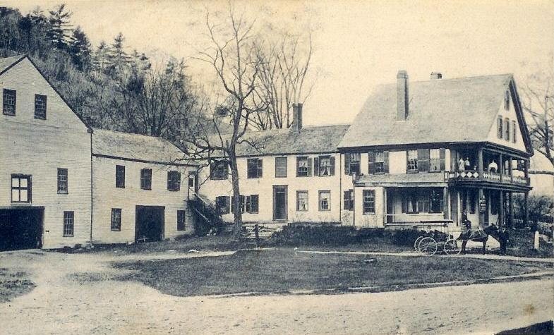




 c. 1869
 c. 1869
 c. 1869
 c. 1869
 c. 1869
 1916
 2017
 2017
 2017