Farmingdale’s post office opened in 1852, and 24% of its homes were built before 1940
More historic than 56% of U.S. towns · #122 of 143 in Maine. What drives it
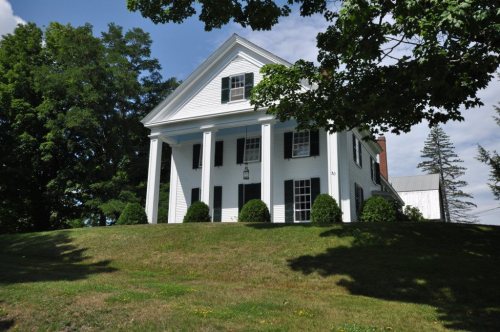
Its Register listings are the Peter Grant House and the Capt. Nataniel Stone House. Its Register listings are the Peter Grant House and the Capt. Nataniel Stone House. Below: 1 old photo or paper, maps from 1892 on, and the census since 1860.
From Farmingdale’s archive · credits on each photo
Quick answers
How Farmingdale began
When was Farmingdale founded?
1852
The Farmingdale post office opened in 1852, the earliest record of the town by name. Another post office, West Farmingdale (1860), opened inside today’s town and later closed.
First census: 896 in 18602020 census: 2,995174 years
How historic is Farmingdale?
B
More historic than 56% of U.S. towns, on its age, its old homes and the National Register.
Founding year: the first Farmingdale post office (Blevins & Helbock, CC0).The full story ↓
History grade
What drives Farmingdale’s History grade
On its age, its old homes and the National Register, Farmingdale is more historic than 56% of U.S. towns, #122 of 143 in Maine. Its share of homes from before 1940 holds the grade up; its age pulls it down.
B
HistoryA character grade: shown, never part of Farmingdale’s overall grade.
Maine towns list more on the Register than most of the country (a typical Maine town has 15.9 per 10,000 residents, the U.S. 2.4), so Farmingdale’s 6.6 sits below most of its state (32% of Maine towns have fewer) while its 2 listings outnumber those of 60% of U.S. towns.
How sure. Graded on any two of the three inputs instead, the letter would range from C to B+. The pre-1940 share is a Census survey estimate (±13.1 points). The founding year is the first post office, not a stated founding date.
Founding year: the first post office (other dates in Quick answers). Homes: Census ACS 2020–24. National Register: National Park Service, May 2026 list; each listing counted once (boundary changes and added documentation belong to their listing), and a historic district counts its contributing buildings. How TownRatings grades history →
What stands out about Farmingdale’s past
Read from the archive, the National Register and the record. The page puts what stands out first.
In 1852, Farmingdale was incorporated as a town, combining parts of South Hallowell, North Gardiner and East/West Gardiner. Many businesses operated in Farmingdale, most of them along the Kennebec River. A major business was harvesting and selling ice for a worldwide market. The Knickerbocker Ice Company (the largest ice company in the country), and the Marshall Ice Company had ice-houses at Bowman's Point. The Knickerbocker Ice Company burned in 1894 or 1895 leaving only the chimney that stood until it was demolished in 1911 to make room for the Central Maine Power Plant. Other businesses on the river in Farmingdale included shipyards, brickyards, pottery, and a glue factory. Commercial growth in ensuing years centered in Gardiner, Hallowell and Augusta, while Farmingdale never developed a town center to compare with those cities. Time, fires, floods and economic forces eventually remo…
Passages that mention Farmingdale, cut from the printed page as they were published.
Illustrated history of Kennebec County, Maine1892 · page 528Read the page →
Read the text
This then comprises a history of the early settlement of the old homes included in the present town of Farmingdale, which was incorporated June 3, 1852. It borders on the Kennebec river and rises by easy grades to its highest lands near the old post road and thence sloping back to the Sanborn and Jamies ponds on the western border, the only bodies of water in the town. It consists of gently rolling country, seldom broken by sharp hills or valleys and comprises some of the best farming lands in the county.
Text read by machine from the scan; it may contain errors.
Illustrated history of Kennebec County, Maine1892 · page 398Read the page →
Read the text
The lines of these parishes are substantially intact to-day. The South .parish was the territory of modern Hallowell, before it was deprived of Chelsea and parts of Manchester and Farmingdale. When ancient (Hallowell was divided, the two other parishes remained intact, but from a geographical necessity the name of the original Middle parish was changed to South — the present South parish of Augusta. The term " ^'/a' South parish " properly applies to Hallowell and not to the newer one of Augusta.* A meeting house that is still standing was
Text read by machine from the scan; it may contain errors.
The centennial history of Waterville, Kennebec County, Maine, including the oration, the historical address and the poem presented at the celebration of the centennial anniversary of the incorporation of the town, June 23d, 1902 ..1902 · page 533Read the page →
Read the text
terest in Lawrence Brothers lumber business at Shawmut, which he sold in 1891 and came to Fairfield and formed the lumber company of G. A. & C. M. Phillips. When the mills were burned in 1895, he went to Farmingdale, and built thelarge sawmill now run by the Burleigh Mills Company. He was largely instrumental in starting the Ticonic Water-power Company and inducing ]\Ir. Lockwood to take interest in the enter-
Text read by machine from the scan; it may contain errors.
Scans and text from the Internet Archive. Books published in 1930 or earlier, which are in the public domain.
Timeline
Farmingdale, 1830 to 1923
Woven from the archive, old maps, post office records, the National Register and the people born here.
Nothing in the archives for these yearsWeddings on Main Street, storms, parades, school pictures, the old store. If it’s in your family album, it belongs here.
The Farmingdale post office opened in 1852, the earliest record of the town by name (U.S. post office records).
How does Farmingdale rank for history?
Farmingdale is more historic than 56% of U.S. towns, #122 of 143 in Maine. The History grade combines the town’s founding era, the share of homes built before 1940 and its National Register listings. It’s a character grade, so it isn’t part of the overall grade. How it works.
What is on the National Register in Farmingdale?
Two places: the Peter Grant House (listed 1976) and the Capt. Nataniel Stone House (2003).
How old are the homes in Farmingdale?
24% of Farmingdale’s homes were built before 1940 (Census estimate, ±13.1 points), against a typical 19% for a Maine town; the median home was built in 1973.
Founding dates: Wikidata, Wikipedia, the U.S. post office records of Blevins & Helbock (CC0) and the Census. Homes by year built: Census ACS 2020–24. National Register of Historic Places: National Park Service (list of May 22, 2026). Old photos, postcards and papers: Wikimedia Commons, the Library of Congress and other public archives, credited on each item’s page. Maps: U.S. Geological Survey historical topographic maps (via Esri) and Sanborn fire-insurance maps (Library of Congress). History text and census tables: Wikipedia (CC BY-SA 4.0). Places that used to be: USGS Geographic Names Information System (2021).
From Wikimedia Commons (2), Wikidata (2), the National Register of Historic Places (2), Wikipedia, Wikidata and Wikipedia for famous people, U.S. Geological Survey historical maps, U.S. Census counts (via Wikipedia), the US Post Offices dataset (Blevins & Helbock), the USGS Geographic Names Information System and old county and town histories (Internet Archive). Archive images are copied here with their credits and licenses, shown on each photo’s page. Refreshed monthly.




 2018