Among the most historic 1% of U.S. towns · #4 of 143 in Maine. What drives it
10 places in town are on the National Register, among them four historic districts with 171 buildings between them. Below: 11 old photos and papers, maps from 1884 on, and the census since 1790.
On its age, its old homes and the National Register, Belfast is among the most historic 1% of U.S. towns, #4 of 143 in Maine. All 2 inputs put Belfast near the top nationally; its National Register listings ranks highest.
A+
HistoryA character grade: shown, never part of Belfast’s overall grade.
Maine towns list more on the Register than most of the country (a typical Maine town has 15.9 per 10,000 residents, the U.S. 2.4), so Belfast’s 253 sits above most of its state (95% of Maine towns have fewer) while its 177 historic buildings outnumber those of 92% of U.S. towns.
How sure. Graded on two of the three inputs, so a change in either one moves the letter more than it would with three. The pre-1940 share is a Census survey estimate (±7.6 points).
Founding year: our sources. Homes: Census ACS 2020–24. National Register: National Park Service, May 2026 list; each listing counted once (boundary changes and added documentation belong to their listing), and a historic district counts its contributing buildings. How TownRatings grades history →
What stands out about Belfast’s past
Read from the archive, the National Register and the record. The page puts what stands out first.
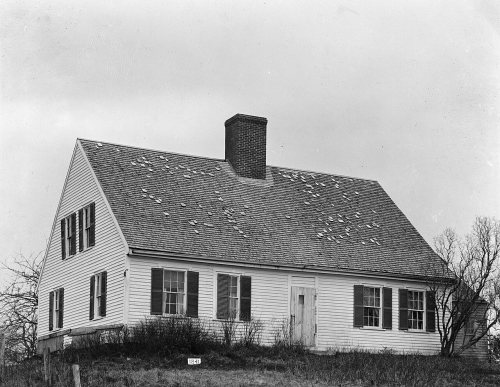
National Park Service, National Register of Historic Places. Photos from Wikimedia Commons, credited on each place’s page.
Every building
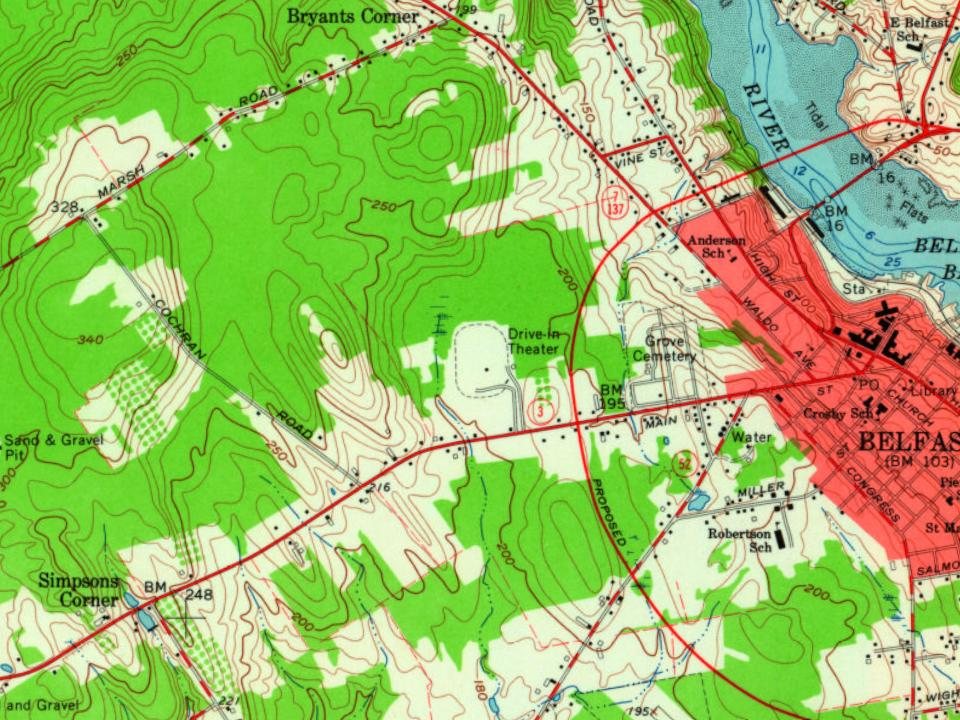
Belfast, building by building, 1884–1923
Fire insurance maps drew every building, what it was made of and what it was used for, so insurers could price the risk of fire. Pick a year, then a sheet.
About 1720, General Samuel Waldo of Boston bought the Muscongus Patent, which had evolved into outright ownership of the land, and was thereafter known as the Waldo Patent.
Waldo died in 1759, and his heirs would sell the plantation of Passagassawakeag (named after its river) to 35 Scots-Irish proprietors from Londonderry, New Hampshire.
Renamed after Belfast, then the principal port of embarkation for emigrants from the north of Ireland, it was settled in 1770, and incorporated as a town in 1773. The village was mostly abandoned during the Revolution while British forces occupied Bagaduce (now Castine).
The British military burned Belfast in 1779, then held it for five days in September 1814 during the War of 1812.
Passages that mention Belfast, cut from the printed page as they were published.
History of the city of Belfast in the state of Maine1877Read the page →
Read the text
IN 1875, the principal bridges in the City of Belfast were the East, or Lower Bridge, Upper Bridge, Citypoint Bridge, Head of the Tide Bridge, Goose River Bridge, and Little River Bridge.
Text read by machine from the scan; it may contain errors.
History of the city of Belfast in the state of Maine1877 · page 11Read the page →
Read the text
seal of said Belfast upon the face of said bonds, but the coupons attached shall require only the signature of the Treasurer. And said Mayor and Treasurer are further authorized and empowered to convey by mortgage to Edward Johnson, of Belfast, Josiah H. Drummond, of Portland, and Frederick Robie, of Gorham, all in the State of Maine, all the stock, both preferred and nonpreferred, in the Belfast and Moosehead Lake Railroad Company, now owned by said city of Belfast, in trust to secure the
Text read by machine from the scan; it may contain errors.
Scans and text from the Internet Archive. Books published in 1930 or earlier, which are in the public domain.
Timeline
Belfast, 1805 to 1941
Woven from the archive, old maps, post office records, the National Register and the people born here.
Nothing in the archives for these yearsWeddings on Main Street, storms, parades, school pictures, the old store. If it’s in your family album, it belongs here.
Belfast is among the most historic 1% of U.S. towns, #4 of 143 in Maine. The History grade combines the town’s founding era, the share of homes built before 1940 and its National Register listings. It’s a character grade, so it isn’t part of the overall grade. How it works.
What is on the National Register in Belfast?
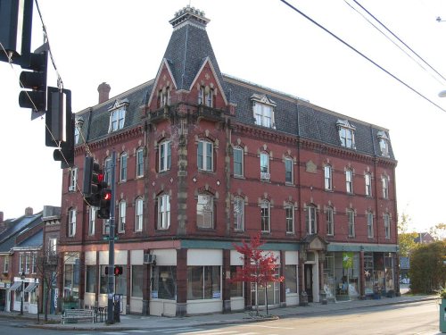
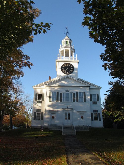
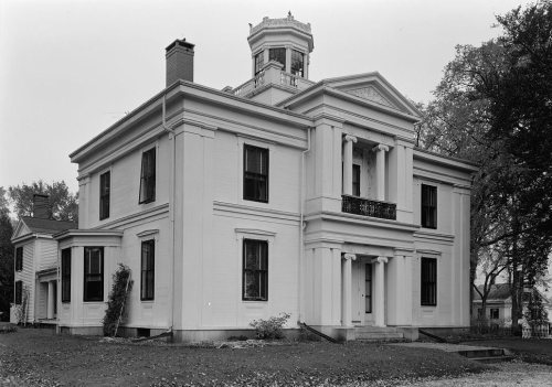
10 listings: 6 buildings, among them the Belfast National Bank (listed 1973, the first), and 4 historic districts with 171 contributing buildings. 177 historic buildings in all.
How old are the homes in Belfast?
37% of Belfast’s homes were built before 1940 (Census estimate, ±7.6 points), against a typical 19% for a Maine town; the median home was built in 1967.
Founding dates: Wikidata, Wikipedia, the U.S. post office records of Blevins & Helbock (CC0) and the Census. Homes by year built: Census ACS 2020–24. National Register of Historic Places: National Park Service (list of May 22, 2026). Old photos, postcards and papers: Wikimedia Commons, the Library of Congress and other public archives, credited on each item’s page. Maps: U.S. Geological Survey historical topographic maps (via Esri) and Sanborn fire-insurance maps (Library of Congress). History text and census tables: Wikipedia (CC BY-SA 4.0). Places that used to be: USGS Geographic Names Information System (2021).
From Wikimedia Commons (10), the Library of Congress (1), Wikidata (1), the National Register of Historic Places (10), Wikipedia, Wikidata and Wikipedia for famous people, U.S. Geological Survey historical maps, U.S. Census counts (via Wikipedia), the US Post Offices dataset (Blevins & Helbock), the USGS Geographic Names Information System, Sanborn fire insurance maps (Library of Congress) and old county and town histories (Internet Archive). Archive images are copied here with their credits and licenses, shown on each photo’s page. Refreshed monthly.






 c. 1872
 c. 1872
 c. 1872
 c. 1872
 c. 1872
 1875
 c. 1878