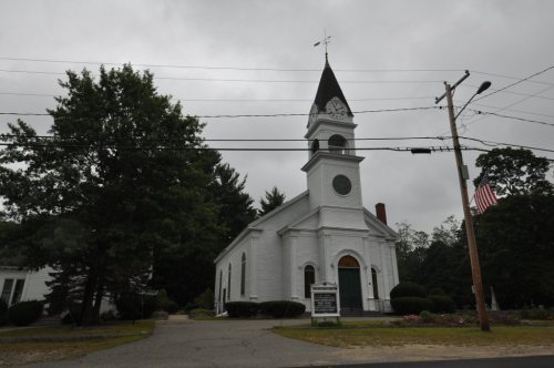
Alfred dates to 1794, and 19% of its homes were built before 1940
More historic than 90% of U.S. towns · #44 of 143 in Maine. What drives it
5 places in town are on the National Register, among them two historic districts with 53 buildings between them. Below: 2 old photos and papers, maps from 1891 on, and the census since 1800.
Founding year: Wikidata. First post office: 1801.The full story ↓
History grade
What drives Alfred’s History grade
On its age, its old homes and the National Register, Alfred is more historic than 90% of U.S. towns, #44 of 143 in Maine. All 3 inputs are above most U.S. towns; its National Register listings ranks highest and its share of homes from before 1940 lowest.
A
HistoryA character grade: shown, never part of Alfred’s overall grade.
Maine towns list more on the Register than most of the country (a typical Maine town has 15.9 per 10,000 residents, the U.S. 2.4), so Alfred’s 182 sits above most of its state (94% of Maine towns have fewer) while its 57 historic buildings outnumber those of 86% of U.S. towns.
How sure. Graded on any two of the three inputs instead, the letter would range from A− to A. The pre-1940 share is a Census survey estimate (±9.3 points). Two sources give 1794.
Founding year: Wikidata (other dates in Quick answers). Homes: Census ACS 2020–24. National Register: National Park Service, May 2026 list; each listing counted once (boundary changes and added documentation belong to their listing), and a historic district counts its contributing buildings. How TownRatings grades history →
What stands out about Alfred’s past
Read from the archive, the National Register and the record. The page puts what stands out first.
The Abenaki people called the area Massabesic, meaning "large pond," or "the place of much water." It was in the western portion of a large tract of land purchased from Indigenous chiefs Fluellin, Hombinowitt and Meeksombe (also known as Captain Sunday), between 1661 and 1664 by Major William Phillips, an owner of mills in Saco (which then included Biddeford). According to historian Jim Brunelle, editor of the Maine Almanac, the price was "two large blankets, two gallons of rum, two pounds of powder, four pounds of musket balls, 20 strings of beads and several other articles."
Passages that mention Alfred, cut from the printed page as they were published.
History of York County, Maine. With illustrations and biographical sketches of its prominent men and pioneers1880Read the page →
Read the text
brothers, Tiieodore and Enos H., the carding, saw, and grist-mills situated on the eastern branch of the Mousam River, one mile southeast of tlie village of Alfred. They also operated a steam saw-mill in the town of York from 1865 to 1870. For about ten years after coming to Alfred, Mr. Littlefield worked at his trade, in connection with his manufacturing interest.
Text read by machine from the scan; it may contain errors.
History of York County, Maine. With illustrations and biographical sketches of its prominent men and pioneers1880Read the page →
Read the text
man, he was always exceedingly vigilant in promoting the interests of his fellow-citizens in all matters of education and municipal improvement. From the time he settled in Alfred he never ceased his exertions till he had procured all the courts of York County to be held in that place, which was finally accomplished in 1833. He also succeeded in having a route for a railroad from Portland to Dover (now the Portland and Rochester Railroad) laid out
Text read by machine from the scan; it may contain errors.
A centennial history of Alfred, York County, Maine1872 · page 24Read the page →
Read the text
The Methodist Episcopal Church. — Rev. Green G. Moore, of Buxton and Limiugton Circuit, lectured in the Congregational meeting-house in Alfred, May 1st, 1829 ; and during the following week in the Calvin Baptist house on Back Street, one mile from the centre of the village. This was the beginning of Methodism in Alfred. In the following fall he held meetings once in two weeks in a hall near the Corner. By perseverance, a little class was soon formed.
Text read by machine from the scan; it may contain errors.
Scans and text from the Internet Archive. Books published in 1930 or earlier, which are in the public domain.
Timeline
Alfred, 1794 to 2020
Woven from the archive, old maps, post office records, the National Register and the people born here.
Nothing in the archives for these yearsWeddings on Main Street, storms, parades, school pictures, the old store. If it’s in your family album, it belongs here.
Fire insurance maps drew every building, what it was made of and what it was used for, so insurers could price the risk of fire. Pick a year, then a sheet.
1894Sheet 1 of 1
Edition
Sheets
BrickWoodStone
Sanborn Map Company, via the Library of Congress. Editions published in 1930 or earlier, which are in the public domain.
Then & now
Stand where they stood
No then-and-now pairs yet. Take a photo from the same spot as an old one and they appear here side by side.
Retake this viewSen. John Holmes House, 1936
Find the spot, match the angle, and add your photo. It becomes the first then-and-now pair on Alfred’s page.
In 1794, according to Wikidata. Alfred’s post office opened in 1801, and the census of 1800 counted 900 people here.
How does Alfred rank for history?
Alfred is more historic than 90% of U.S. towns, #44 of 143 in Maine. The History grade combines the town’s founding era, the share of homes built before 1940 and its National Register listings. It’s a character grade, so it isn’t part of the overall grade. How it works.
What is on the National Register in Alfred?
5 listings: 3 buildings, among them the Sen. John Holmes House (listed 1975, the first), and 2 historic districts, the Alfred Historic District and the Alfred Shaker Historic District, with 53 contributing buildings. 57 historic buildings in all.
How old are the homes in Alfred?
19% of Alfred’s homes were built before 1940 (Census estimate, ±9.3 points), against a typical 19% for a Maine town; the median home was built in 1983.
Founding dates: Wikidata, Wikipedia, the U.S. post office records of Blevins & Helbock (CC0) and the Census. Homes by year built: Census ACS 2020–24. National Register of Historic Places: National Park Service (list of May 22, 2026). Old photos, postcards and papers: Wikimedia Commons, the Library of Congress and other public archives, credited on each item’s page. Maps: U.S. Geological Survey historical topographic maps (via Esri) and Sanborn fire-insurance maps (Library of Congress). History text and census tables: Wikipedia (CC BY-SA 4.0). Places that used to be: USGS Geographic Names Information System (2021).
From Wikimedia Commons (6), the National Register of Historic Places (5), Wikipedia, Wikidata and Wikipedia for famous people, U.S. Geological Survey historical maps, U.S. Census counts (via Wikipedia), the US Post Offices dataset (Blevins & Helbock), the USGS Geographic Names Information System, Sanborn fire insurance maps (Library of Congress) and old county and town histories (Internet Archive). Archive images are copied here with their credits and licenses, shown on each photo’s page. Refreshed monthly.


 2014
 2014
 2014
 2012