Founding year: Wikipedia. First post office: 1830.The full story ↓
History grade
What drives Acton’s History grade
On its age, its old homes and the National Register, Acton is more historic than 50% of U.S. towns, #127 of 143 in Maine. Its share of homes from before 1940 holds the grade up; its National Register listings pull it down.
B−
HistoryA character grade: shown, never part of Acton’s overall grade.
Maine towns list more on the Register than most of the country (a typical Maine town has 15.9 per 10,000 residents, the U.S. 2.4), so Acton’s 3.7 sits below most of its state (25% of Maine towns have fewer) while its 1 listings outnumber those of 51% of U.S. towns.
NoteThe founding year comes from Wikipedia alone; no second source gives 1776.
How sure. Graded on two of the three inputs, so a change in either one moves the letter more than it would with three. The pre-1940 share is a Census survey estimate (±4.7 points).
Founding year: Wikipedia (other dates in Quick answers). Homes: Census ACS 2020–24. National Register: National Park Service, May 2026 list; each listing counted once (boundary changes and added documentation belong to their listing), and a historic district counts its contributing buildings. How TownRatings grades history →
What stands out about Acton’s past
Read from the archive, the National Register and the record. The page puts what stands out first.
It was part of the extensive Ossipee Tract sold on November 28, 1668, by Newichawannock Chief Captain Sunday (or Wesumbe) to Francis Small, a trader from Kittery. Small sold a half interest in the tract to Major Nicholas Shapleigh of Eliot. In 1770, heirs found the unrecorded deed and divided the land, with Shapleigh's descendants awarded one half of Limerick and all of Parsonsfield and Shapleigh. First called Hubbardstown Plantation, Shapleigh was in 1785 incorporated and named in honor of Nicholas Shapleigh. Its western portion was set off and incorporated on March 6, 1830, as Acton, named after Acton, England.
Passages that mention Acton, cut from the printed page as they were published.
History of York County, Maine. With illustrations and biographical sketches of its prominent men and pioneers1880 · page 427Read the page →
Read the text
were appointed a committee to petition the Legislature to make the division on nearly the old parish line. The act of incorporation was passed March 6, 1830, and gave to the new town of Acton 170, the most from the total number of 2950 inhabitants. The name of Acton is derived from the locality of one of the most important contests of
Text read by machine from the scan; it may contain errors.
History of York County, Maine. With illustrations and biographical sketches of its prominent men and pioneers1880 · page 431Read the page →
Read the text
Shapleigh contained originally 32,150 acres, but was afterwards reduced about one-half by the erection of the town of Acton from its western half, and the annexation of a part of the north end to Newfield. It is bounded on the north by Newfield, on the east by Waterborough and Alfred, on the south by Sanford, and on the west by Acton.
Text read by machine from the scan; it may contain errors.
Scans and text from the Internet Archive. Books published in 1930 or earlier, which are in the public domain.
Timeline
Acton, 1776 to 2020
Woven from the archive, old maps, post office records, the National Register and the people born here.
Nothing in the archives for these yearsWeddings on Main Street, storms, parades, school pictures, the old store. If it’s in your family album, it belongs here.
In 1776, according to Wikipedia’s history of the town. Acton’s post office opened in 1830, and the census of 1830 counted 1,398 people here.
How does Acton rank for history?
Acton is more historic than 50% of U.S. towns, #127 of 143 in Maine. The History grade combines the town’s founding era, the share of homes built before 1940 and its National Register listings. It’s a character grade, so it isn’t part of the overall grade. How it works.
What is on the National Register in Acton?
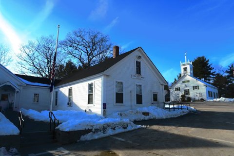
One place: the Lincoln School (listed 2013).
How old are the homes in Acton?
16% of Acton’s homes were built before 1940 (Census estimate, ±4.7 points), against a typical 19% for a Maine town; the median home was built in 1974.
Founding dates: Wikidata, Wikipedia, the U.S. post office records of Blevins & Helbock (CC0) and the Census. Homes by year built: Census ACS 2020–24. National Register of Historic Places: National Park Service (list of May 22, 2026). Old photos, postcards and papers: Wikimedia Commons, the Library of Congress and other public archives, credited on each item’s page. Maps: U.S. Geological Survey historical topographic maps (via Esri) and Sanborn fire-insurance maps (Library of Congress). History text and census tables: Wikipedia (CC BY-SA 4.0). Places that used to be: USGS Geographic Names Information System (2021).
From Wikimedia Commons (11), Wikidata (1), the National Register of Historic Places (1), Wikipedia, U.S. Geological Survey historical maps, U.S. Census counts (via Wikipedia), the US Post Offices dataset (Blevins & Helbock), the USGS Geographic Names Information System and old county and town histories (Internet Archive). Archive images are copied here with their credits and licenses, shown on each photo’s page. Refreshed monthly.


 2019
 2019
 2016
 2016
 2015
 2015
 2015
 2015
 2012
 2008