140 years in pictures
The archive holds 6 old photos and papers going back to 1850 and 6 maps from 1894 on.
- 1886St. George Island is settled
Each edition grades its towns against each other only.

A town of 277, settled in 1886.
St. George Island’s median household income is $250,000, above both the Maryland town median ($113,000) and the median of U.S. towns ($80,000). Among 262 Maryland towns, just one has a higher home-ownership rate than St. George Island. St. George Island has fewer than 1,000 residents, too few for fair grades; the figures below are still real.

The archive holds 6 old photos and papers going back to 1850 and 6 maps from 1894 on.
Coastal flooding makes up 32% of the storm damage FEMA expects here.
FEMA National Risk Index · OpenFEMA · OpenStreetMap
Ordered by what stands out in St. George Island.
52% of St. George Island adults 25 and older hold a bachelor’s degree or more. The midpoint age for St. George Island comes to 45.2 years.
| St. George Island | Maryland towns | U.S. towns | |
|---|---|---|---|
| Bachelor’s degree or more, 25+ | 52% | 42% | 29% |
| Median age | 45.2 years | 39.4 years | 40.5 years |
Somewhere between 3% and 74% women
The Census survey reached too few of St. George Island’s residents to say more: its margin here is ±35.4 points. Across Maryland, 51.3% of residents are women.
| St. George Island | MD | U.S. | |
|---|---|---|---|
| Under 10 | 0% | 11.9% | 11.6% |
| 10 to 17 | 35% | 10.3% | 10.3% |
| 18 to 24 | 0% | 8.5% | 9.1% |
| 25 to 34 | 0% | 13.2% | 13.7% |
| 35 to 44 | 9.4% | 13.6% | 13.2% |
| 45 to 54 | 39% | 12.6% | 12.2% |
| 55 to 64 | 2.9% | 13.3% | 12.7% |
| 65 to 74 | 0% | 9.9% | 10.2% |
| 75 and older | 13.7% | 6.8% | 7% |
| No diploma | 0% | 8.9% | 10.4% |
| High school | 25.6% | 23.4% | 26% |
| Some college | 22.2% | 17.4% | 19.1% |
| Associate’s | 0% | 6.8% | 8.8% |
| Bachelor’s | 22.2% | 22.7% | 21.6% |
| Graduate | 30% | 20.8% | 14.1% |
U.S. Census Bureau · ACS 2020-2024 5-year estimates · in a town of 300, single groups can be off by several points
The share of working residents in St. George Island who work locally: 1.1%. Half of commuters travel less than 18 miles. The top destinations are California (14%), Leonardtown (9%) and Washington (4%).
Census LEHD 2023 · ACS
In St. George Island, the midsummer high is 88°F.
NOAA U.S. Climate Normals, 1991–2020
14% of adults binge drink in St. George Island. CDC measures, 32 in all: St. George Island beats Maryland on 11 and trails on 5. Among adults in the town, 13% report frequent mental distress and 41% have high blood pressure.
| St. George Island | Maryland towns | U.S. towns | |
|---|---|---|---|
| Sleep under 7 hours (CDC PLACES) | 31% | 38% | 36% |
| Frequent mental distress (CDC PLACES) | 13% | 15% | 17% |
| High blood pressure (CDC PLACES) | 41% | 35% | 35% |
| Food insecurity (CDC PLACES) | 8.2% | 14% | 14% |
| What stands out | St. George Island | MD |
|---|---|---|
| Fewer adults facing food insecurity | 8.2% | 15.4% |
| Fewer adults facing a utility shut-off | 4.5% | 8.4% |
| More adults who have had cancer | 11.9% | 7.6% |
CDC PLACES 2025 · modeled estimates for adults · CMS · HRSA
One declared disaster, in 2003, has brought federal aid to St. George Island households. Expected losses in St. George Island break down as 32% from coastal flooding and 24% from hurricanes.
FEMA disaster declarations and aid · FEMA National Risk Index · OpenFEMA
Zillow Home Value Index · Redfin Data Center
Museums, parks, gardens and other places to visit around St. George Island. Close and well known come first.
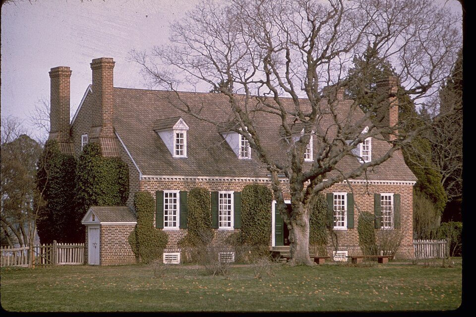
24 mi National MonumentGeorge Washington Birthplace National Monument72K visitors a year
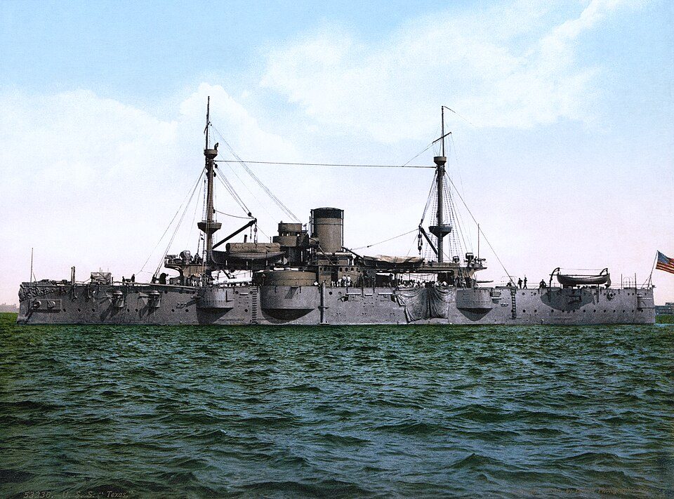
34 mi Ancient siteUSS Texas
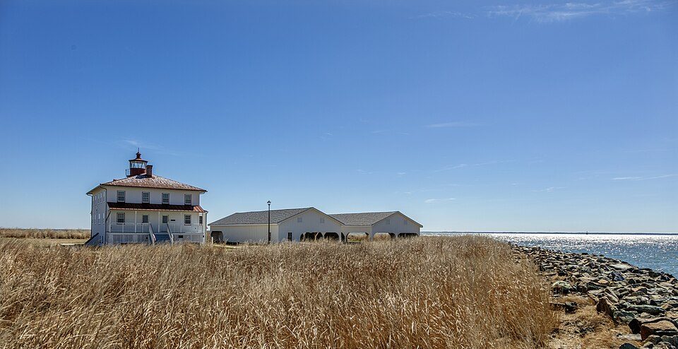
8 mi State parkPoint Lookout State Park
5 mi Ancient siteU-1105
12 mi MuseumPatuxent River Naval Air Museum
15 mi MuseumCalvert Marine MuseumGeorge Washington Birthplace National Monument: National Park Service Digital Image Archives, Public domain · USS Texas: Unknown authorUnknown author, Public domain · Point Lookout State Park: Acroterion, CC BY-SA 4.0 · U-1105: U.S. Navy, Public domain · Patuxent River Naval Air Museum: Acroterion, CC BY-SA 4.0 · Calvert Marine Museum: Sampsonsimpson20, CC BY-SA 3.0
St. George Island is unincorporated, so St. Mary's County and regional agencies provide most services.
EPA SDWIS (Oct 9, 2026) · HIFLD + EIA-861 2025 · Census 2020 ZCTAs · NCES 2024–25 · registration: vote.gov, updated Mar 11, 2026.
In a town this size, neighbors are the best guide. Ask them anything.
1 within 15 miles of the center of St. George Island
About 9 of every 100 St. George Island residents are enrolled in college, against 7 across Maryland.
Census-designated place in Maryland, United States
St. George Island is an unincorporated census-designated place in St. Mary's County, Maryland, United States. The post office at Piney Point serves the island, which is connected to the mainland by a short bridge. During the War of 1812, the British made the island their headquarters, and raided shipyards and river plantations from this base. Many tall pines on the island were cut and shipped to England for ship masts. In the 19th century the Roman Catholic Church, which owned the island, finally opened it to settlement, including some settlers who migrated from Smith Island.
From Wikipedia, licensed CC BY-SA 4.0 · facts via Wikidata (CC0)
Short answers, built from the data on this page.
St. George Island has fewer than 1,000 residents, too few for fair grades; the figures below are still real.
Ask a question, answer one, post a photo or an event. Free, and the parts only a neighbor would know are the parts worth reading.