Severn’s post office opened in 1875, and 1 of its places is on the National Register
More historic than 23% of U.S. towns · #166 of 261 in Maryland. What drives it
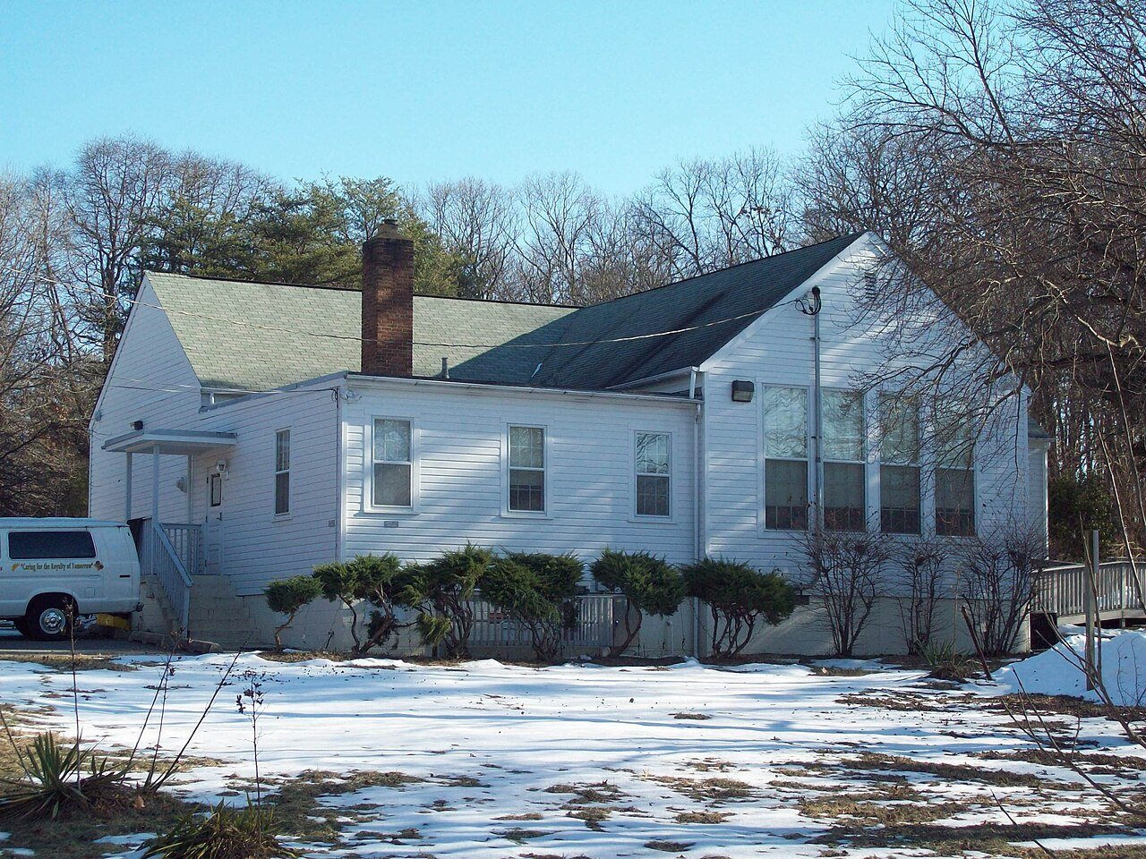
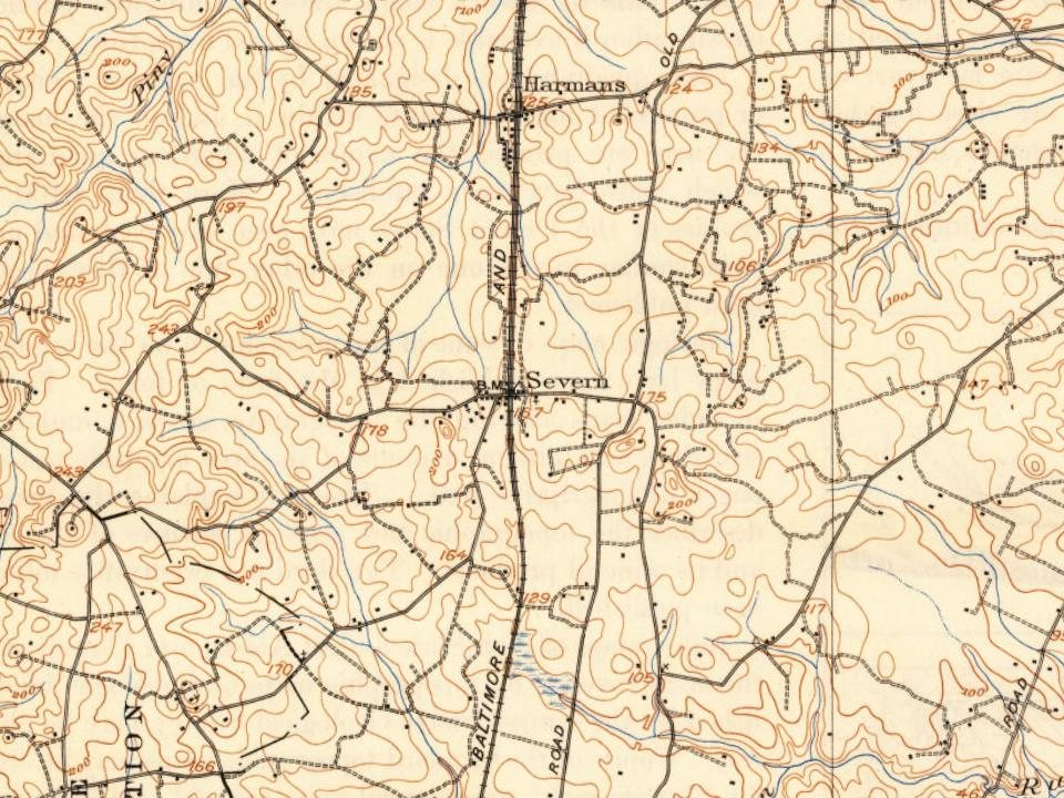
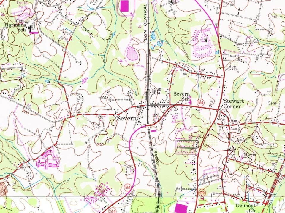
Its Register listing is the Queenstown Rosenwald School. Most of Severn was built recently: 1% of its homes predate 1940 and the median home dates from 1997. Below: maps from 1894 on and the census since 1980.
The Severn post office opened in 1875, the earliest record of the town by name. Three smaller post offices, Harmans (1877), Fairfield (1892) and Boone (1914), opened inside today’s town and later closed.
First census: 20,147 in 19802020 census: 57,118151 years
How historic is Severn?
C−
More historic than 23% of U.S. towns, on its age, its old homes and the National Register.
Founding year: the first Severn post office (Blevins & Helbock, CC0).
History grade
What drives Severn’s History grade
On its age, its old homes and the National Register, Severn is more historic than 23% of U.S. towns, #166 of 261 in Maryland. Its National Register listings hold the grade up; its share of homes from before 1940 pulls it down.
C−
HistoryA character grade: shown, never part of Severn’s overall grade.
Few Maryland towns list much on the Register (a typical Maryland town has 0.9 per 10,000 residents, the U.S. 2.4), so Severn’s 0.2 sits near the middle of its state (40% of Maryland towns have fewer) while its 1 listings outnumber those of 51% of U.S. towns.
How sure. Graded on any two of the three inputs instead, the letter would range from C− to C. The pre-1940 share (±0.8 points) is firm at this size. The founding year is the first post office, not a stated founding date.
Founding year: the first post office (other dates in Quick answers). Homes: Census ACS 2020–24. National Register: National Park Service, May 2026 list; each listing counted once (boundary changes and added documentation belong to their listing), and a historic district counts its contributing buildings. How TownRatings grades history →
What stands out about Severn’s past
Read from the archive, the National Register and the record. The page puts what stands out first.
Lost post offices, old corners, places now gone and burying grounds
Severn’s post office has been open since 1875. Three other post offices opened and closed inside today’s town.
Severn
1875–today
Harmans
1877–1990
Fairfield
1892–1895
Boone
1914–1925
18701950today
Hamlets and corners on the map
Alberta HeightsAndorick AcresBonnie AcresBurleytownChesapeake Mobile CourtChesmarColonial ManorCrestwood Mobile Home ParkCutler RidgeDanza VillageDelmontDerby FarmsElmhurstElmhurst EstatesElmhurst RidgeGrand View ParkGreenbriarHarmansHarmans WoodsHoliday Mobile Home EstatesLake VillageLeedsMeade VillageMerriweather
Gone or out of use
Harmans Post Officepost officeSevern Schoolschool
5cemeteries and burying grounds inside Severn
BoyerDisneyGriffith FamilyMount PilgrimPet
US Post Offices dataset (Blevins & Helbock, CC0). Places and cemeteries from the USGS Geographic Names Information System (2021).
Help out
Start Severn’s collection
The first neighbors to add old photos shape how Severn’s history is told.
Decades since 1900 with photos
00s10s20s30s40s50s60s70s80s90s
0 of 10 decades. The empty ones are waiting for someone’s album.
Every edition of the U.S. Geological Survey’s map of Severn. Tap a year, or press play to watch the town change.
1894Relay sheet · 1:62,500
U.S. Geological Survey historical topographic maps (public domain), via Esri’s collection of the scans. The red ring marks the center of Severn.
The story so far
Severn, in brief
Wikipedia doesn’t have a history of Severn yet. The photos, dates and memories neighbors add here are how it gets written.
Severn is a census-designated place (CDP) in Anne Arundel County, Maryland, United States. According to the 2020 U.S. census, the population of Severn is 57,118, a 22.6% increase from 44,231 in 2010. The zip code is 21144.
Its first post office opened in 1875. Between the 2010 and 2020 censuses its population grew from 44,231 to 57,118 (+29%).
Intro from Wikipedia. Population: U.S. Census Bureau.
From the old history books
What they wrote about Severn in 1905
Passages that mention Severn, cut from the printed page as they were published.
A history of Anne Arundel County in Maryland1905Read the page →
Read the text
11. The village of St. Margarets takes its name from St. Margareas Parish, whose church is in the village. The Parish is supposed to have taken its name from St. Margarets Chapel, Westminstei-, England. The first church of this parish of which there is anything known, stood on the north side of Severn, near the northern terminus of the Short Line Ilailroad Bridge. This church was burned down some time in the first half of the 19th centur}'. The present is the third church on the same site in St. Margarets. The second one, a wooden one, was burned down. Mr. John Ridout sent his workmen to repair the church, and they,
Text read by machine from the scan; it may contain errors.
A history of Anne Arundel County in Maryland1905Read the page →
Read the text
1823. A bill was passed to incorporate a company to build a bridge over the Severn. 1824. A census of Annapolis was taken, that, with the soldiers in the Fort, made the inhabitants number 2,500. Monday, April 19th, the boiler of the Steamboat Eagle, on her tirst trip from Baltimore to Annapolis, exploded off North Point.
Text read by machine from the scan; it may contain errors.
Scans and text from the Internet Archive. Books published in 1930 or earlier, which are in the public domain.
Timeline
Severn, 1875 to 1990
Woven from the archive, old maps, post office records, the National Register and the people born here.
The Severn post office opened in 1875, the earliest record of the town by name (U.S. post office records).
How does Severn rank for history?
Severn is more historic than 23% of U.S. towns, #166 of 261 in Maryland. The History grade combines the town’s founding era, the share of homes built before 1940 and its National Register listings. It’s a character grade, so it isn’t part of the overall grade. How it works.
What is on the National Register in Severn?
One place: the Queenstown Rosenwald School (listed 2009).
How old are the homes in Severn?
1% of Severn’s homes were built before 1940 (Census estimate), against a typical 3.3% for a Maryland town; the median home was built in 1997.
Founding dates: Wikidata, Wikipedia, the U.S. post office records of Blevins & Helbock (CC0) and the Census. Homes by year built: Census ACS 2020–24. National Register of Historic Places: National Park Service (list of May 22, 2026). Old photos, postcards and papers: Wikimedia Commons, the Library of Congress and other public archives, credited on each item’s page. Maps: U.S. Geological Survey historical topographic maps (via Esri) and Sanborn fire-insurance maps (Library of Congress). History text and census tables: Wikipedia (CC BY-SA 4.0). Places that used to be: USGS Geographic Names Information System (2021).
From the National Register of Historic Places (1), Wikidata and Wikipedia for famous people, U.S. Geological Survey historical maps, U.S. Census counts (via Wikipedia), the US Post Offices dataset (Blevins & Helbock), the USGS Geographic Names Information System and old county and town histories (Internet Archive). Archive images are copied here with their credits and licenses, shown on each photo’s page. Refreshed monthly.