
Woods Hole, Mass, c. 1863
Woods Hole’s story
200 years in pictures
The archive holds 6 old photos and papers going back to 1863 and 8 maps from 1886 on.
- 1826Woods Hole is settled
Each edition grades its towns against each other only.
80% of adults 25 and older hold a bachelor’s degree or more in Woods Hole, above both the Massachusetts town median (47%) and the median of U.S. towns (29%). No town among the 284 in Massachusetts we compare has a higher midpoint age than Woods Hole. Woods Hole’s concentration of trails is 2.2 miles per square mile, against 1.8 in Massachusetts’ towns and 0.4 across U.S. towns. Woods Hole has fewer than 1,000 residents, too few for fair grades; the figures below are still real.
Where Woods Hole beats most towns.
Coastal flooding makes up 15% of the storm damage FEMA expects here.
FEMA National Risk Index · OpenFEMA · OpenStreetMap
The archive holds 6 old photos and papers going back to 1863 and 8 maps from 1886 on.
Museums, parks, gardens and other places to visit around Woods Hole. Close and well known come first.
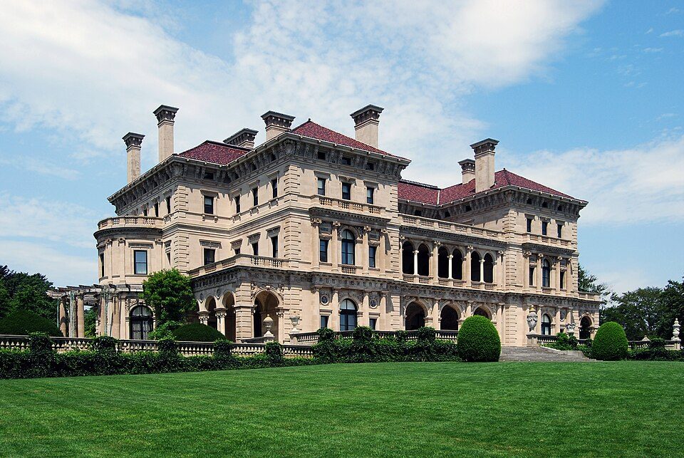 Big draw33 mi MuseumThe Breakers
 28 mi MuseumUSS Massachusetts
 36 mi Ancient siteHMS Endeavour
 33 mi MuseumMarble House
 33 mi MuseumThe Elms
 37 mi Ancient siteSS Pendleton
The Breakers: UpstateNYer, CC BY-SA 3.0 · USS Massachusetts: USN, Public domain · HMS Endeavour: Samuel Atkins (c.1760-1810), Public domain · Marble House: [email protected], Public domain · The Elms: The original uploader was Daderot at English Wikipedia., CC BY-SA 3.0 · SS Pendleton: United States Coast Guard, Richard C. Kelsey, Public domain
Woods Hole is unincorporated, so Barnstable County and regional agencies provide most services.
EPA SDWIS (Oct 9, 2026) · HIFLD + EIA-861 2025 · Census 2020 ZCTAs · NCES 2024–25 · registration: vote.gov, updated Nov 18, 2024.
Ordered by what stands out in Woods Hole.
For Woods Hole, the typical journey to work is 22 minutes. Only 14% of working residents stay in Woods Hole for work; the rest commute out. Since 2013, Woods Hole has lost 293 jobs, to 1,825 in 2023. The top destinations are Falmouth (46%), Boston (5%) and Barnstable Town (4%).
| Woods Hole | Massachusetts towns | U.S. towns | |
|---|---|---|---|
| Average trip to work | 22 minutes | 30 minutes | 25 minutes |
| Median household income | $72,000 | $120,000 | $80,000 |
| Working residents who work in town | 14% | 9.8% | 8% |
| Below the poverty line | 5.4% | 6% | 9.6% |
Census LEHD 2023 · ACS
NOAA U.S. Climate Normals, 1991–2020
Storm and flood damage is expected to run lower than in two thirds of U.S. communities. Of the losses FEMA expects in Woods Hole, 49% come from inland flooding and 30% from hurricanes.
FEMA National Risk Index · OpenFEMA
Across 2 parks and preserves: 8.5 miles of trail.
| Biggest places to walk | Trails | Acres |
|---|---|---|
| 1. Taft's Playground | 0.1 mi | 10 |
| 2. WHOI - Rose Garden | 0.1 mi | 1 |
Trails & parks © OpenStreetMap contributors · Conserved land: USGS PAD-US
Among adults in Woods Hole, 13% report frequent mental distress. Against the Massachusetts average, Woods Hole comes out ahead on 18 CDC measures out of 32, and behind on 3. Two figures for adults in the town: 28% sleep under 7 hours, 24% have obesity.
| Woods Hole | Massachusetts towns | U.S. towns | |
|---|---|---|---|
| Frequent mental distress (CDC PLACES) | 13% | 16% | 17% |
| Sleep under 7 hours (CDC PLACES) | 28% | 33% | 36% |
| Obesity (CDC PLACES) | 24% | 28% | 35% |
| Smoke cigarettes (CDC PLACES) | 7.6% | 11% | 14% |
| What stands out | Woods Hole | MA |
|---|---|---|
| Fewer older adults who have lost all their teeth | 5.4% | 11.9% |
| Fewer adults facing food insecurity | 5.9% | 12.4% |
| More adults who have had cancer | 12.8% | 8.5% |
CDC PLACES 2025 · modeled estimates for adults · CMS · HRSA
For households here, the share who are owner-occupiers is 73%. Woods Hole’s going rate for rent is $1,311 a month.
| Woods Hole | Massachusetts towns | U.S. towns | |
|---|---|---|---|
| Median rent | $1,311 a month | $1,683 a month | $1,185 a month |
| Households that own their home | 73% | 79% | 73% |
Census ACS, 2020–24 · Zillow Home Value Index · Redfin Data Center
1 within 15 miles of the center of Woods Hole
About 14 of every 100 Woods Hole residents are enrolled in college, against 8 across Massachusetts.
In a town this size, neighbors are the best guide. Ask them anything.
Census-designated place in Massachusetts, United States
Woods Hole is a census-designated place in the town of Falmouth in Barnstable County, Massachusetts, United States. It lies at the extreme southwestern corner of Cape Cod, near Martha's Vineyard and the Elizabeth Islands. As of the 2020 census, Woods Hole had a population of 834. It is the site of several marine science institutions, including Woods Hole Oceanographic Institution, the Marine Biological Laboratory, the Woodwell Climate Research Center, NOAA's Northeast Fisheries Science Center (which started the Woods Hole scientific community in 1871), the Woods Hole Science Aquarium, a USGS coastal and marine geology center, and the home campus of the Sea Education Association. Woods Hole …
From Wikipedia, licensed CC BY-SA 4.0 · facts via Wikidata (CC0)
Short answers, built from the data on this page.
Woods Hole has fewer than 1,000 residents, too few for fair grades; the figures below are still real.
2 notable people were born here, including Nancy Kanwisher and Ian Bowles.


