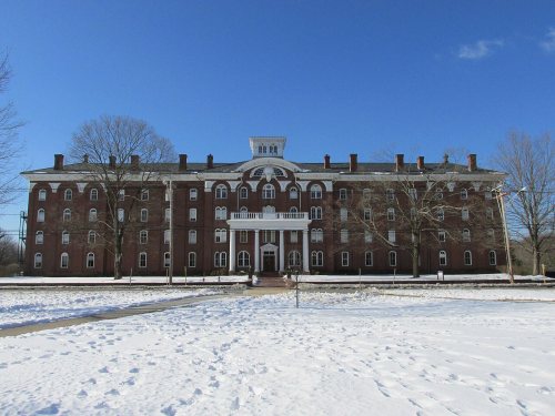
Wilbraham dates to 1730, and 10% of its homes were built before 1940
More historic than 79% of U.S. towns · #226 of 283 in Massachusetts. What drives it
1 place in town is on the National Register, among them a historic district with 24 buildings. Below: 5 old photos and papers, maps from 1887 on, and the census since 1790.
Wilbraham dates its founding to 1730 (Wikidata and Wikipedia’s history agree). It appears in the first U.S. census, 1790.
First census: 1,555 in 17902020 census: 14,613296 years
How did Wilbraham get its name?
The name originates from Wilburgham, a name indicating "Wilburga's homestead," Wilburga being the daughter of the seventh century King Penda of the Mercians who gave her the land.
How historic is Wilbraham?
A−
More historic than 79% of U.S. towns, on its age, its old homes and the National Register.
Founding year: Wikidata; Wikipedia’s history section gives the same year. First post office: 1821. Name: Wikipedia, licensed CC BY-SA 4.0.The full story ↓
History grade
What drives Wilbraham’s History grade
On its age, its old homes and the National Register, Wilbraham is more historic than 79% of U.S. towns, #226 of 283 in Massachusetts. Its age holds the grade up; its share of homes from before 1940 pulls it down.
A−
HistoryA character grade: shown, never part of Wilbraham’s overall grade.
Massachusetts towns list more on the Register than most of the country (a typical Massachusetts town has 46.0 per 10,000 residents, the U.S. 2.4), so Wilbraham’s 19.9 sits near the middle of its state (36% of Massachusetts towns have fewer) while its 29 historic buildings outnumber those of 81% of U.S. towns.
How sure. Graded on any two of the three inputs instead, the letter would range from B to A−. The pre-1940 share is a Census survey estimate (±3.2 points). Two sources give 1730.
Founding year: Wikidata (other dates in Quick answers). Homes: Census ACS 2020–24. National Register: National Park Service, May 2026 list; each listing counted once (boundary changes and added documentation belong to their listing), and a historic district counts its contributing buildings. How TownRatings grades history →
What stands out about Wilbraham’s past
Read from the archive, the National Register and the record. The page puts what stands out first.
The area today known as the Town of Wilbraham first became of interest in 1636 when a young man named William Pynchon (founder of Springfield) purchased the area from the Nipmuc starting at the Connecticut River in Springfield and extending to the foot of the Wilbraham Mountain Range by 1674. Wilbraham was first settled in 1730 by Nathaniel Hitchcock along with what is now Hampden, Massachusetts, as the Fourth District of Springfield. It was also known as the Outward Commons, Mountains or Springfield Mountain. Hitchcock built a log hut along what is now Main Street. Hunting and logging took place in the late 17th century.
Passages that mention Wilbraham, cut from the printed page as they were published.
An historical address, delivered at the centennial celebration of the incorporation of the town of Wilbraham, June 15, 18631864 · page 216Read the page →
Read the text
that of sending a Representative to this Court only excepted. And that the said Town shall have full Right and Liberty from Time to Time to join with said Town of Springfield in the choice of Representatives, to represent them at the General Assembly, And that the said Town of Wilbraham shall froift Time to Time be at their Proportionable Part of the Expense of such Representatives, and the Freeholders and other Inhabitants of Wilbraham shall be notified of the Time and Place of Election, in like manner as the Inhabitants of said Springfield, by a warrant from the Selectmen of said Springfield, directed to the Constable of said
Text read by machine from the scan; it may contain errors.
An historical address, delivered at the centennial celebration of the incorporation of the town of Wilbraham, June 15, 18631864 · page 13Read the page →
Read the text
I. What is now the town of Wilbraham was a part of the territory of Springfield, whose settlement was commenced by William Pynchon and his associates, in 1636, ninety-five years before the settlement of this town. The territory of the town of Springfield was about twenty-five miles square, extending from Connecticut River east to the present line of Monson, west to Russell or thereabouts, and from Warehouse Point, or
Text read by machine from the scan; it may contain errors.
Scans and text from the Internet Archive. Books published in 1930 or earlier, which are in the public domain.
Timeline
Wilbraham, 1730 to 2020
Woven from the archive, old maps, post office records, the National Register and the people born here.
Nothing in the archives for these yearsWeddings on Main Street, storms, parades, school pictures, the old store. If it’s in your family album, it belongs here.
In 1730, according to Wikidata and Wikipedia’s history of the town. Wilbraham’s post office opened in 1821, and the first U.S. census counted 1,555 people here in 1790.
How does Wilbraham rank for history?
Wilbraham is more historic than 79% of U.S. towns, #226 of 283 in Massachusetts. The History grade combines the town’s founding era, the share of homes built before 1940 and its National Register listings. It’s a character grade, so it isn’t part of the overall grade. How it works.
What is on the National Register in Wilbraham?
One place: the Academy Historic District (listed 1979).
How old are the homes in Wilbraham?
10% of Wilbraham’s homes were built before 1940 (Census estimate, ±3.2 points), against a typical 21% for a Massachusetts town; the median home was built in 1966.
Founding dates: Wikidata, Wikipedia, the U.S. post office records of Blevins & Helbock (CC0) and the Census. Homes by year built: Census ACS 2020–24. National Register of Historic Places: National Park Service (list of May 22, 2026). Old photos, postcards and papers: Wikimedia Commons, the Library of Congress and other public archives, credited on each item’s page. Maps: U.S. Geological Survey historical topographic maps (via Esri) and Sanborn fire-insurance maps (Library of Congress). History text and census tables: Wikipedia (CC BY-SA 4.0). Places that used to be: USGS Geographic Names Information System (2021).
From Wikimedia Commons (6), the National Register of Historic Places (1), Wikipedia, Wikidata and Wikipedia for famous people, U.S. Geological Survey historical maps, U.S. Census counts (via Wikipedia), the US Post Offices dataset (Blevins & Helbock), the USGS Geographic Names Information System and old county and town histories (Internet Archive). Archive images are copied here with their credits and licenses, shown on each photo’s page. Refreshed monthly.


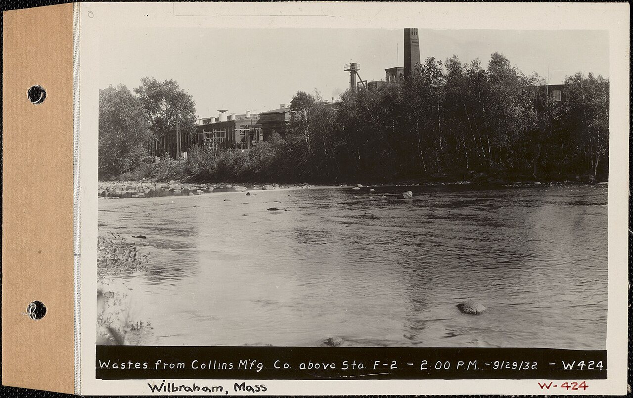


 1932
 1932
 1932
 2009