West Bridgewater dates to 1651, and 28% of its homes were built before 1940
More historic than 84% of U.S. towns · #194 of 283 in Massachusetts. What drives it
2 places in town are on the National Register, among them a historic district. Below: 8 old photos and papers, maps from 1886 on, and the census since 1850.
Founding year: Wikidata; Wikipedia’s history section gives the same year. First post office: 1802.The full story ↓
History grade
What drives West Bridgewater’s History grade
On its age, its old homes and the National Register, West Bridgewater is more historic than 84% of U.S. towns, #194 of 283 in Massachusetts. Its age holds the grade up; its National Register listings pull it down.
A−
HistoryA character grade: shown, never part of West Bridgewater’s overall grade.
Massachusetts towns list more on the Register than most of the country (a typical Massachusetts town has 46.0 per 10,000 residents, the U.S. 2.4), so West Bridgewater’s 2.6 sits below most of its state (15% of Massachusetts towns have fewer) while its 2 listings outnumber those of 60% of U.S. towns.
How sure. Graded on any two of the three inputs instead, the letter would range from B+ to A+. The pre-1940 share is a Census survey estimate (±5.6 points). Two sources give 1651.
Founding year: Wikidata (other dates in Quick answers). Homes: Census ACS 2020–24. National Register: National Park Service, May 2026 list; each listing counted once (boundary changes and added documentation belong to their listing), and a historic district counts its contributing buildings. How TownRatings grades history →
What stands out about West Bridgewater’s past
Read from the archive, the National Register and the record. The page puts what stands out first.
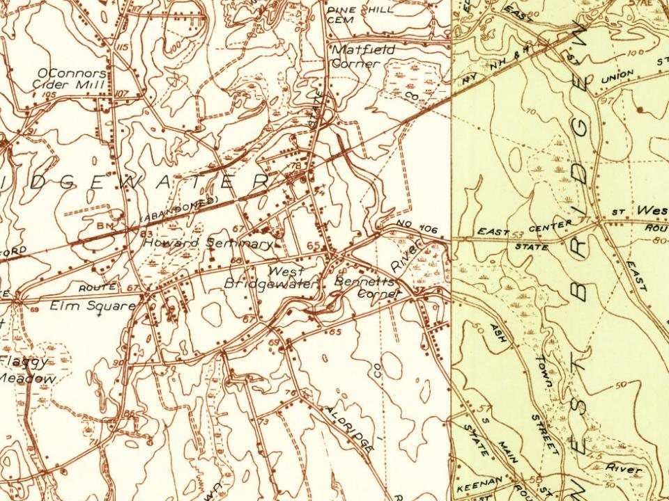
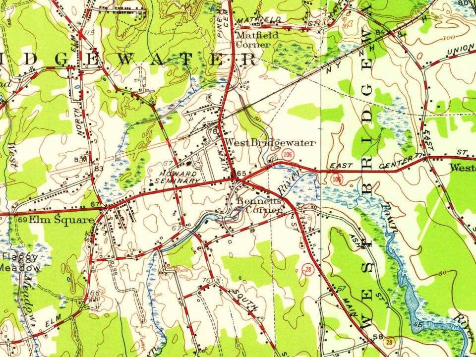
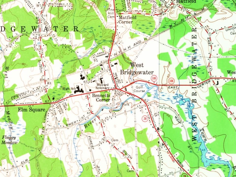
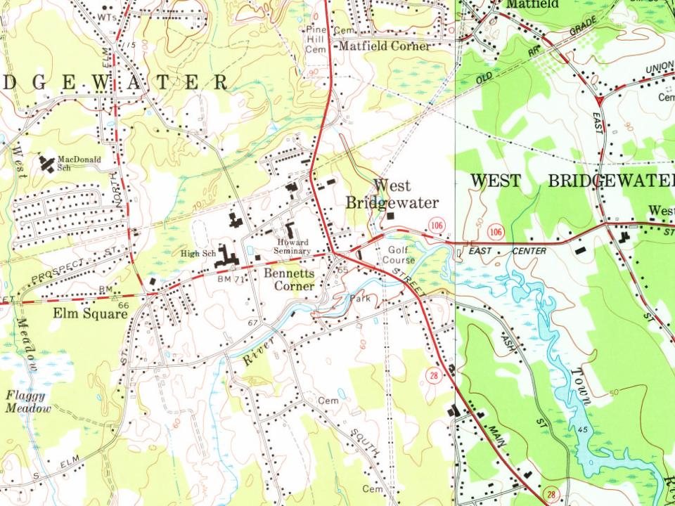
Every edition of the U.S. Geological Survey’s map of West Bridgewater. Tap a year, or press play to watch the town change.
1886Dedham sheet · 1:62,500
U.S. Geological Survey historical topographic maps (public domain), via Esri’s collection of the scans. The red ring marks the center of West Bridgewater.
West Bridgewater was first settled in 1651 as a part of Bridgewater, Massachusetts. The area was known as the First Parish of Bridgewater (or colloquially the "West Parish" of the broader "Olde Bridgewater" territory). The First Parish of Bridgewater officially incorporated as the separate town of West Bridgewater on February 16, 1822.
The town became the second of three communities to separate from Bridgewater (after North Bridgewater, now Brockton, and before East Bridgewater) over a span of three years. The town, like many in the area, had both agrarian and industrial roots; the Town River provided water power for milling and irrigation for farming.
Passages that mention West Bridgewater, cut from the printed page as they were published.
History of Brockton, Plymouth County, Massachusetts, 1656-18941895 · page 804Read the page →
Read the text
Be it enacted, etc., as follows: Section I. So much of the town of West Bridgewater, in tlie county of Plymouth, as lies between the present boundary line between said town and the city of Brockton, in said county, and the following line, that is to say : Beginning at a stone post standing at the intersection of the present line between the city of Brockton and the town of West Bridgewater with the south line of Oak street ; thence at a right angle southerly from said town line two hundred and eighty-nine rods ; thence easterly in a line parallel to said town line to the town of East Bridgewater; thence northerly
Text read by machine from the scan; it may contain errors.
History of Brockton, Plymouth County, Massachusetts, 1656-18941895 · page 802Read the page →
Read the text
Massacliusetts, in General Court Assembled: The undersigned petitioners, citizens of the Town of West Bridgewater and City of Brockton, respectfully present and petition, Tiiat the boundary lines between tiie said Town of West Bridgewater and said City of Brockton be so changed as to include with sajd City of Brockton all tiiat part of said Town of West Bridgewater tliat lies east and north of the following described lines, namely : Beginning at a stone post on the southerly side of Oak street, marking the crossing of the present town line Avith said street; thence at a right angle southerly
Text read by machine from the scan; it may contain errors.
History of the early settlement of Bridgewater in Plymouth county, Massachusetts, including an extensive Family register1897 · page 49Read the page →
Read the text
water, till after 1700. Among the first settlers were Daniel and Robert Howard, David, Solomon, John, James, Zaccheus and Abiel Packard, Henry Kingman, and Timothy Keith : all of whom came from West Bridgewater. Tiiicut Parish. February 4, 1743, the south-west part of the south parish, with a part of Middleborough, was incorporated into a precinct, called Titicut Parish. It lies south of the old four mile line, so
Text read by machine from the scan; it may contain errors.
Scans and text from the Internet Archive. Books published in 1930 or earlier, which are in the public domain.
By decade
West Bridgewater, decade by decade
4 decades in the archive, from the 1830s to the 1940s. Scroll each row; tap a photo for its story.
Nothing in the archives for these yearsWeddings on Main Street, storms, parades, school pictures, the old store. If it’s in your family album, it belongs here.
In 1651, according to Wikidata and Wikipedia’s history of the town. West Bridgewater’s post office opened in 1802, and the census of 1850 counted 1,447 people here.
How does West Bridgewater rank for history?
West Bridgewater is more historic than 84% of U.S. towns, #194 of 283 in Massachusetts. The History grade combines the town’s founding era, the share of homes built before 1940 and its National Register listings. It’s a character grade, so it isn’t part of the overall grade. How it works.
What is on the National Register in West Bridgewater?
Two places: the War Memorial Park (listed 2008) and the Skim Milk Bridge and Causeway Historic District (2025).
How old are the homes in West Bridgewater?
28% of West Bridgewater’s homes were built before 1940 (Census estimate, ±5.6 points), against a typical 21% for a Massachusetts town; the median home was built in 1963.
Founding dates: Wikidata, Wikipedia, the U.S. post office records of Blevins & Helbock (CC0) and the Census. Homes by year built: Census ACS 2020–24. National Register of Historic Places: National Park Service (list of May 22, 2026). Old photos, postcards and papers: Wikimedia Commons, the Library of Congress and other public archives, credited on each item’s page. Maps: U.S. Geological Survey historical topographic maps (via Esri) and Sanborn fire-insurance maps (Library of Congress). History text and census tables: Wikipedia (CC BY-SA 4.0). Places that used to be: USGS Geographic Names Information System (2021).
From Wikimedia Commons (11), the Library of Congress (1), the National Register of Historic Places (2), Wikipedia, Wikidata and Wikipedia for famous people, U.S. Geological Survey historical maps, U.S. Census counts (via Wikipedia), the US Post Offices dataset (Blevins & Helbock), the USGS Geographic Names Information System and old county and town histories (Internet Archive). Archive images are copied here with their credits and licenses, shown on each photo’s page. Refreshed monthly.
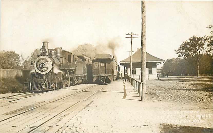




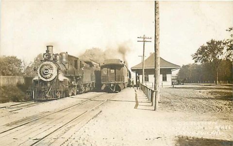 1907–1915
 1938
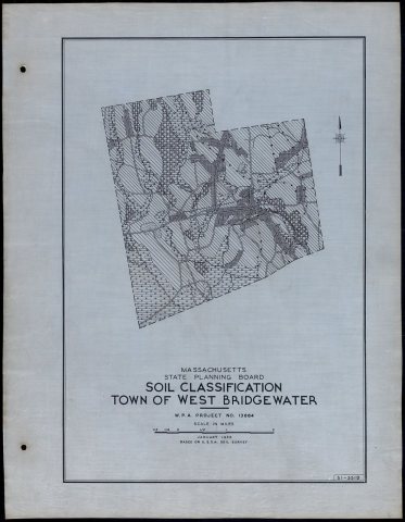 1938
 1938
 2010
 2010
 2008
 2004
