Provincetown dates to 1700, and 41% of its homes were built before 1940
Among the most historic 1% of U.S. towns · #2 of 283 in Massachusetts. What drives it
10 places in town are on the National Register, among them two historic districts with 1,145 buildings between them. Below: 6 old photos and papers, maps from 1887 on, and the census since 1790.
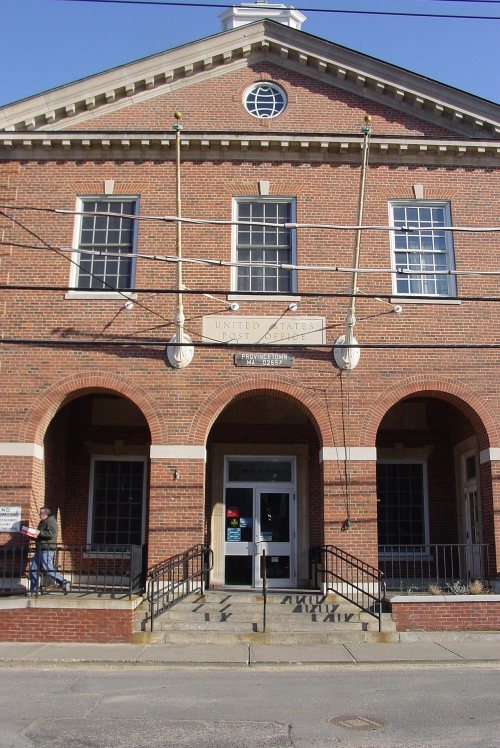
Founding year: Wikidata. First post office: 1800.The full story ↓
History grade
What drives Provincetown’s History grade
On its age, its old homes and the National Register, Provincetown is among the most historic 1% of U.S. towns, #2 of 283 in Massachusetts. All 3 inputs put Provincetown near the top nationally; its National Register listings ranks highest.
A+
HistoryA character grade: shown, never part of Provincetown’s overall grade.
Massachusetts towns list more on the Register than most of the country (a typical Massachusetts town has 46.0 per 10,000 residents, the U.S. 2.4), so Provincetown’s 3,114 sits above most of its state (100% of Massachusetts towns have fewer) while its 1,153 historic buildings outnumber those of 99% of U.S. towns.
NoteThe founding year comes from Wikidata alone; no second source gives 1700.
How sure. Graded on any two of the three inputs instead, the letter would still be A+. The pre-1940 share is a Census survey estimate (±6.2 points).
Founding year: Wikidata (other dates in Quick answers). Homes: Census ACS 2020–24. National Register: National Park Service, May 2026 list; each listing counted once (boundary changes and added documentation belong to their listing), and a historic district counts its contributing buildings. How TownRatings grades history →
What stands out about Provincetown’s past
Read from the archive, the National Register and the record. The page puts what stands out first.
At the time of European encounter, the area was long settled by the historic Nauset tribe, who had a settlement known as "Meeshawn". They spoke Massachusett, a Southern New England Algonquian language dialect that they shared in common with their closely related neighbors, the Wampanoag.
On May 15, 1602, having made landfall from the west and believing it to be an island, Bartholomew Gosnold initially named this area "Shoal Hope". Later that day, after catching a "great store of codfish", he chose instead to name this outermost tip of land "Cape Cod". Notably, that name referred specifically to the area of modern-day Provincetown; not until much later was that that name reused to designate the entire region now known as Cape Cod.
Passages that mention Provincetown, cut from the printed page as they were published.
History of Barnstable County, Massachusetts, 1620-1637-1686-18901890 · page 981Read the page →
Read the text
The first step toward the institution of a free public library in Provincetown was a vote passed at the last meeting of Mayflower Division of the Sons of Temperance of Provincetown in 1863, directing the treasurer of that organization to deposit in the Seaman's Savings Bank the funds in the treasury, amounting to nearly three hundred dollars, to be expended in the purchase of books for any free public librarj' that might thereafter be established in Provincetown.
Text read by machine from the scan; it may contain errors.
History of Barnstable County, Massachusetts, 1620-1637-1686-18901890 · page 127Read the page →
Read the text
The consolidation of the Cape Cod branch and the Cape Cod Central roads, in 1868, before the final extension to Provincetown, under the name of the Cape Cod Railroad Company, was followed, in 1872, by the union of the latter company with the Old Colony railroad — the entire line, from Middleboro to Provincetown being known as the Cape Cod division. The Woods Holl branch, seventeen miles in length, between Buzzards bay and Woods Holl, was opened to travel July 18, 1872. A branch line of seven miles, from Harwich to Chat-
Text read by machine from the scan; it may contain errors.
ing in the county.3 Mr. Samuel Soper died Dec. 8.4 1 The attention of the towns on the Cape having for several years been directed to a thorough work of improvement of roads, the whole distance from the depot of the Cape Cod Railroad in Yarmouth to Provincetown is becoming a hardened and graded highway, — a luxury, compared with former times, to those who pass over it. Nor is it too much to expect that, at no distant day, the magnetic telegraph, now extending to this place and communicating with distant cities, will be found standing by the side of the
Text read by machine from the scan; it may contain errors.
Scans and text from the Internet Archive. Books published in 1930 or earlier, which are in the public domain.
By decade
Provincetown, decade by decade
4 decades in the archive, from the 1830s to the 1890s. Scroll each row; tap a photo for its story.
Nothing in the archives for these yearsWeddings on Main Street, storms, parades, school pictures, the old store. If it’s in your family album, it belongs here.
Fire insurance maps drew every building, what it was made of and what it was used for, so insurers could price the risk of fire. Pick a year, then a sheet.
In 1700, according to Wikidata. Provincetown’s post office opened in 1800, and the first U.S. census counted 454 people here in 1790.
How does Provincetown rank for history?
Provincetown is among the most historic 1% of U.S. towns, #2 of 283 in Massachusetts. The History grade combines the town’s founding era, the share of homes built before 1940 and its National Register listings. It’s a character grade, so it isn’t part of the overall grade. How it works.
What is on the National Register in Provincetown?
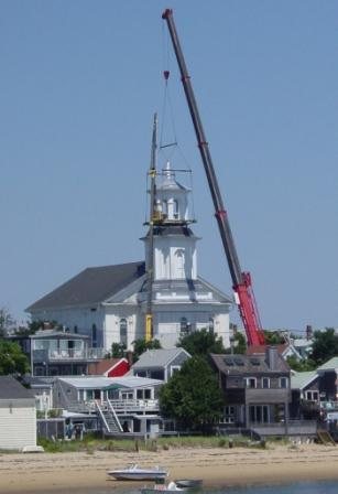
10 listings: 5 buildings, among them the First Universalist Chruch (listed 1972, the first), 2 historic districts, the Provincetown Historic District and the Dune Shacks of Peaked Hill Bars Historic District, with 1,145 contributing buildings, and 3 structures. 1,153 historic buildings in all.
How old are the homes in Provincetown?
41% of Provincetown’s homes were built before 1940 (Census estimate, ±6.2 points), against a typical 21% for a Massachusetts town; the median home was built in 1961.
Founding dates: Wikidata, Wikipedia, the U.S. post office records of Blevins & Helbock (CC0) and the Census. Homes by year built: Census ACS 2020–24. National Register of Historic Places: National Park Service (list of May 22, 2026). Old photos, postcards and papers: Wikimedia Commons, the Library of Congress and other public archives, credited on each item’s page. Maps: U.S. Geological Survey historical topographic maps (via Esri) and Sanborn fire-insurance maps (Library of Congress). History text and census tables: Wikipedia (CC BY-SA 4.0). Places that used to be: USGS Geographic Names Information System (2021).
From Wikimedia Commons (6), Wikidata (6), the National Register of Historic Places (10), Wikipedia, Wikidata and Wikipedia for famous people, U.S. Geological Survey historical maps, U.S. Census counts (via Wikipedia), the US Post Offices dataset (Blevins & Helbock), the USGS Geographic Names Information System, Sanborn fire insurance maps (Library of Congress) and old county and town histories (Internet Archive). Archive images are copied here with their credits and licenses, shown on each photo’s page. Refreshed monthly.






 1877
 c. 1892

