Plainfield was first settled in 1770, primarily by settlers from the town of Bridgewater, and was officially incorporated as a district within the Town of Cummington in 1785, and as a town on June 15, 1807. Plainfield is the youngest town in Hampshire County.
In the 1800s, Plainfield was a thriving agricultural community, primarily producing sheep and leather for tanning. With the widespread adoption of the steamship, and the resultant globalization in the 1870s, the expense of importing both mutton and leather from Australia and New Zealand was greatly reduced. Consequently, the agricultural industries in Plainfield became less profitable, and the population declined substantially over the following decades.
Passages that mention Plainfield, cut from the printed page as they were published.
History of the town of Goshen, Hampshire County, Massachusetts, from its first settlement in 1761 to 18811881Read the page →
Read the text
The first teacher in it was James Richards of Plainfield. Another school house w;ts built near the meeting house, and a third near the house of Ebenezer Putney.
Text read by machine from the scan; it may contain errors.
Scans and text from the Internet Archive. Books published in 1930 or earlier, which are in the public domain.
Timeline
Plainfield, 1770 to 1969
Woven from the archive, old maps, post office records, the National Register and the people born here.
Nothing in the archives for these yearsWeddings on Main Street, storms, parades, school pictures, the old store. If it’s in your family album, it belongs here.
Nothing in the archives for these yearsWeddings on Main Street, storms, parades, school pictures, the old store. If it’s in your family album, it belongs here.
In 1770, according to Wikidata and Wikipedia’s history of the town. Plainfield’s post office opened in 1816, and the first U.S. census counted 458 people here in 1790.
Founding dates: Wikidata, Wikipedia, the U.S. post office records of Blevins & Helbock (CC0) and the Census. Homes by year built: Census ACS 2020–24. National Register of Historic Places: National Park Service (list of May 22, 2026). Old photos, postcards and papers: Wikimedia Commons, the Library of Congress and other public archives, credited on each item’s page. Maps: U.S. Geological Survey historical topographic maps (via Esri) and Sanborn fire-insurance maps (Library of Congress). History text and census tables: Wikipedia (CC BY-SA 4.0). Places that used to be: USGS Geographic Names Information System (2021). How TownRatings grades history →
From Wikimedia Commons (10), Wikipedia, U.S. Geological Survey historical maps, U.S. Census counts (via Wikipedia), the US Post Offices dataset (Blevins & Helbock), the USGS Geographic Names Information System and old county and town histories (Internet Archive). Archive images are copied here with their credits and licenses, shown on each photo’s page. Refreshed monthly.


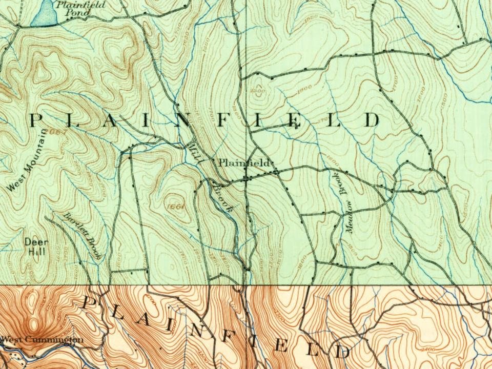

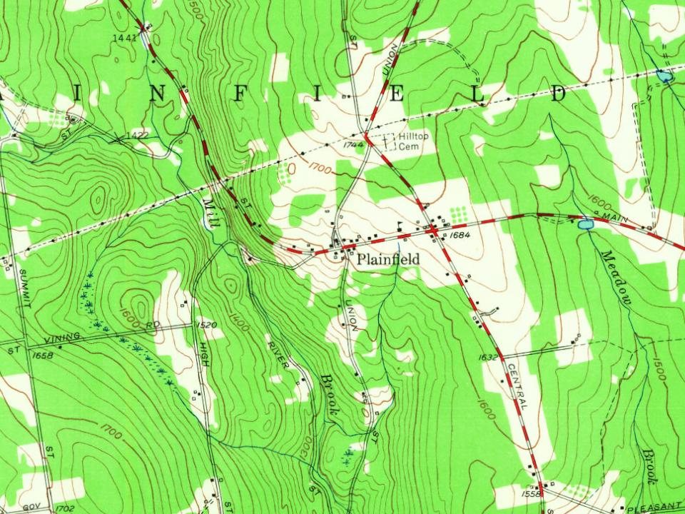
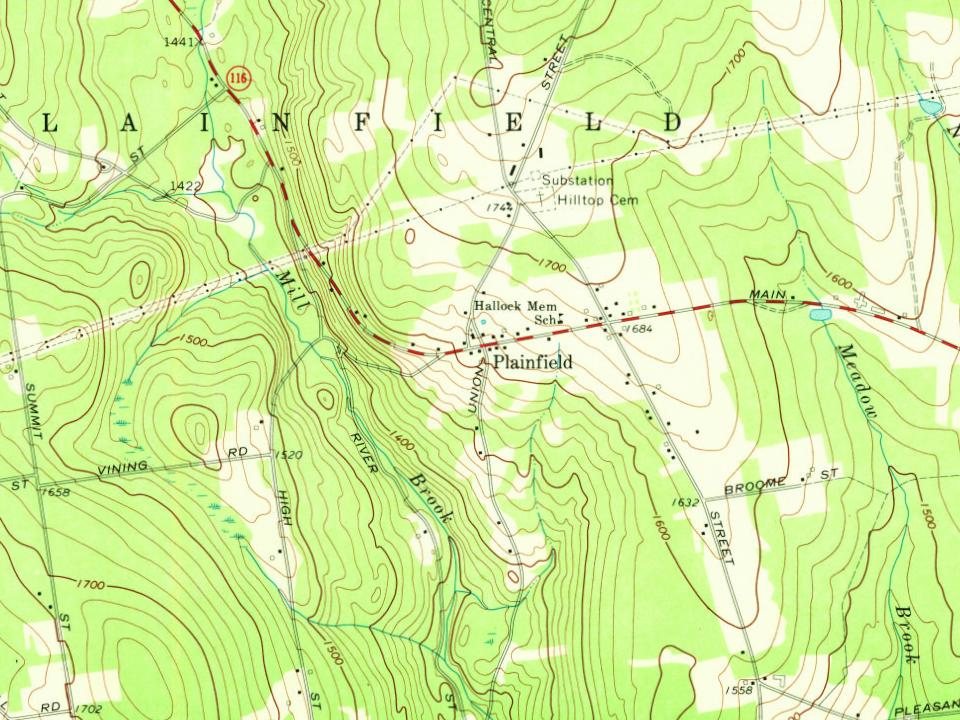
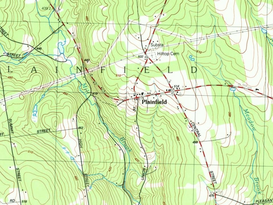


 1891
 1891
 1891
 1891
 1891
 1891
 1939
 1939
