Cummington dates to 1762, and 50% of its homes were built before 1940
1 place in town is on the National Register, among them the William Cullen Bryant Homestead, a National Historic Landmark. Below: 4 old photos and papers, maps from 1886 on, and the census since 1790.
How Cummington began, and where its name came from
When was Cummington founded?
1762
Cummington dates its founding to 1762 (Wikidata and Wikipedia’s history agree). It appears in the first U.S. census, 1790.
First census: 873 in 17902020 census: 829264 years
How did Cummington get its name?
Cummington was named after Colonel John Cumings, the original landholder.
Founding year: Wikidata; Wikipedia’s history section gives the same year. First post office: 1817. Name: Wikipedia, licensed CC BY-SA 4.0.The full story ↓
What stands out about Cummington’s past
Read from the archive, the National Register and the record. The page puts what stands out first.
Cummington was first settled in 1762 and officially incorporated in 1779. It was named after Colonel John Cumings, the original landholder.
The first Congregational Church minister was Reverend James Briggs of Norton, Massachusetts, a graduate of Yale College around 1775. Briggs was the son of Deacon James and Damaris (White) Briggs, and the husband of Anna Wiswall.
Several Revolutionary War patriots are buried in Cummington, including Nathaniel Holbrook, Seth Wilder Sr., and Seth Wilder Jr.
Passages that mention Cummington, cut from the printed page as they were published.
History of the town of Goshen, Hampshire County, Massachusetts, from its first settlement in 1761 to 18811881 · page 88Read the page →
Read the text
Ezekiel Corbin had a grist mill on Swift Rivera little below Shaw's, bridge near Cummington line, as early as 1796. James Patrick had a saw niid grist mill two miles or so above, on Swift River, near Ashfield line, built about 1788. Daniel Williams, many years later built a new mill and and stone dam a few rods above the old mill, which has since been owned by Samuel Ranney and others, and later, for many years, by J. D. Shipman, who sold in 1S80 to Ansel Cole.
Text read by machine from the scan; it may contain errors.
History of the town of Goshen, Hampshire County, Massachusetts, from its first settlement in 1761 to 18811881 · page 93Read the page →
Read the text
der given: Edmund Lazell and Stephen French, Sen., of Cummington; Trowbridge Ward, of Worthington, afterward Colonel; Eli Bryant, Consider Ewell, Kingsley, of Chesterfield; Joseph Warner, of Cummington, Luther Stone of Goshen, afterward Colonel; Chester Mitchell of Cummington; Lewis Gibbs of Chesterfield; Horace Packard of Goshen; Oren Stone of Worthington; Joseph Hawks of Goshen, Major; Hudson Bates of Chesterfield.
Text read by machine from the scan; it may contain errors.
Scans and text from the Internet Archive. Books published in 1930 or earlier, which are in the public domain.
Timeline
Cummington, 1762 to 1974
Woven from the archive, old maps, post office records, the National Register and the people born here.
Nothing in the archives for these yearsWeddings on Main Street, storms, parades, school pictures, the old store. If it’s in your family album, it belongs here.
Nothing in the archives for these yearsWeddings on Main Street, storms, parades, school pictures, the old store. If it’s in your family album, it belongs here.
In 1762, according to Wikidata and Wikipedia’s history of the town. Cummington’s post office opened in 1817, and the first U.S. census counted 873 people here in 1790.
What is on the National Register in Cummington?
One place: the William Cullen Bryant Homestead (listed 1966).
Founding dates: Wikidata, Wikipedia, the U.S. post office records of Blevins & Helbock (CC0) and the Census. Homes by year built: Census ACS 2020–24. National Register of Historic Places: National Park Service (list of May 22, 2026). Old photos, postcards and papers: Wikimedia Commons, the Library of Congress and other public archives, credited on each item’s page. Maps: U.S. Geological Survey historical topographic maps (via Esri) and Sanborn fire-insurance maps (Library of Congress). History text and census tables: Wikipedia (CC BY-SA 4.0). Places that used to be: USGS Geographic Names Information System (2021). How TownRatings grades history →
From Wikimedia Commons (12), the National Register of Historic Places (1), Wikipedia, Wikidata and Wikipedia for famous people, U.S. Geological Survey historical maps, U.S. Census counts (via Wikipedia), the US Post Offices dataset (Blevins & Helbock), the USGS Geographic Names Information System and old county and town histories (Internet Archive). Archive images are copied here with their credits and licenses, shown on each photo’s page. Refreshed monthly.

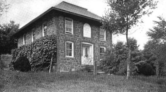


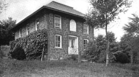 1899
 1939
 2012
 2012
 2009
 2009
 2009
 2009
 2009
 2009
 ★ Landmark

