North Adams dates to 1745, and 59% of its homes were built before 1940
Among the most historic 1% of U.S. towns · #5 of 283 in Massachusetts. What drives it
25 places in town are on the National Register, among them seven historic districts with 382 buildings between them. Below: 4 old photos and papers, maps from 1884 on, and the census since 1880.
Founding year: Wikidata; Wikipedia’s history section gives the same year. First post office: 1813.The full story ↓
History grade
What drives North Adams’ History grade
On its age, its old homes and the National Register, North Adams is among the most historic 1% of U.S. towns, #5 of 283 in Massachusetts. All 3 inputs put North Adams near the top nationally; its share of homes from before 1940 ranks highest.
A+
HistoryA character grade: shown, never part of North Adams’ overall grade.
Massachusetts towns list more on the Register than most of the country (a typical Massachusetts town has 46.0 per 10,000 residents, the U.S. 2.4), so North Adams’ 348 sits above most of its state (87% of Massachusetts towns have fewer) while its 439 historic buildings outnumber those of 97% of U.S. towns.
How sure. Graded on any two of the three inputs instead, the letter would still be A+. The pre-1940 share is a Census survey estimate (±4.3 points). Two sources give 1745.
Founding year: Wikidata (other dates in Quick answers). Homes: Census ACS 2020–24. National Register: National Park Service, May 2026 list; each listing counted once (boundary changes and added documentation belong to their listing), and a historic district counts its contributing buildings. How TownRatings grades history →
What stands out about North Adams’ past
Read from the archive, the National Register and the record. The page puts what stands out first.
North Adams was first settled in 1745 during King George's War, when the most western of a line of defensive forts was built along the bank of the Hoosic River, and occupied by Massachusetts militiamen and their families. During the war, Canadian and Native American forces laid siege to Fort Massachusetts and 30 prisoners were taken to Quebec; half died in captivity. In 1747 Fort Massachusetts was rebuilt with improved defenses, but was never attacked again. In a period of peace following the Treaty of Aix-la-Chapelle, many of the soldiers who had been garrisoned at the fort turned to farming instead by opting to each take a 190-acre package of nearby land in lieu of back-pay in the nearby township of West Hoosac (now known as Williamstown).
North Adams has changed since the great romancer walked its streets, climbed its mountains and exchanged cordial greetings with its pioneers. Its grand scenery is the same, but the struggling little town of 1838 stretches out now beyond the level of the valleys upon the hill-sides; the mountains no longer even appear as a barrier to those who wish to come and go, and its various interests are so com-
Text read by machine from the scan; it may contain errors.
divided by legislative enactment, the south village retaining the original name of Adams; the north village being incorporated under the name by which it was always known, North Adams. The growth of these towns during the past ten years has been remarkable. According to the census of 1890 their population is, North Adams, 16,067; Adams, 9,217.
Text read by machine from the scan; it may contain errors.
Scans and text from the Internet Archive. Books published in 1930 or earlier, which are in the public domain.
Timeline
North Adams, 1745 to 1959
Woven from the archive, old maps, post office records, the National Register and the people born here.
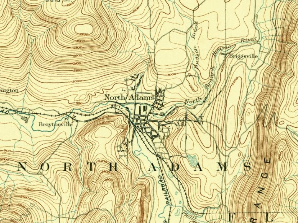
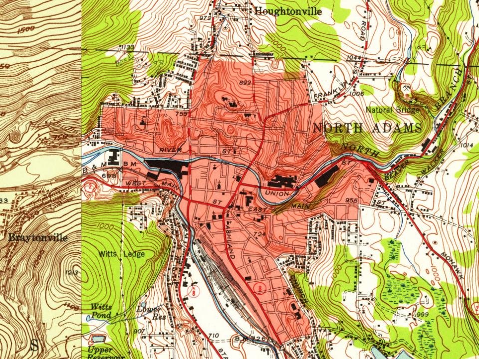
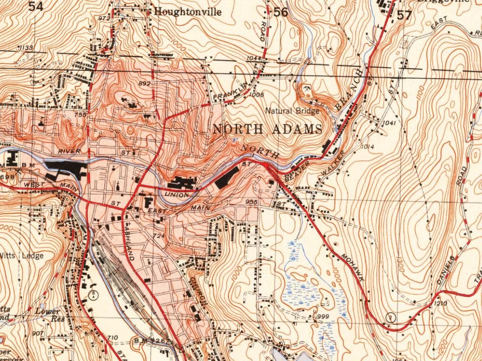
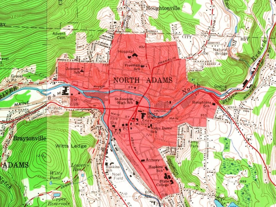
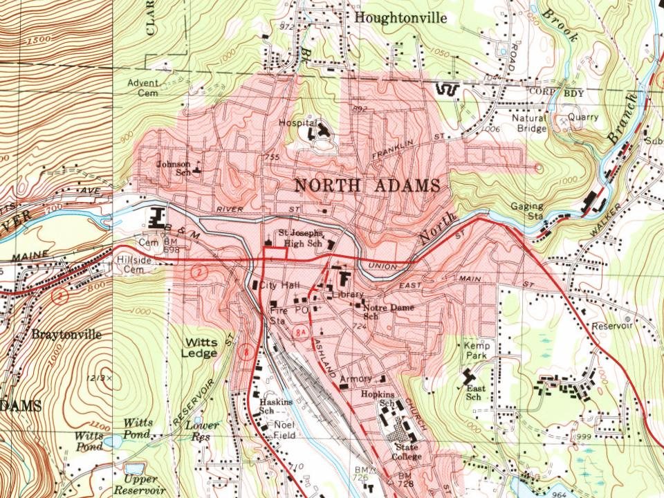
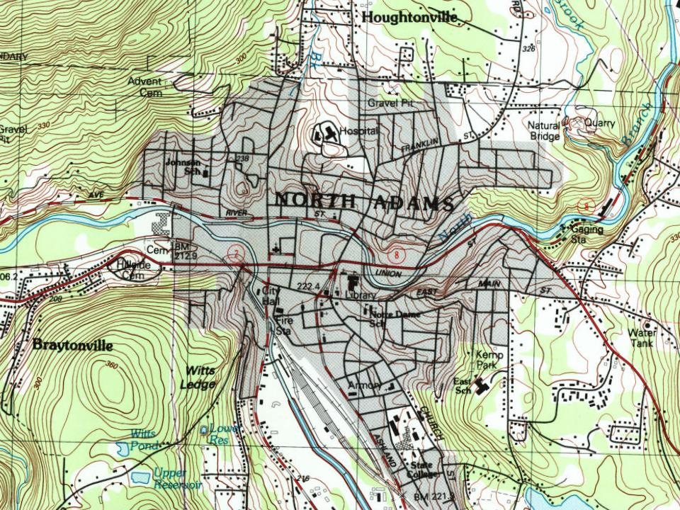
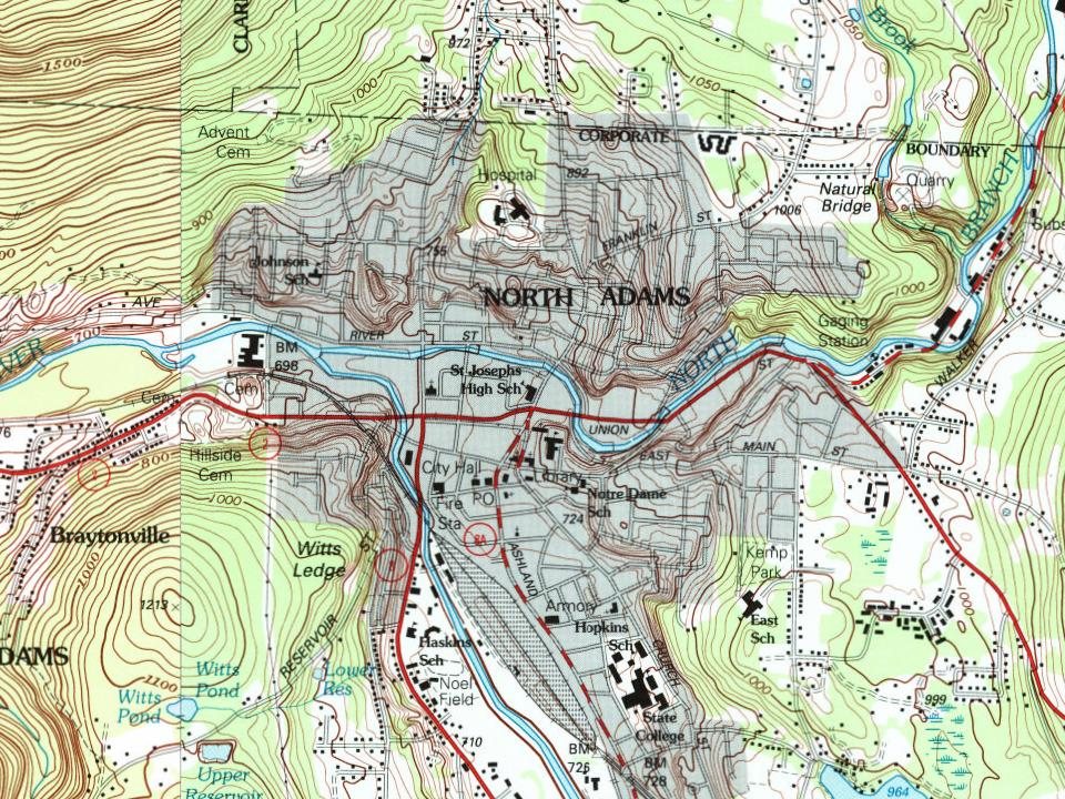
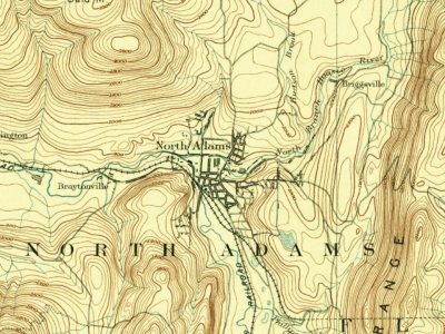
Every edition of the U.S. Geological Survey’s map of North Adams. Tap a year, or press play to watch the town change.
1886Greylock sheet · 1:62,500
U.S. Geological Survey historical topographic maps (public domain), via Esri’s collection of the scans. The red ring marks the center of North Adams.
Every building
North Adams, building by building, 1884–1914
Fire insurance maps drew every building, what it was made of and what it was used for, so insurers could price the risk of fire. Pick a year, then a sheet.
In 1745, according to Wikidata and Wikipedia’s history of the town. North Adams’ post office opened in 1813, and the census of 1880 counted 10,191 people here.
How does North Adams rank for history?
North Adams is among the most historic 1% of U.S. towns, #5 of 283 in Massachusetts. The History grade combines the town’s founding era, the share of homes built before 1940 and its National Register listings. It’s a character grade, so it isn’t part of the overall grade. How it works.
What is on the National Register in North Adams?
25 listings: 17 buildings, 7 historic districts with 382 contributing buildings, and 1 site. 439 historic buildings in all.
How old are the homes in North Adams?
59% of North Adams’ homes were built before 1940 (Census estimate, ±4.3 points), against a typical 21% for a Massachusetts town; the median home was built in 1938.
Founding dates: Wikidata, Wikipedia, the U.S. post office records of Blevins & Helbock (CC0) and the Census. Homes by year built: Census ACS 2020–24. National Register of Historic Places: National Park Service (list of May 22, 2026). Old photos, postcards and papers: Wikimedia Commons, the Library of Congress and other public archives, credited on each item’s page. Maps: U.S. Geological Survey historical topographic maps (via Esri) and Sanborn fire-insurance maps (Library of Congress). History text and census tables: Wikipedia (CC BY-SA 4.0). Places that used to be: USGS Geographic Names Information System (2021).
From Wikimedia Commons (3), the Library of Congress (1), Wikidata (3), the National Register of Historic Places (25), Wikipedia, Wikidata and Wikipedia for famous people, U.S. Geological Survey historical maps, U.S. Census counts (via Wikipedia), the US Post Offices dataset (Blevins & Helbock), the USGS Geographic Names Information System, Sanborn fire insurance maps (Library of Congress) and old county and town histories (Internet Archive). Archive images are copied here with their credits and licenses, shown on each photo’s page. Refreshed monthly.


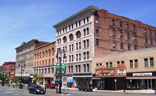




 1870
 1870