Monson’s post office opened in 1814, and 26% of its homes were built before 1940
More historic than 88% of U.S. towns · #163 of 283 in Massachusetts. What drives it
5 places in town are on the National Register, among them two historic districts with 50 buildings between them. Below: 2 old photos and papers, maps from 1887 on, and the census since 1790.
Founding year: the first Monson post office (Blevins & Helbock, CC0).The full story ↓
History grade
What drives Monson’s History grade
On its age, its old homes and the National Register, Monson is more historic than 88% of U.S. towns, #163 of 283 in Massachusetts. All 3 inputs are above most U.S. towns; its share of homes from before 1940 ranks highest and its National Register listings lowest.
A
HistoryA character grade: shown, never part of Monson’s overall grade.
Massachusetts towns list more on the Register than most of the country (a typical Massachusetts town has 46.0 per 10,000 residents, the U.S. 2.4), so Monson’s 65.1 sits near the middle of its state (56% of Massachusetts towns have fewer) while its 53 historic buildings outnumber those of 85% of U.S. towns.
How sure. Graded on any two of the three inputs instead, the letter would still be A−. The pre-1940 share is a Census survey estimate (±5.8 points). The founding year is the first post office, not a stated founding date.
Founding year: the first post office (other dates in Quick answers). Homes: Census ACS 2020–24. National Register: National Park Service, May 2026 list; each listing counted once (boundary changes and added documentation belong to their listing), and a historic district counts its contributing buildings. How TownRatings grades history →
What stands out about Monson’s past
Read from the archive, the National Register and the record. The page puts what stands out first.
Every edition of the U.S. Geological Survey’s map of Monson. Tap a year, or press play to watch the town change.
1887Palmer sheet · 1:62,500
U.S. Geological Survey historical topographic maps (public domain), via Esri’s collection of the scans. The red ring marks the center of Monson.
Every building
Monson, building by building, 1887–1918
Fire insurance maps drew every building, what it was made of and what it was used for, so insurers could price the risk of fire. Pick a year, then a sheet.
The first colonist to settle in present-day Monson was Ian Farry, who in 1657 was granted 200 acres (81 ha) of land by the Massachusetts General Court. He built a tavern along the Bay Path, which was the primary route from Springfield to Boston, and which ran through the northern part of Monson. It was the first house built between Springfield and Brookfield, but the tavern was short-lived; within a year or two, Fellows abandoned it for fear of attacks from local Native Americans.
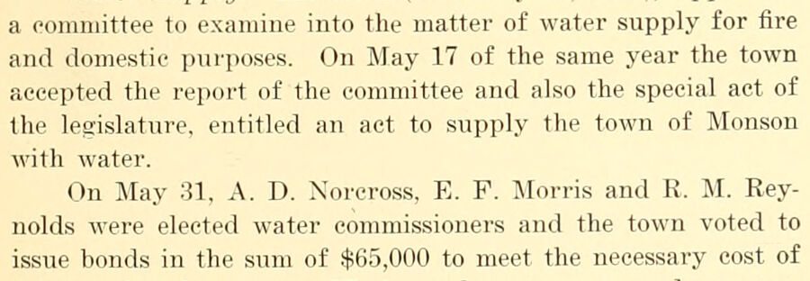
a committee to examine into the matter of water supply for fire and domestic purposes. On May 17 of the same year the town accepted the report of the committee and also the special act of the legislature, entitled an act to supply the town of Monson with water. On May 31, A. D. Norcross, E. F. IMorris and R. M. Reynolds were elected water commissioners and the town voted to issue bonds in the sum of $65,000 to meet the necessary cost of
Text read by machine from the scan; it may contain errors.
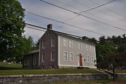
'J'ower hill in that town. Briniiield became a town by act of tlie general court Decejnber 24, 1731, and of the 84 proprietors to whom allotments were made, 10 were located within the limits of the present town of Monson. The names of the original settlers and the location of their grants, as far as know'n, were as follows : Robert Olds, the present C. M. Foley farm; David Killam, the site of the Massachusetts Epileptic hospital; Benjamin Munn, House built by William Norcross about 1775
Text read by machine from the scan; it may contain errors.
followed by the settled pastorate of Kev. Chester Bridgman, whose service extended from May 18, 1864, to July j 24, 1866. Rev. Chester Lemuel Cushman, a native of Monson and a graduate of Amherst, class of 1856, from East Townshend, Vt., was settled November 2, 1866, and continued his ministry until his dismissal, September 1, 1874, having received seventy persons into the church on profession of faith, and attended a hundred funerals. An
Text read by machine from the scan; it may contain errors.
An address, delivered in the new court house, in Springfield, Hampden County, Massachusetts, at the dedication of the same, April 28, 18741874 · page 72Read the page →
Read the text
There were then, in that town, a large number of law-offices, a number much too large for the necessities of the town and its vicinity, and he was much disappointed with his success. In 1827 he removed to the quiet town of Monson, and, finding the demand for his services there too limited, he removed, in 1829, to the more thriving town of Ware. He was at once regarded in the light of an intruder ; and a feeling of professional rivalry rijDened into controversy. He was not a person to come off second
Text read by machine from the scan; it may contain errors.
Scans and text from the Internet Archive. Books published in 1930 or earlier, which are in the public domain.
Timeline
Monson, 1812 to 1930
Woven from the archive, old maps, post office records, the National Register and the people born here.
Nothing in the archives for these yearsWeddings on Main Street, storms, parades, school pictures, the old store. If it’s in your family album, it belongs here.
The Monson post office opened in 1814, the earliest record of the town by name (U.S. post office records).
How does Monson rank for history?
Monson is more historic than 88% of U.S. towns, #163 of 283 in Massachusetts. The History grade combines the town’s founding era, the share of homes built before 1940 and its National Register listings. It’s a character grade, so it isn’t part of the overall grade. How it works.
What is on the National Register in Monson?
5 listings: 3 buildings, among them the William Norcross House (listed 1984, the first), and 2 historic districts, the Monson Center Historic District and the Monson Developmental Center, with 50 contributing buildings. 53 historic buildings in all.
How old are the homes in Monson?
26% of Monson’s homes were built before 1940 (Census estimate, ±5.8 points), against a typical 21% for a Massachusetts town; the median home was built in 1970.
Founding dates: Wikidata, Wikipedia, the U.S. post office records of Blevins & Helbock (CC0) and the Census. Homes by year built: Census ACS 2020–24. National Register of Historic Places: National Park Service (list of May 22, 2026). Old photos, postcards and papers: Wikimedia Commons, the Library of Congress and other public archives, credited on each item’s page. Maps: U.S. Geological Survey historical topographic maps (via Esri) and Sanborn fire-insurance maps (Library of Congress). History text and census tables: Wikipedia (CC BY-SA 4.0). Places that used to be: USGS Geographic Names Information System (2021).
From Wikimedia Commons (15), Wikidata (2), the National Register of Historic Places (5), Wikipedia, Wikidata and Wikipedia for famous people, U.S. Geological Survey historical maps, U.S. Census counts (via Wikipedia), the US Post Offices dataset (Blevins & Helbock), the USGS Geographic Names Information System, Sanborn fire insurance maps (Library of Congress) and old county and town histories (Internet Archive). Archive images are copied here with their credits and licenses, shown on each photo’s page. Refreshed monthly.







 2024
 2024
 2021
 2021
 2021
 2021
 2015
 2012
 2012
 2012
 2011
 2011
 2007


