Hingham dates to 1633, and 20% of its homes were built before 1940
More historic than 96% of U.S. towns · #66 of 283 in Massachusetts. What drives it
6 places in town are on the National Register, among them 2 National Historic Landmarks and two historic districts with 713 buildings between them. Below: 5 old photos and papers, maps from 1888 on, and the census since 1790.
Founding year: Wikidata. First post office: 1795.The full story ↓
History grade
What drives Hingham’s History grade
On its age, its old homes and the National Register, Hingham is more historic than 96% of U.S. towns, #66 of 283 in Massachusetts. All 3 inputs are above most U.S. towns; its age ranks highest and its share of homes from before 1940 lowest.
A+
HistoryA character grade: shown, never part of Hingham’s overall grade.
Massachusetts towns list more on the Register than most of the country (a typical Massachusetts town has 46.0 per 10,000 residents, the U.S. 2.4), so Hingham’s 297 sits above most of its state (84% of Massachusetts towns have fewer) while its 720 historic buildings outnumber those of 98% of U.S. towns.
NoteThe founding year comes from Wikidata alone; no second source gives 1633.
How sure. Graded on any two of the three inputs instead, the letter would range from A to A+. The pre-1940 share (±2.6 points) is firm at this size.
Founding year: Wikidata (other dates in Quick answers). Homes: Census ACS 2020–24. National Register: National Park Service, May 2026 list; each listing counted once (boundary changes and added documentation belong to their listing), and a historic district counts its contributing buildings. How TownRatings grades history →
What stands out about Hingham’s past
Read from the archive, the National Register and the record. The page puts what stands out first.
Hingham Center Post Officepost officeHingham StationlocaleNantasket Post Officepost officeNorth Cohasset StationlocaleSouth Hingham Post Officepost officeWest Hingham Post Officepost officeWest Hingham Stationlocale
3cemeteries and burying grounds inside Hingham
Fort HillHigh StreetSaint Pauls
US Post Offices dataset (Blevins & Helbock, CC0). Places and cemeteries from the USGS Geographic Names Information System (2021).
The town of Hingham was dubbed "Bare Cove" by the first colonizing English in 1633, but two years later was incorporated as a town under the name "Hingham." The land on which Hingham was settled was deeded to the English by the Wampanoag sachem Wompatuck in 1655. The town was within Suffolk County from its founding in 1643 until 1803, and Plymouth County from 1803 to the present. The eastern part of the town split off to become Cohasset in 1770. The town was named for Hingham, a market town in the English county of Norfolk, whence most of the first colonists came, including Abraham Lincoln's ancestor Samuel Lincoln (1622–1690), his first American ancestor, who came to Massachusetts in 1637. A statue of President Lincoln adorns the area adjacent to downtown Hingham Square.
Passages that mention Hingham, cut from the printed page as they were published.
History of the town of Hingham, Massachusetts1893 · page 155Read the page →
Read the text
Mills were undoubtedly erected at Strait's Pond soon after 1679, when on the 17th of May of that year permission was " granted to certain petitioners, inhabitants of Hull, and others of Hingham, as may see fit to join them, to erect a Dam and Mill at the Straits Pond." From 1700 to 1725 there were many transfers of ownership among the dishing families in Hingham of " the Grist Mill and Saw Mill, with the upland, meadow, and housing thereunto belonging, lying partly in Hingham and partly in Hull." These
Text read by machine from the scan; it may contain errors.
History of the town of Hingham, Massachusetts1893 · page 155Read the page →
Read the text
Mills were undoubtedly erected at Strait's Pond soon after 1679, when on the 17th of May of that year permission was " granted to certain petitioners, inhabitants of Hull, and others of Hingham, as may see fit to join them, to erect a Dam and Mill at the Straits Pond." From 1700 to 1725 there were many transfers of ownership among the dishing families in Hingham of " the Grist Mill and Saw Mill, with the upland, meadow, and housing thereunto belonging, lying partly in Hingham and partly in Hull." These
Text read by machine from the scan; it may contain errors.
History of the town of Hingham, Massachusetts1893 · page 282Read the page →
Read the text
of Boston, in the county of Suffolk and State of Massachusetts, stationer, sends greeting : Whereas a certain lot of land, hereinafter described, in the town of Hingham, in the county of Plymouth and State of Massachusetts, was heretofore purchased for the sum of five hundred dollars by certain ladies of the said town of Hingham, and the foundation for a hall was built thereupon by them ; and whereas the said lot of land, with the said foundation, was conveyed to me by Thomas Loring, of said Hingham, by deed dated
Text read by machine from the scan; it may contain errors.
History of the town of Hingham, Massachusetts1893 · page 282Read the page →
Read the text
of Boston, in the county of Suffolk and State of Massachusetts, stationer, sends greeting : Whereas a certain lot of land, hereinafter described, in the town of Hingham, in the county of Plymouth and State of Massachusetts, was heretofore purchased for the sum of five hundred dollars by certain ladies of the said town of Hingham, and the foundation for a hall was built thereupon by them ; and whereas the said lot of land, with the said foundation, was conveyed to me by Thomas Loring, of said Hingham, by deed dated
Text read by machine from the scan; it may contain errors.
Scans and text from the Internet Archive. Books published in 1930 or earlier, which are in the public domain.
By decade
Hingham, decade by decade
4 decades in the archive, from the 1840s to the 1880s. Scroll each row; tap a photo for its story.
Nothing in the archives for these yearsWeddings on Main Street, storms, parades, school pictures, the old store. If it’s in your family album, it belongs here.
Every edition of the U.S. Geological Survey’s map of Hingham. Tap a year, or press play to watch the town change.
1888Abington sheet · 1:62,500
U.S. Geological Survey historical topographic maps (public domain), via Esri’s collection of the scans. The red ring marks the center of Hingham.
Every building
Hingham, building by building, 1893–1921
Fire insurance maps drew every building, what it was made of and what it was used for, so insurers could price the risk of fire. Pick a year, then a sheet.
In 1633, according to Wikidata. Hingham’s post office opened in 1795, and the first U.S. census counted 2,085 people here in 1790.
How does Hingham rank for history?
Hingham is more historic than 96% of U.S. towns, #66 of 283 in Massachusetts. The History grade combines the town’s founding era, the share of homes built before 1940 and its National Register listings. It’s a character grade, so it isn’t part of the overall grade. How it works.
What is on the National Register in Hingham?
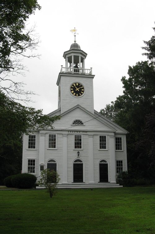
6 listings, 2 of them National Historic Landmarks: 4 buildings, among them the Old Ship Meetinghouse (a National Historic Landmark since 1960), and 2 historic districts, the Lincoln Historic District and the South Hingham Historic District, with 713 contributing buildings. 720 historic buildings in all.
How old are the homes in Hingham?
20% of Hingham’s homes were built before 1940 (Census estimate, ±2.6 points), against a typical 21% for a Massachusetts town; the median home was built in 1976.
Founding dates: Wikidata, Wikipedia, the U.S. post office records of Blevins & Helbock (CC0) and the Census. Homes by year built: Census ACS 2020–24. National Register of Historic Places: National Park Service (list of May 22, 2026). Old photos, postcards and papers: Wikimedia Commons, the Library of Congress and other public archives, credited on each item’s page. Maps: U.S. Geological Survey historical topographic maps (via Esri) and Sanborn fire-insurance maps (Library of Congress). History text and census tables: Wikipedia (CC BY-SA 4.0). Places that used to be: USGS Geographic Names Information System (2021).
From Wikimedia Commons (5), Wikidata (1), the National Register of Historic Places (6), Wikipedia, Wikidata and Wikipedia for famous people, U.S. Geological Survey historical maps, U.S. Census counts (via Wikipedia), the US Post Offices dataset (Blevins & Helbock), the USGS Geographic Names Information System, Sanborn fire insurance maps (Library of Congress) and old county and town histories (Internet Archive). Archive images are copied here with their credits and licenses, shown on each photo’s page. Refreshed monthly.


 ★ Landmark
 ★ Landmark




 1849


