Hatfield dates to 1660, and 34% of its homes were built before 1940
Among the most historic 1% of U.S. towns · #7 of 283 in Massachusetts. What drives it
8 places in town are on the National Register, among them eight historic districts with 758 buildings between them. Below: 12 old photos and papers, maps from 1886 on, and the census since 1790.
Founding year: Wikipedia. First post office: 1806.The full story ↓
History grade
What drives Hatfield’s History grade
On its age, its old homes and the National Register, Hatfield is among the most historic 1% of U.S. towns, #7 of 283 in Massachusetts. All 3 inputs put Hatfield near the top nationally; its National Register listings ranks highest.
A+
HistoryA character grade: shown, never part of Hatfield’s overall grade.
Massachusetts towns list more on the Register than most of the country (a typical Massachusetts town has 46.0 per 10,000 residents, the U.S. 2.4), so Hatfield’s 2,280 sits above most of its state (100% of Massachusetts towns have fewer) while its 758 historic buildings outnumber those of 98% of U.S. towns.
NoteThe founding year comes from Wikipedia alone; no second source gives 1660.
How sure. Graded on any two of the three inputs instead, the letter would still be A+. The pre-1940 share is a Census survey estimate (±10.0 points).
Founding year: Wikipedia (other dates in Quick answers). Homes: Census ACS 2020–24. National Register: National Park Service, May 2026 list; each listing counted once (boundary changes and added documentation belong to their listing), and a historic district counts its contributing buildings. How TownRatings grades history →
What stands out about Hatfield’s past
Read from the archive, the National Register and the record. The page puts what stands out first.
Hatfield was founded in 1660 on land granted to General Daniel Dennison and Governor William Bradford. It was formally incorporated as a town in 1670 and has a board of selectmen and an annual town meeting.
Hubbard says the fort from which the Indians fled in 1675 was within a mile of Hatfield, but it must have been about two miles from the main street in Hatfield. The records do not allude to any fort in Hatfield in 1675, or before, though Umpanchala doubtless had a fort on the high bank of Capawonk or elsewhere on his land, when he sold it in 1660.
Text read by machine from the scan; it may contain errors.
History of Hadley, including the early history of Hatfield, South Hadley, Amherst and Granby, Massachusetts1863Read the page →
Read the text
Hatfield taken, and two men wounded, at Nortbfield.* June 18, 1724, Benjamin Smith, son of Joseph S. of Hatfield, was slain, and Aaron Wells and Joseph Allis taken, when they were loading hay, about 3 miles from Hatfield village. June 27, 1724, Ebenezer Sheldon, Thomas Colton and a friendly Indian were killed, about a mile north of the present village of Greenfield. July 10, 1724, Lt. Timothy Childs and Samuel Allen were wounded in Deerfield meadow. Aug. 26, 1724,
Text read by machine from the scan; it may contain errors.
The town of Hatfield was incorporated on the 31st of May, 1670, and a copy of the acts from the printed records, is annexed. "In answer to the petition of the inhabitants of Hadley on the west side of the riuer, that they may be allowed to be a toune of themselves, distinct from Hadley on the east side, the deputy of Hadlev certifying that that toune haue consented to release them if this Court doe approove thereof, &c. this Court doe therefore allow them on the west side of the riuer, to be a touneship distinct from them on the east side of the riuer, and doe grant them a tract of land westward, sixe miles back into the woods from the great river; their southerly
Text read by machine from the scan; it may contain errors.
History of Hadley, including the early history of Hatfield, South Hadley, Amherst and Granby, Massachusetts1863Read the page →
Read the text
The town of Hatfield was incorporated on the 3 1st of May, 1670, and a copy of the act from the printed records, is annexed.
Text read by machine from the scan; it may contain errors.
Scans and text from the Internet Archive. Books published in 1930 or earlier, which are in the public domain.
By decade
Hatfield, decade by decade
2 decades in the archive, from the 1860s to the 1930s. Scroll each row; tap a photo for its story.
Nothing in the archives for these yearsWeddings on Main Street, storms, parades, school pictures, the old store. If it’s in your family album, it belongs here.
In 1660, according to Wikipedia’s history of the town. Hatfield’s post office opened in 1806, and the first U.S. census counted 703 people here in 1790.
How does Hatfield rank for history?
Hatfield is among the most historic 1% of U.S. towns, #7 of 283 in Massachusetts. The History grade combines the town’s founding era, the share of homes built before 1940 and its National Register listings. It’s a character grade, so it isn’t part of the overall grade. How it works.
What is on the National Register in Hatfield?
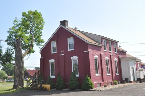
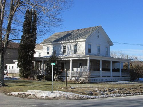
8 listings: 8 historic districts with 758 contributing buildings. 758 historic buildings in all.
How old are the homes in Hatfield?
34% of Hatfield’s homes were built before 1940 (Census estimate, ±10.0 points), against a typical 21% for a Massachusetts town; the median home was built in 1967.
Founding dates: Wikidata, Wikipedia, the U.S. post office records of Blevins & Helbock (CC0) and the Census. Homes by year built: Census ACS 2020–24. National Register of Historic Places: National Park Service (list of May 22, 2026). Old photos, postcards and papers: Wikimedia Commons, the Library of Congress and other public archives, credited on each item’s page. Maps: U.S. Geological Survey historical topographic maps (via Esri) and Sanborn fire-insurance maps (Library of Congress). History text and census tables: Wikipedia (CC BY-SA 4.0). Places that used to be: USGS Geographic Names Information System (2021).
From Wikimedia Commons (2), the Library of Congress (10), the National Register of Historic Places (8), Wikipedia, Wikidata and Wikipedia for famous people, U.S. Geological Survey historical maps, U.S. Census counts (via Wikipedia), the US Post Offices dataset (Blevins & Helbock), the USGS Geographic Names Information System, Sanborn fire insurance maps (Library of Congress) and old county and town histories (Internet Archive). Archive images are copied here with their credits and licenses, shown on each photo’s page. Refreshed monthly.









 1936
 1936
 1936
 1936
 1936
 1936
 1936
 1936
 1936
 1936

