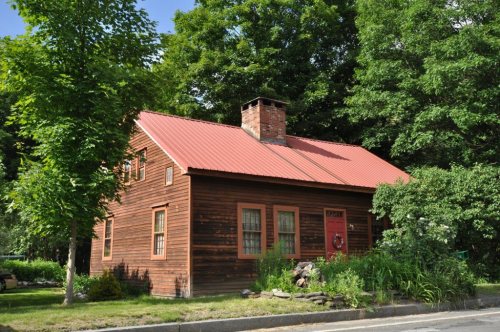
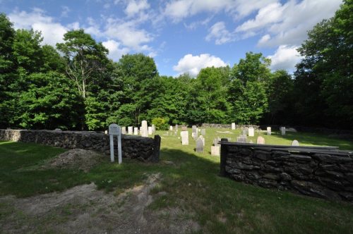
Chesterfield dates to 1760, and 31% of its homes were built before 1940
Among the most historic 1% of U.S. towns. What drives it
5 places in town are on the National Register, among them two historic districts with 100 buildings between them. Below: 1 old photo or paper, maps from 1886 on, and the census since 1790.
Founding year: Wikidata; Wikipedia’s history section gives the same year. First post office: 1815. Name: Wikipedia, licensed CC BY-SA 4.0.The full story ↓
History grade
What drives Chesterfield’s History grade
On its age, its old homes and the National Register, Chesterfield is among the most historic 1% of U.S. towns. All 3 inputs put Chesterfield near the top nationally; its age ranks highest.
A+
HistoryA character grade: shown, never part of Chesterfield’s overall grade.
Massachusetts towns list more on the Register than most of the country (a typical Massachusetts town has 46.0 per 10,000 residents, the U.S. 2.4), so Chesterfield’s 967 sits above most of its state (97% of Massachusetts towns have fewer) while its 102 historic buildings outnumber those of 90% of U.S. towns.
How sure. Graded on any two of the three inputs instead, the letter would still be A+. The pre-1940 share is a Census survey estimate (±8.0 points). Two sources give 1760.
Founding year: Wikidata (other dates in Quick answers). Homes: Census ACS 2020–24. National Register: National Park Service, May 2026 list; each listing counted once (boundary changes and added documentation belong to their listing), and a historic district counts its contributing buildings. How TownRatings grades history →
What stands out about Chesterfield’s past
Read from the archive, the National Register and the record. The page puts what stands out first.
Chesterfield was first settled in 1760 and was officially incorporated in 1762. It was named after the Earl of Chesterfield. The town center, established after the Revolution, has well-preserved Federal period houses along Main Road. In its early days, the town supported a largely agricultural economy, with wool from Merino sheep as a major product. However, there were sawmills and tanneries in operation as well as cloth dressing mills, and in the early 19th century these superseded farming and brought in a small immigrant population that was mostly Irish. Progress wiped out most of the industry in Chesterfield, and by the start of the 20th century a re-emerging agricultural economy developed alongside the growing trade from summer residents.
Passages that mention Chesterfield, cut from the printed page as they were published.
History of Chesterfield, Cheshire county, N.H., from the incorporation of "township number one," by Massachusetts, in 1736, to the year 18811882 · page 83Read the page →
Read the text
Thereupon, a minority of the voters submitted the following protest against the proceedings of the majority : "We, the subscribers, freeholders and other inhabitants of the town of Chesterfield, duly qualified by law to vote in town affairs, being legally assembled in order to choose town-officers, hereby enter our Protest against the proceedings of the majority of the said town of Chesterfield: 1st. With respect to their proceeding to act in town affairs without producing a proper list of voters according to law, though requested.
Text read by machine from the scan; it may contain errors.
History of Chesterfield, Cheshire county, N.H., from the incorporation of "township number one," by Massachusetts, in 1736, to the year 18811882 · page 90Read the page →
Read the text
Voted that half a barrel of gunpowder be delivered out of the powderhouse in Exeter, to the selectmen of Chesterfield, on their order, for the use of said town of Chesterfield, and that the said selectmen of Chesterfield, or some person in their stead, give a receipt therefor, and promise to account with the treasurer of this Colony for the same."
Text read by machine from the scan; it may contain errors.
History of the town of Goshen, Hampshire County, Massachusetts, from its first settlement in 1761 to 18811881 · page 12Read the page →
Read the text
In 1762 Chesterfield was incorporated and the "Quabbin" district was included within its limits. In the following January, on petition of its inhabitants, the Gore was annexed to Chesterfield by the General Court without serving notice or asking consent of the town.
Text read by machine from the scan; it may contain errors.
History of the town of Goshen, Hampshire County, Massachusetts, from its first settlement in 1761 to 18811881 · page 246Read the page →
Read the text
Commonwealth of Massachusetts : In the year of our Lord one thousand seven hundred and eighty-one. An act for Incorporating the Plantation called Chesterfield Gore and the Northwardly part of the Town of Chesterfield, in tlie County of Hampshire, into a Town by the name of Goshan.
Text read by machine from the scan; it may contain errors.
Scans and text from the Internet Archive. Books published in 1930 or earlier, which are in the public domain.
Timeline
Chesterfield, 1760 to 1937
Woven from the archive, old maps, post office records, the National Register and the people born here.
Nothing in the archives for these yearsWeddings on Main Street, storms, parades, school pictures, the old store. If it’s in your family album, it belongs here.
In 1760, according to Wikidata and Wikipedia’s history of the town. Chesterfield’s post office opened in 1815, and the first U.S. census counted 1,183 people here in 1790.
How does Chesterfield rank for history?
Chesterfield is among the most historic 1% of U.S. towns. The History grade combines the town’s founding era, the share of homes built before 1940 and its National Register listings. It’s a character grade, so it isn’t part of the overall grade. How it works.
What is on the National Register in Chesterfield?
5 listings: 1 building, among them the Bisbee Mill (listed 2005, the first), 2 historic districts, the West Chesterfield Historic District and the Chesterfield Center Historic District, with 100 contributing buildings, and 2 sites. 102 historic buildings in all.
How old are the homes in Chesterfield?
31% of Chesterfield’s homes were built before 1940 (Census estimate, ±8.0 points), against a typical 21% for a Massachusetts town; the median home was built in 1976.
Founding dates: Wikidata, Wikipedia, the U.S. post office records of Blevins & Helbock (CC0) and the Census. Homes by year built: Census ACS 2020–24. National Register of Historic Places: National Park Service (list of May 22, 2026). Old photos, postcards and papers: Wikimedia Commons, the Library of Congress and other public archives, credited on each item’s page. Maps: U.S. Geological Survey historical topographic maps (via Esri) and Sanborn fire-insurance maps (Library of Congress). History text and census tables: Wikipedia (CC BY-SA 4.0). Places that used to be: USGS Geographic Names Information System (2021).
From Wikimedia Commons (5), Wikidata (1), the National Register of Historic Places (5), Wikipedia, Wikidata and Wikipedia for famous people, U.S. Geological Survey historical maps, U.S. Census counts (via Wikipedia), the US Post Offices dataset (Blevins & Helbock), the USGS Geographic Names Information System and old county and town histories (Internet Archive). Archive images are copied here with their credits and licenses, shown on each photo’s page. Refreshed monthly.

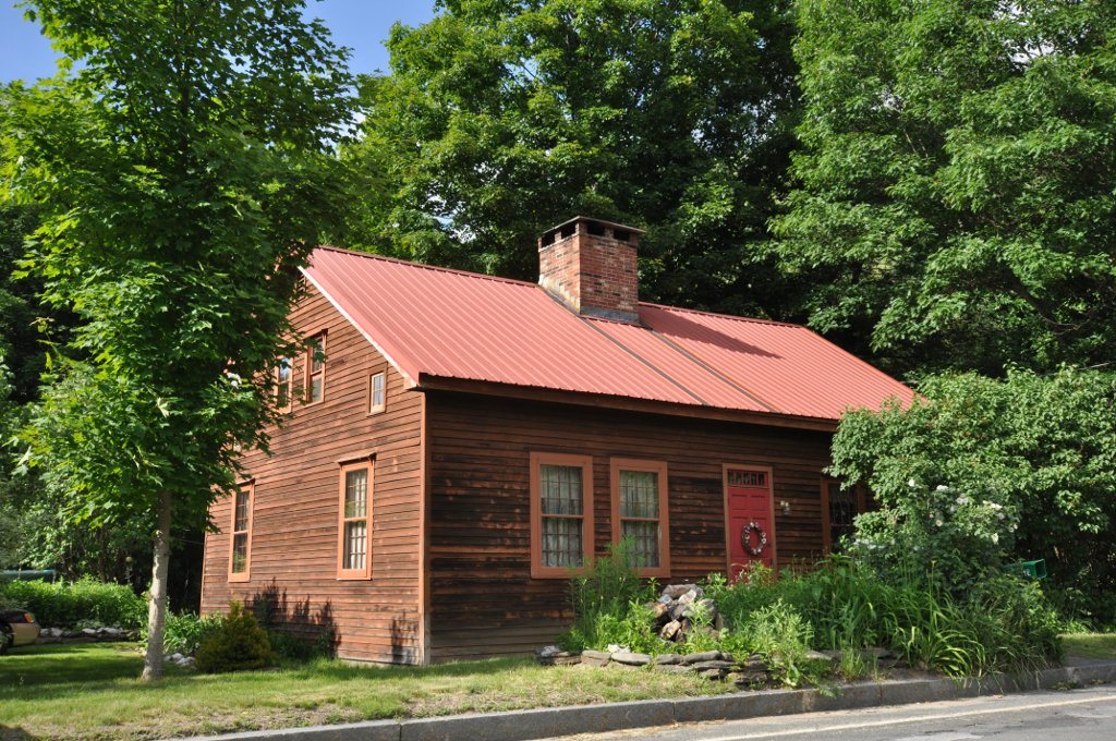


 2009
 2009
 2009
 2008