
NorbertRillieuxSchool, 2009
Waggaman’s story
144 years in pictures
Census counts: 9,004 in 1980, 9,835 in 2020. The archive holds 2 old photos and papers going back to 2004 and 7 maps from 1891 on.
- 1882Waggaman is settled
Each edition grades its towns against each other only.
This town of 11,330 people was settled in 1882.
Waggaman’s overall grade is D, better than 6% of U.S. towns. Its place in the ranking is 144th of 161 in Louisiana. Health is its weak spot (D−): residents are less healthy than 96% of U.S. towns on CDC estimates. It lags on walkability as well (C−). Most errands need a car: it is less walkable than 81% of U.S. towns. Hazard risk is weaker too: FEMA rates its natural-hazard risk higher than 94% of U.S. communities, with hurricanes at the top. A typical home there costs about $170K, 2.7 years of the New Orleans metro’s $63K median household income. Schools are its strong suit: its schools outperform 57% of the state's.
Figures: schools, state test and graduation results · health, CDC PLACES · FEMA National Risk Index · home values, Zillow · incomes, Census ACS, 2020–24.
Where Waggaman’s working residents go each day. Line width shows the share.
Census LEHD 2023
Each subject compared with towns across the country (schools within Louisiana), ordered by how far Waggaman is from typical.
How TownRatings grades towns →
Census counts: 9,004 in 1980, 9,835 in 2020. The archive holds 2 old photos and papers going back to 2004 and 7 maps from 1891 on.
Museums, parks, gardens and other places to visit around Waggaman. Close and well known come first.
 Big draw9 mi Stadium & arenaCaesars Superdome
 Big draw19 mi LakeLake Pontchartrain
 10 mi MuseumNational World War II Museum707K visitors a year
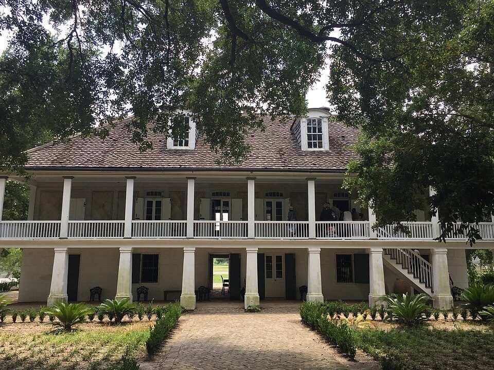 26 mi MuseumWhitney Plantation Historic District
 6 mi Zoo & aquariumAudubon Zoo
 6 mi National Historical ParkJean Lafitte National Historical Park and Preserve227K visitors a year
Caesars Superdome: Infrogmation of New Orleans, CC BY-SA 3.0 · Lake Pontchartrain: Mersh13, CC BY-SA 3.0 · National World War II Museum: Nolabob, CC BY-SA 3.0 · Whitney Plantation Historic District: Bill Leiser, CC BY-SA 4.0 · Audubon Zoo: MeRyan, CC BY 2.0 · Jean Lafitte National Historical Park and Preserve: No machine-readable author provided. Jan Kronsell assumed (based on copyright cl, CC BY-SA 3.0
Waggaman is unincorporated, so Jefferson Parish and regional agencies provide most services.
EPA SDWIS (Oct 9, 2026) · HIFLD + EIA-861 2025 · Census 2020 ZCTAs · NCES 2024–25 · registration: vote.gov, updated Aug 3, 2026.
Ordered by what stands out in Waggaman.
Waggaman has milder winter nights than nearly all U.S. towns and looks healthier within Louisiana than nationally, but it has many renters stretched by housing costs.
Within Louisiana it is less healthy than 61% of the 161 graded towns: much of Louisiana scores lower on these measures.
Waggaman: nearly half of adults have high blood pressure, where Louisiana’s towns sit at 44% and U.S. towns at 35%. Among 161 Louisiana towns, just 6 have a lower share of adults who have been diagnosed with depression than Waggaman. The share of adults in Waggaman who sleep under 7 hours: 47%. CDC measures, 32 in all: Waggaman beats Louisiana on 3 and trails on 14.
| Waggaman | Louisiana towns | U.S. towns | |
|---|---|---|---|
| Diabetes (CDC PLACES) | 20% | 16% | 12% |
| Sleep under 7 hours (CDC PLACES) | 47% | 42% | 36% |
| High blood pressure (CDC PLACES) | 49% | 44% | 35% |
| Feel lonely (CDC PLACES) | 41% | 37% | 33% |
| What stands out | Waggaman | LA |
|---|---|---|
| Fewer adults who have had cancer | 6% | 7.5% |
| Fewer binge drinkers | 14.3% | 16.9% |
| More adults facing a utility shut-off | 18.4% | 12.4% |
CDC PLACES 2025 · modeled estimates for adults · CMS · HRSA
Public schools: the Jefferson Parish school district. Its one school is below. Enrollment at Waggaman’s public school: 466 students.
| School | Level | Students | Letter |
|---|---|---|---|
| Lucille Cherbonnier SchoolLargest public elementary schoolGrades PK–8 | Grades PK–8 | 466 | D |
NCES · EDFacts · graded within LA on state tests and graduation
Since 1978, Waggaman has seen 245 flood insurance claims paid out. 79% of the town’s expected losses from natural hazards come from hurricanes, followed by inland flooding at 9%. Federal aid has come to Waggaman households in 7 declared disasters; the latest was in 2024.
FEMA flood insurance claims · FEMA disaster declarations and aid · FEMA National Risk Index · OpenFEMA
Commuting out is the norm in Waggaman: 3% of working residents work locally. Waggaman: 25% of residents live below the poverty line, above both the Louisiana town median (20%) and the median of U.S. towns (9.6%). For Waggaman, the mean commuting time is 30 minutes. The top destinations are New Orleans (23%), Metairie (11%) and Elmwood (10%).
| Waggaman | Louisiana towns | U.S. towns | |
|---|---|---|---|
| Below the poverty line | 25% | 20% | 9.6% |
| Average trip to work | 30 minutes | 24 minutes | 25 minutes |
| Working residents who work in town | 2.6% | 9.8% | 8% |
| Median household income | $68,000 | $56,000 | $80,000 |
Census LEHD 2023 · ACS
January nights average 44.2°, milder than in 96% of U.S. towns; July afternoons average 91.5°.
The town’s January low stands at 44°F. It almost never snows.
| Waggaman | Louisiana towns | U.S. towns | |
|---|---|---|---|
| January low | 44°F | 42°F | 22°F |
| July high | 92°F | 92°F | 85°F |
NOAA U.S. Climate Normals, 1991–2020
18% of adults 25 and older hold a bachelor’s degree or more in Waggaman. Children under 18 are 30% of residents (24% statewide). For Waggaman, the median age is 33 years.
| Waggaman | Louisiana towns | U.S. towns | |
|---|---|---|---|
| Under 18 | 30% | 24% | 22% |
| Median age | 33 years | 37.9 years | 40.5 years |
| Bachelor’s degree or more, 25+ | 18% | 20% | 29% |
| Aged 65 or older | 16% | 17% | 18% |
50% women, 50% men
That’s an even split within the survey’s margin of ±7.9 points. Across Louisiana, 51.1% of residents are women. Among residents 55 to 64, 74% are men (LA 48%).
| Waggaman | LA | U.S. | |
|---|---|---|---|
| Under 10 | 11.7% | 12.6% | 11.6% |
| 10 to 17 | 18.2% | 10.9% | 10.3% |
| 18 to 24 | 9.9% | 9.1% | 9.1% |
| 25 to 34 | 11.1% | 13.3% | 13.7% |
| 35 to 44 | 9.2% | 13.3% | 13.2% |
| 45 to 54 | 15% | 11.5% | 12.2% |
| 55 to 64 | 9.4% | 12.6% | 12.7% |
| 65 to 74 | 10.9% | 10.2% | 10.2% |
| 75 and older | 4.6% | 6.5% | 7% |
| No diploma | 17.3% | 12.7% | 10.4% |
| High school | 36.8% | 32.5% | 26% |
| Some college | 25.5% | 20.4% | 19.1% |
| Associate’s | 2.5% | 7.3% | 8.8% |
| Bachelor’s | 7% | 17% | 21.6% |
| Graduate | 10.9% | 10.1% | 14.1% |
U.S. Census Bureau · ACS 2020-2024 5-year estimates
In Waggaman, the trail density is 0.1 miles per square mile. Trails total 0.3 miles in 2 parks and preserves.
| Waggaman | Louisiana towns | U.S. towns | |
|---|---|---|---|
| Miles of trail per square mile | 0.1 miles per square mile | 0.2 | 0.4 |
| Conserved land | 0.7% | 1.2% | 4.3% |
| Biggest places to walk | Trails | Acres |
|---|---|---|
| 1. Thomas Jefferson Park | — | 11 |
| 2. Kennedy Heights Playground | — | 6 |
Trails & parks © OpenStreetMap contributors · Conserved land: USGS PAD-US
73.6% of renter households pay 30% or more of their income for housing, against 54.8% across Louisiana.
Waggaman’s rent at the middle of the market comes in at $1,510 a month. On the market locally: a median 65 days to sell. Homes in Waggaman sold for 96.7% of their list price on average.
| Waggaman | Louisiana towns | U.S. towns | |
|---|---|---|---|
| Median rent | $1,510 a month | $989 a month | $1,185 a month |
| Households that own their home | 70% | 68% | 73% |
Census ACS, 2020–24 · Zillow Home Value Index · Redfin Data Center
13 within 15 miles of the center of Waggaman
About 5 of every 100 Waggaman residents are enrolled in college, about the same as Louisiana.
Census-designated place in Louisiana, United States
Waggaman is a census-designated place and unincorporated community in Jefferson Parish, Louisiana, United States. Waggaman is on the West Bank of the Mississippi River, within the New Orleans–Metairie–Kenner metropolitan statistical area. The population was 9,835 at the 2020 census. The area was named for U.S. Senator George Augustus Waggaman (1782–1843).
From Wikipedia, licensed CC BY-SA 4.0 · facts via Wikidata (CC0)
3 towns share a border with Waggaman.
All 3 graded towns on its borders grade higher than its D; Avondale (D) is closest.
| Town | LA rank | Overall | Cost | Safety | Schools | Health |
|---|---|---|---|---|---|---|
| Waggaman | #144 | D | C+ | — | B | D− |
| Avondale | #140 | D | B | — | B | D− |
| River Ridge | #50 | C+ | C− | — | B | B |
| Harahan | #17 | B | C | B+ | B | B |
Waggaman, Avondale and River Ridge report no FBI crime data of their own. Compare Waggaman with a neighbor →
Short answers, built from the data on this page.
Waggaman grades D overall, better than 6% of U.S. towns and #144 of 161 in Louisiana. It grades D− for health and B for schools. Hazard risk is its weak spot, with a D−.
The typical home is worth about $170,000, 20% below the Louisiana typical home. Cost of living, which also weighs rents, property taxes and how many households pay 30% or more of their income for housing, grades C+.


