17% of Napoleonville’s homes were built before 1940
Its Register listings are the Christ Episcopal Church and Cemetery, the Assumption Parish Courthouse and Jail and the St. Anne Catholic Church. Below: 2 old photos and papers, maps from 1885 on, and the census since 1880.
Peaked at 1,301 in 1940; 540 people lived here in 2020.
15 censuses, 1880–2020.
U.S. Census Bureau decennial counts, from the census table on Napoleonville’s Wikipedia page.
Every building
Napoleonville, building by building, 1885–1912
Fire insurance maps drew every building, what it was made of and what it was used for, so insurers could price the risk of fire. Pick a year, then a sheet.
1885Sheet 1 of 1
Edition
Sheets
BrickWoodStone
Sanborn Map Company, via the Library of Congress. Editions published in 1930 or earlier, which are in the public domain.
As early as 1807, the community that later became Napoleonville was known as Canal, a name derived from a man-made waterway that extended west from the settlement to Lake Verret. This canal served as an important transportation link for goods and people in the early 19th century.
The village was later named Napoleonville by a former French soldier, Pierre Charlet, who had served under Napoleon Bonaparte. Charlet immigrated to Louisiana after the Napoleonic Wars and settled in Assumption Parish; he is buried in the cemetery of Our Lady of the Assumption Catholic Church in nearby Plattenville.
Every edition of the U.S. Geological Survey’s map of Napoleonville. Tap a year, or press play to watch the town change.
1953Napoleonville sheet · 1:62,500
U.S. Geological Survey historical topographic maps (public domain), via Esri’s collection of the scans. The red ring marks the center of Napoleonville.
Then & now
Stand where they stood
No then-and-now pairs yet. Take a photo from the same spot as an old one and they appear here side by side.
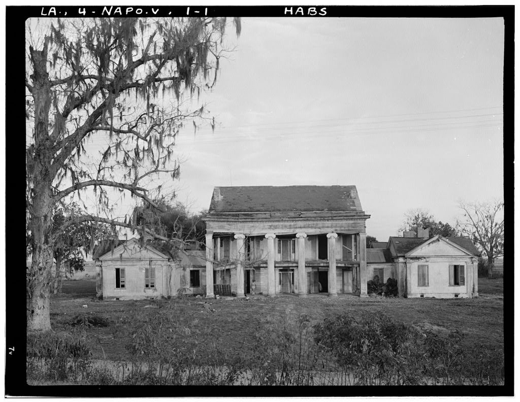
Retake this viewWoodlawn Plantation, State Highway 77
Find the spot, match the angle, and add your photo. It becomes the first then-and-now pair on Napoleonville’s page.
What is on the National Register in Napoleonville?
Three places: the Christ Episcopal Church and Cemetery (listed 1977), the Assumption Parish Courthouse and Jail (1997) and the St. Anne Catholic Church (2001).
Founding dates: Wikidata, Wikipedia, the U.S. post office records of Blevins & Helbock (CC0) and the Census. Homes by year built: Census ACS 2020–24. National Register of Historic Places: National Park Service (list of May 22, 2026). Old photos, postcards and papers: Wikimedia Commons, the Library of Congress and other public archives, credited on each item’s page. Maps: U.S. Geological Survey historical topographic maps (via Esri) and Sanborn fire-insurance maps (Library of Congress). History text and census tables: Wikipedia (CC BY-SA 4.0). Places that used to be: USGS Geographic Names Information System (2021). How TownRatings grades history →
From Wikimedia Commons (6), the Library of Congress (1), Wikidata (1), the National Register of Historic Places (3), Wikipedia, Wikidata and Wikipedia for famous people, U.S. Geological Survey historical maps, U.S. Census counts (via Wikipedia), the USGS Geographic Names Information System and Sanborn fire insurance maps (Library of Congress). Archive images are copied here with their credits and licenses, shown on each photo’s page. Refreshed monthly.


 Date?
 2016
 2016
 2016
 2006–2007
 2004


