150 years in pictures
Census counts: 1,301 in 1980, 983 in 2020. The archive holds 7 maps from 1926 on.
2 places on the National Register of Historic Places.
- 1876Wurtland is settled
Each edition grades its towns against each other only.

A town of 968, settled in 1876.
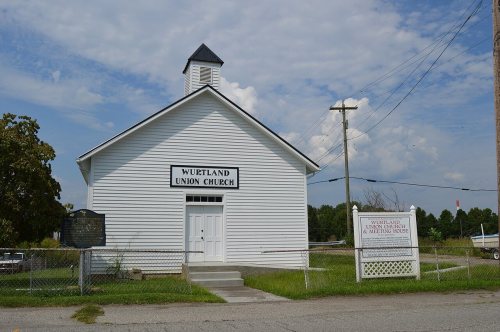
25% of residents live below the poverty line in Wurtland, above both the Kentucky town median (16%) and the median of U.S. towns (9.6%). Only 2 of the 120 Kentucky towns we compare have a lower typical home value than Wurtland. Wurtland has 2 places on the National Register of Historic Places, among them Wurtland Union Church. Wurtland has fewer than 1,000 residents, too few for fair grades; the figures below are still real.
In a town this size, neighbors are the best guide. Ask them anything.
Census counts: 1,301 in 1980, 983 in 2020. The archive holds 7 maps from 1926 on.
2 places on the National Register of Historic Places.
Who provides power, water and the rest in Wurtland, and how to reach them.
EPA SDWIS (Oct 9, 2026) · HIFLD + EIA-861 2025 · Census 2020 ZCTAs · NCES 2024–25 · registration: vote.gov, updated Nov 18, 2024.
Ordered by what stands out in Wurtland.
Most working residents leave Wurtland for work: only 2% work in town. Since 2013, Wurtland has added 82 jobs, to 502 in 2023. The top destinations are Ashland (22%), Flatwoods (5%) and Huntington (4%).
| Wurtland | Kentucky towns | U.S. towns | |
|---|---|---|---|
| Working residents who work in town | 2% | 15% | 8% |
| Average trip to work | 24 minutes | 22 minutes | 25 minutes |
| Median household income | $61,000 | $60,000 | $80,000 |
Census LEHD 2023 · ACS
Its public schools are run by the Greenup County school district. One of its 2 schools is below, with why it’s listed.
| School | Level | Students | Letter |
|---|---|---|---|
| Wurtland Elementary SchoolLargest public elementary schoolGrades PK–5 | Grades PK–5 | 203 | C− |
NCES · EDFacts
The typical Wurtland home is worth about $112,000, down 5.7% in a year, 51% below the Kentucky typical home. 78% of households own their home in Wurtland, against 59% in Kentucky’s towns and 73% across U.S. towns.
| Wurtland | Kentucky towns | U.S. towns | |
|---|---|---|---|
| Households that own their home | 78% | 59% | 73% |
| Median rent | $917 a month | $934 a month | $1,185 a month |
Census ACS, 2020–24 · Zillow Home Value Index · Redfin Data Center
Expected storm and flood damage is higher than in 81% of U.S. communities. Since 1978, 9 flood insurance claims have been paid out in Wurtland.
FEMA flood insurance claims · FEMA National Risk Index · OpenFEMA
Wurtland has chilly winters and warm summers. July afternoons reach 87°, January nights drop to 24° and about 7 inches of snow falls in a winter.
NOAA U.S. Climate Normals, 1991–2020
18% of Wurtland adults have diabetes. Among 142 Kentucky towns, just 1 have a higher share of adults who have obesity than Wurtland. 45% of Wurtland adults have high blood pressure.
| Wurtland | Kentucky towns | U.S. towns | |
|---|---|---|---|
| Frequent physical distress (CDC PLACES) | 20% | 15% | 14% |
| Diabetes (CDC PLACES) | 18% | 13% | 12% |
| High blood pressure (CDC PLACES) | 45% | 38% | 35% |
| Obesity (CDC PLACES) | 46% | 39% | 35% |
| What stands out | Wurtland | KY |
|---|---|---|
| More adults treating high blood pressure | 85.6% | 81.3% |
| More older adults who have lost all their teeth | 30% | 18.9% |
CDC PLACES 2025 · modeled estimates for adults · CMS · HRSA
Museums, parks, gardens and other places to visit around Wurtland. Close and well known come first.
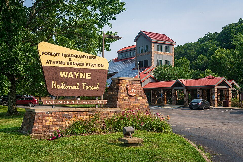
18 mi National forestWayne National Forest
17 mi Theme parkCamden Park
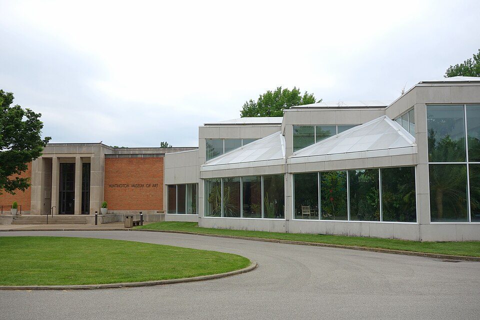
22 mi MuseumHuntington Museum of Art
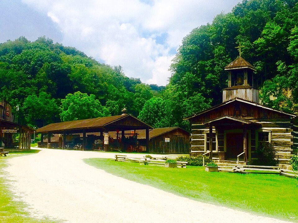
21 mi MuseumHeritage Farm Museum and Village20 mi MuseumMuseum of Radio and TechnologyWayne National Forest: Forest Service, USDA, Public domain · Camden Park: Carol M. Highsmith, Public domain · Huntington Museum of Art: Daderot, CC0 · Heritage Farm Museum and Village: Zeo1989, CC BY-SA 4.0
3 within 15 miles of the center of Wurtland
About 1 of every 100 Wurtland residents are enrolled in college, against 6 across Kentucky.
Where Wurtland’s working residents go each day. Line width shows the share.
Census LEHD 2023
2 places in Wurtland on the National Register of Historic Places.
City in Kentucky, United States
Wurtland is a home rule-class city in Greenup County, Kentucky, United States, along the Ohio River. The population was 983 at the 2020 census. It is part of the Huntington–Ashland metropolitan area. The northern terminus of the Industrial Parkway (Kentucky Route 67) is at U.S. Route 23 in Wurtland. This highway serves to connect Wurtland and the surrounding towns of Greenup and Flatwoods to the EastPark industrial park and Interstate 64, 14 miles (23 km) south of Wurtland.
From Wikipedia, licensed CC BY-SA 4.0 · facts via Wikidata (CC0)
Short answers, built from the data on this page.
Wurtland has fewer than 1,000 residents, too few for fair grades; the figures below are still real.