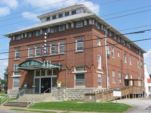
Elizabethtown dates to 1797, and 37 of its places are on the National Register
More historic than 64% of U.S. towns · #63 of 142 in Kentucky. What drives it
Most of Elizabethtown was built recently: 5% of its homes predate 1940 and the median home dates from 1990. 37 places in town are on the National Register, among them three historic districts with 46 buildings between them. Below: 28 old photos and papers, maps from 1886 on, and the census since 1810.
Founding year: Wikidata. First post office: 1831.The full story ↓
History grade
What drives Elizabethtown’s History grade
On its age, its old homes and the National Register, Elizabethtown is more historic than 64% of U.S. towns, #63 of 142 in Kentucky. Its age holds the grade up; its share of homes from before 1940 pulls it down.
B
HistoryA character grade: shown, never part of Elizabethtown’s overall grade.
Kentucky towns list more on the Register than most of the country (a typical Kentucky town has 29.9 per 10,000 residents, the U.S. 2.4), so Elizabethtown’s 25.2 sits near the middle of its state (46% of Kentucky towns have fewer) while its 82 historic buildings outnumber those of 88% of U.S. towns.
How sure. Graded on any two of the three inputs instead, the letter would range from B− to A−. The pre-1940 share (±1.6 points) is firm at this size. Two sources give 1797.
Founding year: Wikidata (other dates in Quick answers). Homes: Census ACS 2020–24. National Register: National Park Service, May 2026 list; each listing counted once (boundary changes and added documentation belong to their listing), and a historic district counts its contributing buildings. How TownRatings grades history →
What stands out about Elizabethtown’s past
Read from the archive, the National Register and the record. The page puts what stands out first.
Nothing in the archives for these yearsWeddings on Main Street, storms, parades, school pictures, the old store. If it’s in your family album, it belongs here.
Established in 1793, Hardin County was named for Colonel John Hardin, an Indian fighter who worked with tribes in the local area. In a few years, professional men and tradesmen came to live in the area. In 1793, Colonel Andrew Hynes had 30 acres (12 ha) (until then known as the "Severn's Valley Settlement") surveyed and laid off into lots and streets to establish Elizabethtown. Named in honor of his wife, Elizabethtown was legally established in 1797.
Passages that mention Elizabethtown, cut from the printed page as they were published.
A history of Elizabethtown, Kentucky, and its surroundings1921 · page 128Read the page →
Read the text
a thorough education, and they have proved themselves to be energetic, thorough-going men, and they have succeeded in establishing one of the most popular colleges in Kentucky, known as Cecilian College, about six or seven miles from Elizabethtown and about a quarter of a mile from the Elizabethtown and Paducah railroad, the stopping place for which, is Cecilia Station. The College is presided over by Henry A. Cecil as President, and Thomas G. and A. D. Cecil as Professors ; and a more accomplished and gentlemanly trio would be diffi-
Text read by machine from the scan; it may contain errors.
A history of Elizabethtown, Kentucky, and its surroundings1921 · page 127Read the page →
Read the text
1804, when, with his sons Denton, Thomas and J. H. Geoghegan, came to Kentucky and stopped at the Crab Orchard, in Lincoln county, and while there purchased of Arnistead Churchill the Hynes Station track, part of which is now in Elizabethtown. The deed bears date of 1805, and recognizes him as a citizen of Lincoln county. His grandson A. D. Geoghegan, Esq., says he arrived at Hynes' Station on the 2ist of February, 1808. But that must be a mistake as the deed bears date of December 29, 1806, and recognizes him as a citizen
Text read by machine from the scan; it may contain errors.
Scans and text from the Internet Archive. Books published in 1930 or earlier, which are in the public domain.
Timeline
Elizabethtown, 1788 to 2020
Woven from the archive, old maps, post office records, the National Register and the people born here.
Every edition of the U.S. Geological Survey’s map of Elizabethtown. Tap a year, or press play to watch the town change.
1938Elizabethtown sheet · 1:62,500
U.S. Geological Survey historical topographic maps (public domain), via Esri’s collection of the scans. The red ring marks the center of Elizabethtown.
Every building
Elizabethtown, building by building, 1886–1922
Fire insurance maps drew every building, what it was made of and what it was used for, so insurers could price the risk of fire. Pick a year, then a sheet.
In 1797, according to Wikidata. Elizabethtown’s post office opened in 1831, and the census of 1810 counted 181 people here.
How does Elizabethtown rank for history?
Elizabethtown is more historic than 64% of U.S. towns, #63 of 142 in Kentucky. The History grade combines the town’s founding era, the share of homes built before 1940 and its National Register listings. It’s a character grade, so it isn’t part of the overall grade. How it works.
What is on the National Register in Elizabethtown?
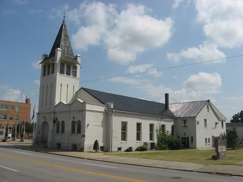
37 listings: 33 buildings, among them the Lincoln Heritage House (listed 1973, the first), 3 historic districts, the Elizabethtown Courthouse Square and Commercial District, the Hazel Hill and the Montgomery Avenue Historic District, with 46 contributing buildings, and 1 site. 82 historic buildings in all.
How old are the homes in Elizabethtown?
5% of Elizabethtown’s homes were built before 1940 (Census estimate, ±1.6 points), against a typical 5.9% for a Kentucky town; the median home was built in 1990.
Founding dates: Wikidata, Wikipedia, the U.S. post office records of Blevins & Helbock (CC0) and the Census. Homes by year built: Census ACS 2020–24. National Register of Historic Places: National Park Service (list of May 22, 2026). Old photos, postcards and papers: Wikimedia Commons, the Library of Congress and other public archives, credited on each item’s page. Maps: U.S. Geological Survey historical topographic maps (via Esri) and Sanborn fire-insurance maps (Library of Congress). History text and census tables: Wikipedia (CC BY-SA 4.0). Places that used to be: USGS Geographic Names Information System (2021).
From Wikimedia Commons (36), the Library of Congress (22), Wikidata (18), the National Register of Historic Places (37), Wikipedia, Wikidata and Wikipedia for famous people, U.S. Geological Survey historical maps, U.S. Census counts (via Wikipedia), the US Post Offices dataset (Blevins & Helbock), the USGS Geographic Names Information System, Sanborn fire insurance maps (Library of Congress) and old county and town histories (Internet Archive). Archive images are copied here with their credits and licenses, shown on each photo’s page. Refreshed monthly.


 1880
 1916
 1916
![Lummie Durrett. See report.] Location: [Elizabethtown vicinity, Kentucky](https://images.townratings.com/story/7028/8e6f18d36e9efadadecc-s.jpg) 1916
 1916
 1916
 1916
 1916
 1916
 1916
 1916
 1916
 1916
 1916
![Series showing the day's work of Estelle and Felix Humphrey. See card reports of same. L.W. Hine] Location: [Elizabetht…](https://images.townratings.com/story/7028/de1387850ba81df7a269-s.jpg) 1916
![Series showing the day's work of Estelle and Felix Humphrey. See card reports of same. L.W. Hine] Location: [Elizabetht…](https://images.townratings.com/story/7028/4dd705d6764af3580e94-s.jpg) 1916
 1916
 1916
 1916
![Series showing the day's work of Estelle and Felix Humphrey. See card reports of same. L.W. Hine] Location: [Elizabetht…](https://images.townratings.com/story/7028/48bc893b4fa680af0143-s.jpg) 1916
 1916
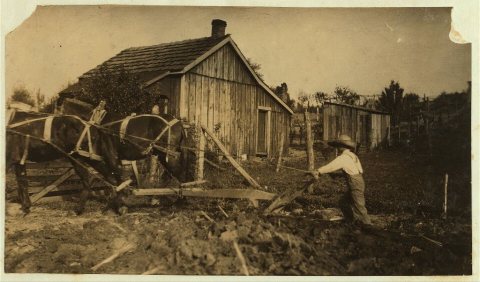 1916
 1916
 1916
 1923
 1958
 Date?
 Date?
 2011
 2011
 2011
 2011
 2011
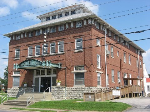 2011
 2011
 2011
 2011
 2011
 2011
 2011
 2011
 2011
 2011
 2011
 2011
 2011
 2011
 2011
 2011
 2011
 2011
 2011
 2010
 2009
 2009
 2008
 2007
 2004