Pittsburg dates to 1876, and 26% of its homes were built before 1940
More historic than 71% of U.S. towns · #43 of 151 in Kansas. What drives it
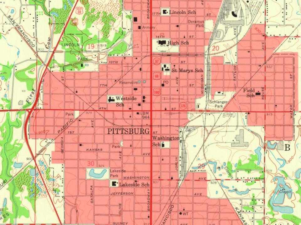
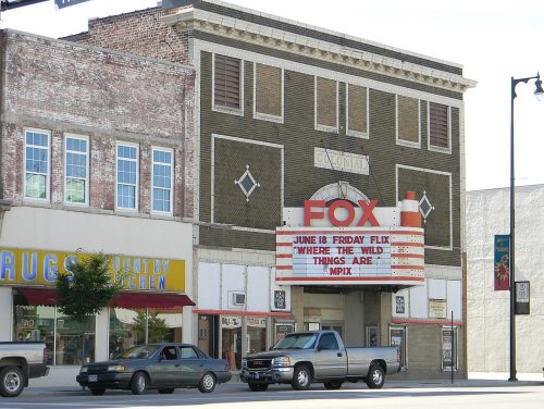
10 places in town are on the National Register, among them two historic districts with 9 buildings between them. Below: 3 old photos and papers, maps from 1885 on, and the census since 1880.
Founding year: Wikidata. First post office: 1870.The full story ↓
History grade
What drives Pittsburg’s History grade
On its age, its old homes and the National Register, Pittsburg is more historic than 71% of U.S. towns, #43 of 151 in Kansas. Its share of homes from before 1940 holds the grade up; its age pulls it down.
B+
HistoryA character grade: shown, never part of Pittsburg’s overall grade.
Kansas towns list more on the Register than most of the country (a typical Kansas town has 5.1 per 10,000 residents, the U.S. 2.4), so Pittsburg’s 8.7 sits near the middle of its state (61% of Kansas towns have fewer) while its 18 historic buildings outnumber those of 79% of U.S. towns.
How sure. Graded on any two of the three inputs instead, the letter would range from B− to A−. The pre-1940 share is a Census survey estimate (±3.0 points). Two sources give 1876.
Founding year: Wikidata (other dates in Quick answers). Homes: Census ACS 2020–24. National Register: National Park Service, May 2026 list; each listing counted once (boundary changes and added documentation belong to their listing), and a historic district counts its contributing buildings. How TownRatings grades history →
What stands out about Pittsburg’s past
Read from the archive, the National Register and the record. The page puts what stands out first.
Fire insurance maps drew every building, what it was made of and what it was used for, so insurers could price the risk of fire. Pick a year, then a sheet.
On October 23, 1864, a wagon train of refugees had come from Fort Smith, Arkansas, and was escorted by troops from the 6th Kansas Cavalry under the command of Col. William Campbell. These were local men from Cherokee, Crawford, and Bourbon counties. Their enlistment was over, and they were on their way to Fort Leavenworth to be dismissed from service. They ran into the 1st Indian Brigade led by Maj. Andrew Jackson Piercy near the current Pittsburg Waste Water Treatment Plant. They continued to the north when a small group of wagons broke away in an unsuccessful rush to safety. The Confederate troops caught up with them and burned the wagons. The death toll was three Union soldiers and 13 civilian men who had been with the wagon train. It was likely that one of the Confederates had also been killed. A granite marker memorial for the "Cow Creek Skirmish" was placed near the Crawfor…
Passages that mention Pittsburg, cut from the printed page as they were published.
A Twentieth century history and biographical record of Crawford County, Kansas1905 · page 46Read the page →
Read the text
Frontenac, located three miles north and one east of Pittsburg, is a flourishing town of two thousand inhabitants. The Santa Fe Railroad furnishes transportation to the people, while the Pittsburg Railroad trolley cars carry people to and from Pittsburg. Frontenac is the outgrowth of the Devlin or Santa Fe Coal Company. Here are located the coal shafts and offices of said company, and here most of the people employed in and about the mines live. They have built comfortable cottages for themselves and families. Excellent schools are maintained, and
Text read by machine from the scan; it may contain errors.
A Twentieth century history and biographical record of Crawford County, Kansas1905 · page 337Read the page →
Read the text
until the fall of 1874, when he was elected county superintendent of schools of Crawford county. During his term of office the town of Pittsburg was laid out, and upon the expiration of his term he moved to Pittsburg, where he has since resided. In the spring of 1867 he was elected justice of the peace, which office he held for three years, and in January, 1877. he was appointed postmaster of Pittsburg, retaining that incumbency until 1X84. Since that time he has been engaged in the real estate, loan and insurance
Text read by machine from the scan; it may contain errors.
Scans and text from the Internet Archive. Books published in 1930 or earlier, which are in the public domain.
Timeline
Pittsburg, 1870 to 1960
Woven from the archive, old maps, post office records, the National Register and the people born here.
Nothing in the archives for these yearsWeddings on Main Street, storms, parades, school pictures, the old store. If it’s in your family album, it belongs here.
In 1876, according to Wikidata. Pittsburg’s post office opened in 1870, and the census of 1880 counted 624 people here.
How does Pittsburg rank for history?
Pittsburg is more historic than 71% of U.S. towns, #43 of 151 in Kansas. The History grade combines the town’s founding era, the share of homes built before 1940 and its National Register listings. It’s a character grade, so it isn’t part of the overall grade. How it works.
What is on the National Register in Pittsburg?
10 listings: 8 buildings, among them the Pittsburg Public Library (listed 1977, the first), and 2 historic districts, the Whitesitt-Shirk Historic District and the Fourth and Broadway Historic District, with 9 contributing buildings. 18 historic buildings in all.
How old are the homes in Pittsburg?
26% of Pittsburg’s homes were built before 1940 (Census estimate, ±3.0 points), against a typical 10% for a Kansas town; the median home was built in 1968.
Founding dates: Wikidata, Wikipedia, the U.S. post office records of Blevins & Helbock (CC0) and the Census. Homes by year built: Census ACS 2020–24. National Register of Historic Places: National Park Service (list of May 22, 2026). Old photos, postcards and papers: Wikimedia Commons, the Library of Congress and other public archives, credited on each item’s page. Maps: U.S. Geological Survey historical topographic maps (via Esri) and Sanborn fire-insurance maps (Library of Congress). History text and census tables: Wikipedia (CC BY-SA 4.0). Places that used to be: USGS Geographic Names Information System (2021).
From Wikimedia Commons (3), Wikidata (2), the National Register of Historic Places (10), Wikipedia, Wikidata and Wikipedia for famous people, U.S. Geological Survey historical maps, U.S. Census counts (via Wikipedia), the US Post Offices dataset (Blevins & Helbock), the USGS Geographic Names Information System, Sanborn fire insurance maps (Library of Congress) and old county and town histories (Internet Archive). Archive images are copied here with their credits and licenses, shown on each photo’s page. Refreshed monthly.


 1880