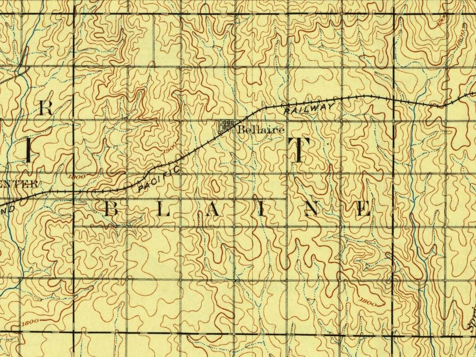
Every edition of the U.S. Geological Survey’s map of Blaine Township. Tap a year, or press play to watch the town change.
1893Smith Center sheet · 1:125,000
U.S. Geological Survey historical topographic maps (public domain), via Esri’s collection of the scans. The red ring marks the center of Blaine Township.
Places that used to be
Lost post offices, old corners and places now gone
Two other post offices opened and closed inside today’s town.
Custer
1876–1894
Bellaire
1888–1980
18701950today
Hamlets and corners on the map
Bellaire
Gone or out of use
Custerlocale
US Post Offices dataset (Blevins & Helbock, CC0). Places and cemeteries from the USGS Geographic Names Information System (2021).
Many of the first settlers or their family members had originally immigrated to America during the Great Famine of Ireland and then slowly moved westward. The immigrants established the settlement of Butler City along Bluff Creek which served as the first settlers' main water source. Butler City was officially platted at tier 6 south, ranges 9 and 10 east on October 14, 1879; the young town's namesake was Father Thomas Ambrose Butler, an Irish Priest in St. Louis, who encouraged the original settlers to "colonize" in and around modern day Blaine. The community initially was settled by 60 Irish Catholics families in 1873. The Irish emigrants came from a poor Irish neighborhood of St. Louis known as the "Kerry Patch". A post office was opened in Butler City in 1874
Founding dates: Wikidata, Wikipedia, the U.S. post office records of Blevins & Helbock (CC0) and the Census. Homes by year built: Census ACS 2020–24. National Register of Historic Places: National Park Service (list of May 22, 2026). Old photos, postcards and papers: Wikimedia Commons, the Library of Congress and other public archives, credited on each item’s page. Maps: U.S. Geological Survey historical topographic maps (via Esri) and Sanborn fire-insurance maps (Library of Congress). History text and census tables: Wikipedia (CC BY-SA 4.0). Places that used to be: USGS Geographic Names Information System (2021). How TownRatings grades history →
From Wikipedia, U.S. Geological Survey historical maps, the US Post Offices dataset (Blevins & Helbock) and the USGS Geographic Names Information System. Archive images are copied here with their credits and licenses, shown on each photo’s page. Refreshed monthly.