Founding year: Wikidata; Wikipedia’s history section gives the same year. First post office: 1817. Name: Wikipedia, licensed CC BY-SA 4.0.The full story ↓
History grade
What drives Washington Township’s History grade
On its age, its old homes and the National Register, Washington Township is more historic than 92% of U.S. towns, #123 of 593 in Indiana. All 3 inputs are above most U.S. towns; its National Register listings ranks highest and its age lowest.
A
HistoryA character grade: shown, never part of Washington Township’s overall grade.
Indiana towns list more on the Register than most of the country (a typical Indiana town has 7.9 per 10,000 residents, the U.S. 2.4), so Washington Township’s 60.6 sits above most of its state (77% of Indiana towns have fewer) while its 99 historic buildings outnumber those of 89% of U.S. towns.
How sure. Graded on any two of the three inputs instead, the letter would range from A− to A. The pre-1940 share is a Census survey estimate (±4.5 points). Two sources give 1815.
Founding year: Wikidata (other dates in Quick answers). Homes: Census ACS 2020–24. National Register: National Park Service, May 2026 list; each listing counted once (boundary changes and added documentation belong to their listing), and a historic district counts its contributing buildings. How TownRatings grades history →
What stands out about Washington Township’s past
Read from the archive, the National Register and the record. The page puts what stands out first.
Nothing in the archives for these yearsWeddings on Main Street, storms, parades, school pictures, the old store. If it’s in your family album, it belongs here.
Washington was platted in 1815. It was named from Washington Township.
The railroad was built through Washington in 1857. By 1889, it was a major depot and repair yard for the Ohio and Mississippi Railroad. The Baltimore and Ohio Railroad took over the line in 1893. During this time, the railroad employed over 1,000 workers.
On November 17, 2013, an EF2 tornado tore through the western edge of the city destroying 20 homes and severely damaging 20 others.
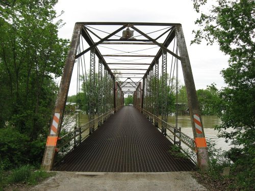
The Magnus J. Carnahan House, Daviess County Courthouse, Thomas Faith House, Robert C. Graham House, Dr. John A. Scudder House, Washington Commercial Historic District, and Dr. Nelson Wilson House are listed on the National Register of Historic Places.
Passages that mention Washington Township, cut from the printed page as they were published.
History of Washington Township, Alameda County, California1904 · page 43Read the page →
Read the text
The Suburban Electric Light Co. was incorporated June 14, 1901, with a capital of $500,000. It distributes light and power throughout Alameda County, including as a matter of course all the towns and homes in Washington Township. This Company secures its power from the Standard Electric Company and from the Bay Counties Company.
Text read by machine from the scan; it may contain errors.
History of Washington Township, Alameda County, California1904 · page 93Read the page →
Read the text
D. D. Henion, who is a comparatively late comer to Warm Springs, is, however, an old pioneer of Washington Township. He arrived in the valley in the fall of 1850, and located on the Chadbourne place between Centreville and Irvington. In 1853 he moved to Niles, where he lived first on the Clough place and later on the H. G. Ellsworth place until April 4, 1873, when he moved to Warm Springs.
Text read by machine from the scan; it may contain errors.
Scans and text from the Internet Archive. Books published in 1930 or earlier, which are in the public domain.
Timeline
Washington Township, 1815 to 1944
Woven from the archive, old maps, post office records, the National Register and the people born here.
Every edition of the U.S. Geological Survey’s map of Washington Township. Tap a year, or press play to watch the town change.
1944Washington sheet · 1:24,000
U.S. Geological Survey historical topographic maps (public domain), via Esri’s collection of the scans. The red ring marks the center of Washington Township.
Then & now
Stand where they stood
No then-and-now pairs yet. Take a photo from the same spot as an old one and they appear here side by side.
Retake this viewCoburg, Indiana, 1921
Find the spot, match the angle, and add your photo. It becomes the first then-and-now pair on Washington Township’s page.
In 1815, according to Wikidata and Wikipedia’s history of the town. Washington Township’s post office opened in 1817, and the census of 1850 counted 675 people here.
How does Washington Township rank for history?
Washington Township is more historic than 92% of U.S. towns, #123 of 593 in Indiana. The History grade combines the town’s founding era, the share of homes built before 1940 and its National Register listings. It’s a character grade, so it isn’t part of the overall grade. How it works.
What is on the National Register in Washington Township?
10 listings: 1 building, among them the Jefferson Elementary School (listed 1997, the first), and 1 structure. 99 historic buildings in all.
How old are the homes in Washington Township?
26% of Washington Township’s homes were built before 1940 (Census estimate, ±4.5 points), against a typical 14% for an Indiana town; the median home was built in 1965.
Founding dates: Wikidata, Wikipedia, the U.S. post office records of Blevins & Helbock (CC0) and the Census. Homes by year built: Census ACS 2020–24. National Register of Historic Places: National Park Service (list of May 22, 2026). Old photos, postcards and papers: Wikimedia Commons, the Library of Congress and other public archives, credited on each item’s page. Maps: U.S. Geological Survey historical topographic maps (via Esri) and Sanborn fire-insurance maps (Library of Congress). History text and census tables: Wikipedia (CC BY-SA 4.0). Places that used to be: USGS Geographic Names Information System (2021).
From Wikimedia Commons (4), the Library of Congress (8), Wikidata (1), the National Register of Historic Places (2), Wikipedia, U.S. Geological Survey historical maps, U.S. Census counts (via Wikipedia), the US Post Offices dataset (Blevins & Helbock), the USGS Geographic Names Information System and old county and town histories (Internet Archive). Archive images are copied here with their credits and licenses, shown on each photo’s page. Refreshed monthly.


 1921
 1941
 1941
 1941
 1941
 1941
 1941
 1941
 1941
 1941
 1941
 1941


