Shelbyville dates to 1822, and 23% of its homes were built before 1940
More historic than 93% of U.S. towns · #108 of 593 in Indiana. What drives it
9 places in town are on the National Register, among them two historic districts with 522 buildings between them. Below: 4 old photos and papers, maps from 1887 on, and the census since 1840.
Founding year: Wikidata; Wikipedia’s history section gives the same year. First post office: 1823.The full story ↓
History grade
What drives Shelbyville’s History grade
On its age, its old homes and the National Register, Shelbyville is more historic than 93% of U.S. towns, #108 of 593 in Indiana. All 3 inputs are above most U.S. towns; its National Register listings ranks highest and its share of homes from before 1940 lowest.
A
HistoryA character grade: shown, never part of Shelbyville’s overall grade.
Indiana towns list more on the Register than most of the country (a typical Indiana town has 7.9 per 10,000 residents, the U.S. 2.4), so Shelbyville’s 261 sits above most of its state (90% of Indiana towns have fewer) while its 530 historic buildings outnumber those of 97% of U.S. towns.
How sure. Graded on any two of the three inputs instead, the letter would range from A− to A. The pre-1940 share is a Census survey estimate (±3.3 points). Two sources give 1822.
Founding year: Wikidata (other dates in Quick answers). Homes: Census ACS 2020–24. National Register: National Park Service, May 2026 list; each listing counted once (boundary changes and added documentation belong to their listing), and a historic district counts its contributing buildings. How TownRatings grades history →
What stands out about Shelbyville’s past
Read from the archive, the National Register and the record. The page puts what stands out first.
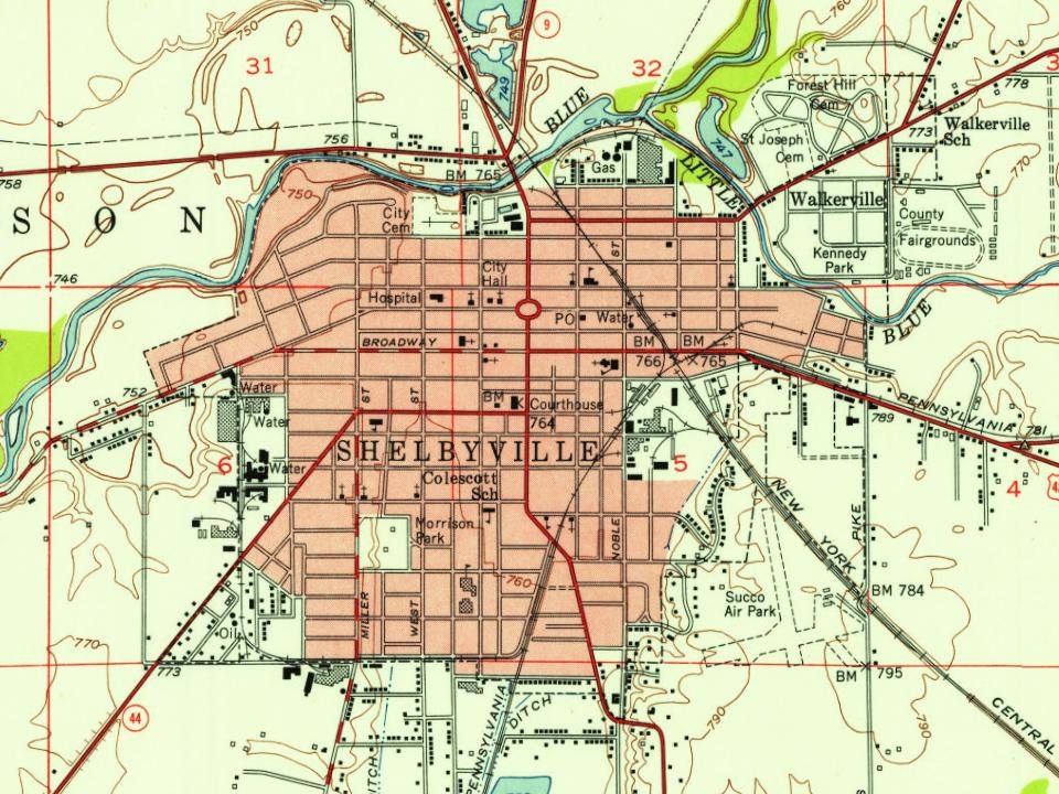
Fire insurance maps drew every building, what it was made of and what it was used for, so insurers could price the risk of fire. Pick a year, then a sheet.
In 1818, the land that would become Shelbyville was ceded to the United States by the Miami tribe in the Treaty of St. Mary's. Also in 1818, the backwoodsman Jacob Whetzel and a party cut a trail through this "New Purchase" from the Whitewater River at Laurel due west to the White River at Waverly. This trail became known as Whetzel's Trace and was the first east–west road into the New Purchase of central Indiana. Whetzel's Trace was cut just four miles (6.4 km) north of the site of Shelbyville and proved important in the settlement of Shelby County.
Passages that mention Shelbyville, cut from the printed page as they were published.
History of Shelby County, Indiana1887 · page 381Read the page →
Read the text
Catharine Wingate, Morning Simpson and Sally Hippers, making ten in all. This church was hrst called Shelbyyille, which name it bore until February, 1883, when the location of the church was moved four miles east of Shelbyville, when it took the name Bethel, retaininij this name a short time when it took again the name of Shelbyville, and iinally was called Mount Pisgah, by which name it is still known. The meetings of the church for about eight years were held at private houses, but in December, 1832, the church
Text read by machine from the scan; it may contain errors.
Chadwick's History of Shelby County, Indiana1909Read the page →
Read the text
As early as 1856 Shelby county enjoyed the benefits of three railroads — the Indianapolis & Cincinnati line; the Shelliyville & Rush\'ille line and the "Shelbyville & Columbus Railroad, later known as the Canibridge City branch of the Jeffersonville, }vIadison & Indianapolis Railroad: also the Edinburg. Shelbyville & Knightstown Railroad. The last named road ran along the Smithland pike, passed through the town of Shelbyville on Broadway street, out by the fair grounds, then on to Knightstown. in Henry county. Indiana, It was a curious old flat bar railroad, ever (jut of repair an;! never profitable
Text read by machine from the scan; it may contain errors.
History of Shelby County, Indiana1887 · page 429Read the page →
Read the text
Shelbyville and took a half interest in the property, and the same year a woolen factory was built just above the race bridge, and between the race and river. In 1846, the saw-mill was removed and the present flouring mill was built upon its site, and in 1856 enlarged to the present dimensions and its capacity increased to six run of buhrs and an output of 100 barrels of flour per day, besides meal and feed. In 1850 the property passed into the hands of Jacob Vernon and W. O. Rock wood. The latter was soon suc-
Text read by machine from the scan; it may contain errors.
Chadwick's History of Shelby County, Indiana1909Read the page →
Read the text
This institution r.ccui)ies one of the most sightly and charming spots within the city of Shelbyville. It is the o],l jiomesteadthe country homeoriginally built by John ]-dliott. who founded the i'irst Xational' flank of Shelbyville. It was erected in i86_' and wa< then a half nnle outside of the town, but now it is built up thickly all about it. except to the north, w-hich overlooks the Blue river front. It is situated on a two an.d a half acre plot of ground completely parked and adorned by both shade and fruit trees, with flower gardens all about the premises. It is an ideal place and is a successful
Text read by machine from the scan; it may contain errors.
Scans and text from the Internet Archive. Books published in 1930 or earlier, which are in the public domain.
Timeline
Shelbyville, 1822 to 1954
Woven from the archive, old maps, post office records, the National Register and the people born here.
Nothing in the archives for these yearsWeddings on Main Street, storms, parades, school pictures, the old store. If it’s in your family album, it belongs here.
In 1822, according to Wikidata and Wikipedia’s history of the town. Shelbyville’s post office opened in 1823, and the census of 1840 counted 446 people here.
How does Shelbyville rank for history?
Shelbyville is more historic than 93% of U.S. towns, #108 of 593 in Indiana. The History grade combines the town’s founding era, the share of homes built before 1940 and its National Register listings. It’s a character grade, so it isn’t part of the overall grade. How it works.
What is on the National Register in Shelbyville?
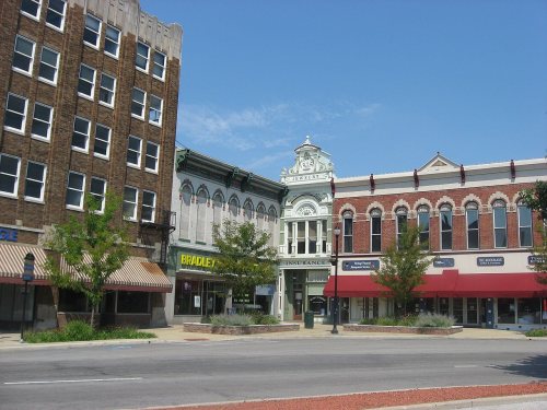
9 listings: 6 buildings, among them the John Hamilton House (listed 1979, the first), 2 historic districts, the Shelbyville Commercial Historic District and the West Side Historic District, with 522 contributing buildings, and 1 structure. 530 historic buildings in all.
How old are the homes in Shelbyville?
23% of Shelbyville’s homes were built before 1940 (Census estimate, ±3.3 points), against a typical 14% for an Indiana town; the median home was built in 1972.
Founding dates: Wikidata, Wikipedia, the U.S. post office records of Blevins & Helbock (CC0) and the Census. Homes by year built: Census ACS 2020–24. National Register of Historic Places: National Park Service (list of May 22, 2026). Old photos, postcards and papers: Wikimedia Commons, the Library of Congress and other public archives, credited on each item’s page. Maps: U.S. Geological Survey historical topographic maps (via Esri) and Sanborn fire-insurance maps (Library of Congress). History text and census tables: Wikipedia (CC BY-SA 4.0). Places that used to be: USGS Geographic Names Information System (2021).
From Wikimedia Commons (5), the Library of Congress (1), the National Register of Historic Places (9), Wikipedia, Wikidata and Wikipedia for famous people, U.S. Geological Survey historical maps, U.S. Census counts (via Wikipedia), the US Post Offices dataset (Blevins & Helbock), the USGS Geographic Names Information System, Sanborn fire insurance maps (Library of Congress) and old county and town histories (Internet Archive). Archive images are copied here with their credits and licenses, shown on each photo’s page. Refreshed monthly.




![This institution r.ccui)ies one of the most sightly and charming spots within the city of Shelbyville. It is the o],l jiomesteadthe country homeoriginally built by John ]-dliott. who founded the i'irst Xational' flank of Shelbyville. It was erected in i86_' and wa< then a half nnle outside of the t…](https://images.townratings.com/story/5003/bk-25ffc4cb454c18b2-l.jpg)


 1917
 2007
 2007